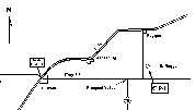
 A roadmap to the CP4 site may be found by clicking on this map
icon.
A roadmap to the CP4 site may be found by clicking on this map
icon.
CP4 coordinates, as determined from a hand-held GPS survey, are as follows (WGS84 coordinate system):
        40:06:08  N. Latitude
       104:21:26  W. Longitude
            1453  m  Elevation (at feedhorn)
Orientation of the CP4 trailers was selected to limit
obstruction in the usable portions of dual Doppler lobes shared with
other radars, with the modification that low-level scanning over the
CHILL radar was required (CHILL azimuth: 328 degrees from CP4,
referred to true north).
A roadmap to the CP4 site may be found by clicking on this map
icon.
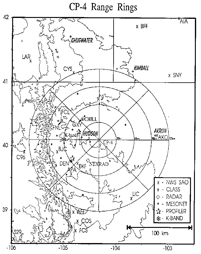
A larger scale, general map of other WISP94 instrumented sites (with CP4 range-rings) may be found by clicking here (map made available by RAP).
The following site-related information is also available: