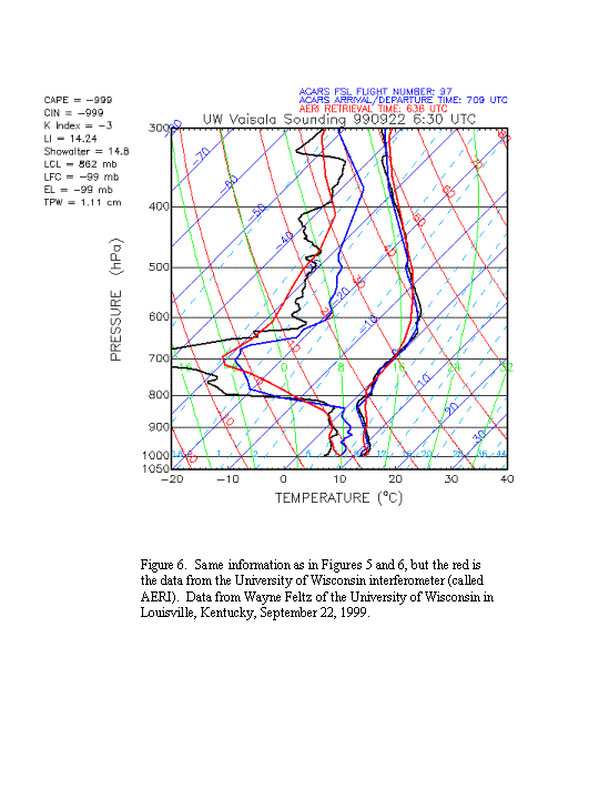
A preliminary intercomparison was performed independently by Wayne Feltz of the University of Wisconsin at the request of the National Weather Service. This test will be published later, but Wayne has provided the following examples of results shown in Figures 4-6. One sees that the radiosonde dewpoints (black) have the same vertical pattern as the WVSS-I dewpoints (blue). However, there are slight offsets near the surface (radiosondes with a slight dry bias, aircraft with a slight wet bias, or a combination of both) and above the boundary layer where the radiosonde goes extremely dry before returning (probably a radiosonde problem, observed by others, as reported by Hal Cole [NCAR] and Bill Blackmore [NWS]). Figure 6 also has an interferometer result (red) that is only valid up to 700 mb. Above this level, the information is dominated by the first guess used.
This preliminary intercomparison was obtained in a two-week period in September, 1999 with six aircraft flying. Approximately 40 radiosonde/aircraft intercomparisons were possible. A more formal evaluation of the WVSS-I will occur at a later date when more aircraft are flying.
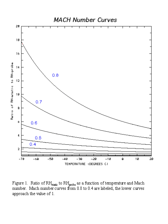
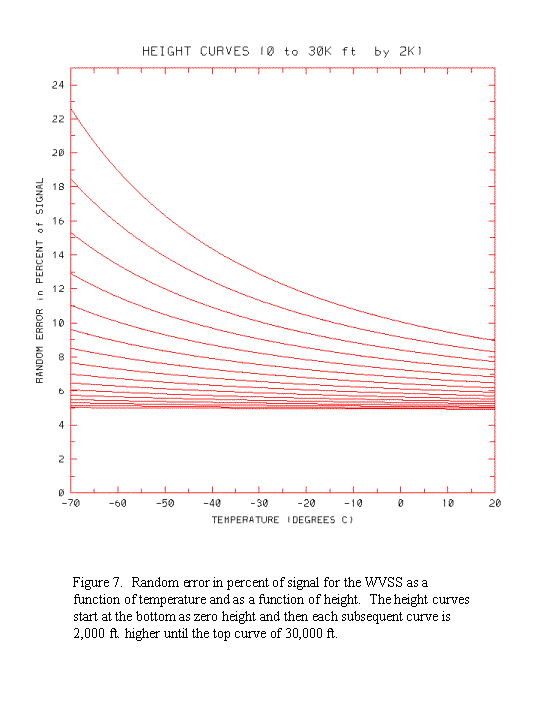
One can say something about the random error of the WVSS-I now. This will be dominated by the Mach # effect discussed in Section 2 and illustrated in Figure 1. If one adds the additional random error associated with the random error of temperature (small) and pressure measurements (very small), one can obtain the random error curves of Figure 7. This result has been obtained by adding a random error of 3.8% of signal to the Mach # random error as a percent of signal. Heights in Figure 7 have been approximated by the approximate relation between aircraft Mach number and height:
M=0.2 + 0.61 (Height/30 000 ft)Data from this University of Wisconsin intercomparison and all WVSS-I data obtained from the Internet after May 5, 1999 are considered good. Data obtained before that period are subject to errors (see Appendix B).
for heights £ 30 000 ft and
M=0.81 for greater heights.
An effort has been started at UCAR to look at the continuity of the WVSS-I data over time. The details of this effort are beyond the scope of this report, but the multiple methods of investigation are capable of detecting systematic bias correction requirements. Thus far, only one aircraft appears to be significantly out of calibration. This was aircraft number (00441) and it began providing data considered significantly biased "dry" since August 1999 (see next section on aircraft IDs and access to the data).