NSF Weather Station Information
Station Geographical Information
| Latitude | 38°48'06.1"N |
|---|
| Longitude | 77°04'13.6"W |
|---|
| Elevation | 215 feet, 66 meters |
|---|
Weather Station Hardware
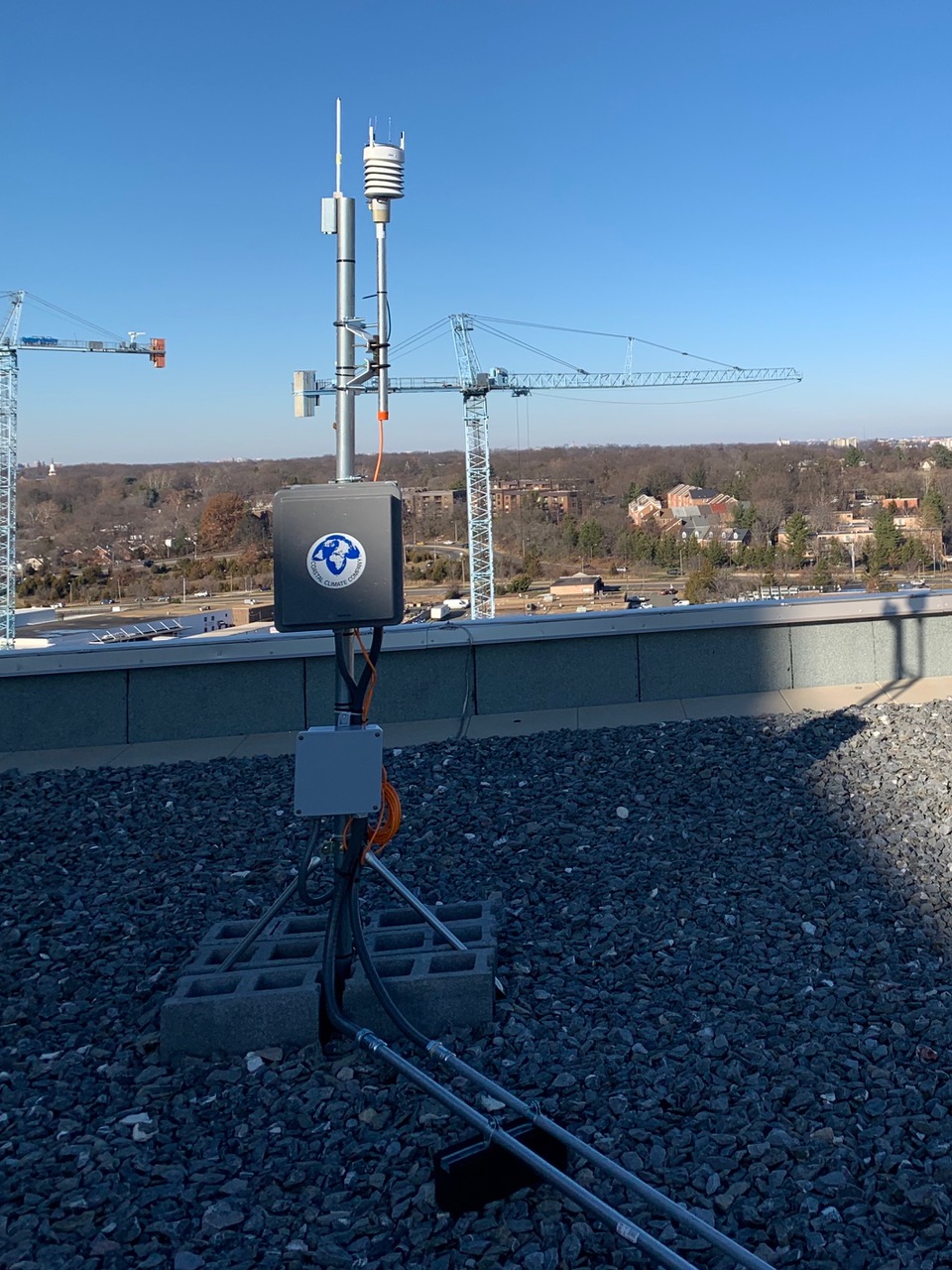
Vaisala WXT530 series weather station on top of the NSF building
A Vaisala WXT530 weather station is being used to collect the
meteorological measurements. This is a self-contained weather station with sensors
to measure temperature, humidity, pressure,
rain accumulation, wind speed, direction and peak gust speed.
These
sensor specifications are for the WXT510. They are
probably similar to the WXT530, but may not be completely accurate.
Data Transmission and Ingest
The RS-232 data message from the weather station is relayed through a
serial-ethernet transceiver over the Internet back to Boulder, Colorado,
where the data are parsed, recorded, and plotted for the web site.
The weather station's data are collected by NIDAS, then parsed by a C
program called ccwd (Coastal Climate Weather Daemon), stored in
netCDF
format files, and plotted using
gnuplot which is run from a
Perl
script called cdf2gif_cc.
Data Filters
Wind Direction
The wind direction signal is not valid for zero wind speed and the
data is removed from the plots in that situation to eliminate the resulting
noisy wind direction data.
Peak Gust
The peak gust information is calculated inside of the Coastal weather station
and consists of the highest average value from an N point moving window.
We have N set to 3 so we record the highest 3 sample average for each 5 minute
period. This tends to lower the peak gust readings.
Internal samples are taken once every second.
Rain Accumulation
The rain accumulation data is a plot of "rain events" which are periods
where the rain is actually falling. After an hour of no rainfall, the
chart resets to zero. The total rainfall over a period of time is a sum
of the individual rain events. The textual rain accumulation info at the
top of the page represents total rainfall since midnight.
Derived Fields
Corrected Pressure
Aeronautical pressure correction is used to remove the altitude information
from pressure readings so that comparisons can be made between locations at
different heights.
Here is the formula that we are using for
altitude corrected pressure.
Dewpoint
If the air were cooled down, the dewpoint would be the temperature where
the moisture in the air would condense and form dew.
Here is formula for the derivation of
dewpoint.
Wind Chill
An NSF NCAR meteorologist, Bob Rilling has put together this information on
Wind Chill.
We are currently using the Court method for calculating wind chill.
Note that the wind chill is undefined for wind speeds below 1.9 meters per
second and for temperatures above 33 degrees C.
Known Problems
General Comment
The weather station is mounted on top of a building where other obstructions exist. This can and will effect the data depending on the wind directions.
Elevated Temperature Readings at Low Wind Speeds
The temperature transducer in this weather station is mounted in a passive radiation shield.
Experience with this type of shield shows higher temperature readings when
wind speeds are below 5 Miles/Hour. This is due to the solar radiation heating
of the shield.
Reloading of Plots
With certain browsers, it may be necessary to press the reload button to
update the data plots.
If you are using Netscape, try using the "reload" button or
"shift-reload".
Origins
This web weather station is one of several similar stations supported by the
NSF
National Center for Atmospheric Research
in Boulder, Colorado, USA.
Check out the
Weather at NSF NCAR Foothills Campus
in Boulder.