Operational Status:
- requestable, ready for deployment
General Description:
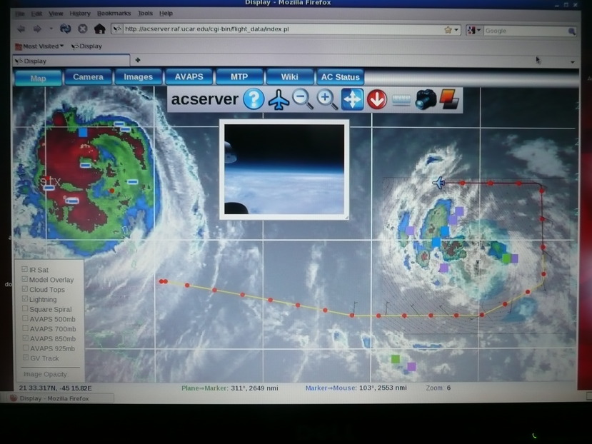
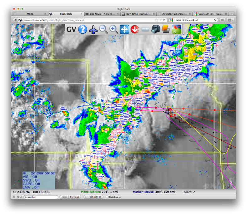
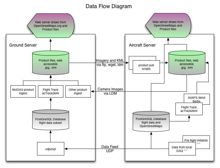
The mission coordinator is a web-based situational awereness tool. It runs on the ground and onboard the aircraft, and is designed to provide the same information in both places. OpenStreetMaps is used as the base map, and OpenLayers is used provide GIS type layering of KML products (imagery or KML files) similar to Google Earth.
- Map, IR, model output, lightning (dash marks), overshooting cloud tops (squares), track, AVAPS wind barbs:
- Map, Visible Satellite, NEXRAD, lightning, and three aircraft tracks:
Measurement Characteristics:
- Overall estimate of uncertainty:
- Response time: Variable
- Precision:
- Other measurement characteristics (comments on signal/noise, bias limits, etc):


