Project #2002-112 IDEAS Phase 2
Instrument Development and Education in Airborne Science
J. Stith, et al.
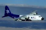
NSF/NCAR C-130Q Hercules (N130AR)
 Flight Summary Information Matrix
For detailed information on a specific flight, click on its RAF flight
number.
RAF
Flight
No. |
Start Date |
Flight Times (UTC) |
Mission |
Instrument
Anomalies
* |
Get Data |
Whole-Flight Plots |
| RF01 |
10/03/2002 |
19:00:00
22:40:00
3.7 hours |
Clear-air maneuvers for DU study; profiles of cold
status cloud; clear air above clouds for CCN and trace gas measurements.
|
PLWCC1,
MRLH,
DPLA1,
MRLA1,
RHOLA1,
RHLA1,
TEO3C,
TEO3P,
XNTWC,
Winds,
Icing |
Low-Rate netCDF file |
Temp/Dew Point |
Reference Altitude |
X-Y Track |
X-Y-Z Track |
| RF02 |
10/09/2002 |
19:06:00
21:24:00
2.3 hours |
Overflight of major burn area; passes in urban BL for
chemical tests; overpass over Marshall to calibrate AIMR. |
MRLH,
PLWCC2,
XPLWDMT,
DPLA1,
MRLA1,
RHOLA1,
RHLA1,
TEO3C,
XNTWC |
Low-Rate netCDF file |
Temp/Dew Point |
Reference Altitude |
X-Y Track |
X-Y-Z Track |
| RF03 |
10/16/2002 |
21:24:00
22:43:00
1.3 hours |
Brief test of Hallett systems. |
MRLH,
XPLWDMT,
PLWCC2,
TEO3C,
TEO3P,
DPLA1,
MRLA1,
RHOLA1,
RHLA1,
CONCN,
PSFRD,
PSFC |
Low-Rate netCDF file |
Temp/Dew Point |
Reference Altitude |
X-Y Track |
X-Y-Z Track |
| RF04 |
10/17/2002 |
20:27:00
22:34:00
2.1 hours |
Speed test for cloud scopes; characterization of CCN
from prescribed burn; coordinated flight with CHILL radar. |
XPLWDMT,
PLWCC2,
XNLWC,
XNTWC,
DPLA1,
MRLA1,
RHOLA1,
RHLA1 |
Low-Rate netCDF file |
Temp/Dew Point |
Reference Altitude |
X-Y Track |
X-Y-Z Track |
| RF05 |
10/24/2002 |
21:04:00
23:22:00
2.3 hours |
|
TEO3C,
TEO3P,
XNLWC,
XNTWC,
XGLWC,
CONCF_LWI,
CONCF_RWI,
DPLA1,
MRLA1,
RHOLA1,
RHLA1 |
Low-Rate netCDF file |
Temp/Dew Point |
Reference Altitude |
X-Y Track |
X-Y-Z Track |
| RF06 |
10/29/2002 |
20:22:00
21:50:00
1.5 hours |
Characterization of deep extratropical storm. |
DPLA1,
MRLA1,
RHOLA1,
RHLA1,
PSFRD,
PSFC,
ADIFR,
XGLWC,
CONCF_LWI,
CONCF_RWI,
OAT,
MRLH,
Icing |
Low-Rate netCDF file |
Temp/Dew Point |
Reference Altitude |
X-Y Track |
X-Y-Z Track |
| RF07 |
11/01/2002 |
19:30:00
23:36:00
4.1 hours |
Remote sensing characterization of vegetation regions
near MesaVerde; did complete characterization of small Cu for Jensen. |
DPLA1,
MRLA1,
RHOLA1,
RHLA1,
XGLWC |
Low-Rate netCDF file |
Temp/Dew Point |
Reference Altitude |
X-Y Track |
X-Y-Z Track |
| RF08 |
12/17/2002 |
19:15:00
22:44:00
3.5 hours |
|
MRLH,
DPLA1,
MRLA1,
RHOLA1,
RHLA1,
XGLWC,
HGM232 |
Low-Rate netCDF file |
Temp/Dew Point |
Reference Altitude |
X-Y Track |
X-Y-Z Track |