Project #2001-161 EPIC 2001
Eastern Pacific Investigation of Climate Processes
in the Coupled Ocean-Atmosphere System
Principal Investigators: David Raymond, et al.
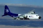
NSF/NCAR EC-130Q Hercules (N130AR)
 Flight Summary Information Matrix
For detailed information on a specific flight, click on its flight
number.
RAF
Flight
No. |
Start Date |
Flight Times (UTC) |
Mission |
Instrument
Anomalies
* |
Get Data |
Whole-Flight Plots |
| RF01 |
09/03/2001 |
13:58:51
22:37:59
8.7 hours |
ITCZ |
PLWCC,
PLWCC1 |
Low-Rate
netCDF file |
Temp/Dew Point |
Reference Altitude |
X-Y Track |
X-Y-Z Track |
| RF02 |
09/05/2001 |
13:53:39
22:30:08
8.6 hours |
ITCZ |
RSTT,
Ophir,
DPTC |
Low-Rate
netCDF file |
Temp/Dew Point |
Reference Altitude |
X-Y Track |
X-Y-Z Track |
| RF03 |
09/07/2001 |
13:45:00
22:39:00
8.9 hours |
95 Transect |
None Reported |
Low-Rate
High-Rate
netCDF file |
Temp/Dew Point |
Reference Altitude |
X-Y Track |
X-Y-Z Track |
| RF04 |
09/09/2001 |
14:28:00
22:06:52
7.6 hours |
ITCZ |
None Reported |
Low-Rate
netCDF file |
Temp/Dew Point |
Reference Altitude |
X-Y Track |
X-Y-Z Track |
| RF05 |
09/13/2001 |
14:27:00
22:05:21
7.6 hours |
ITCZ |
None Reported |
Low-Rate
netCDF file |
Temp/Dew Point |
Reference Altitude |
X-Y Track |
X-Y-Z Track |
| RF06 |
09/14/2001 |
13:30:00
22:04:21
8.6 hours |
95 Transect |
DPTC |
Low-Rate
High-Rate
netCDF file |
Temp/Dew Point |
Reference Altitude |
X-Y Track |
X-Y-Z Track |
| RF07 |
09/16/2001 |
14:24:00
21:39:19
7.3 hours |
ITCZ |
PLWCC,
PLWCC1,
QCRC,
TASR,
ATRR,
ATRL |
Low-Rate
netCDF file |
Temp/Dew Point |
Reference Altitude |
X-Y Track |
X-Y-Z Track |
| RF08 |
09/19/2001 |
13:24:00
22:23:31
9.0 hours |
95 Transect |
QCRC,
TASR,
DPTC,
XGLWC,
PLWCC1 |
Low-Rate
High-Rate
netCDF file |
Temp/Dew Point |
Reference Altitude |
X-Y Track |
X-Y-Z Track |
| RF09 |
09/20/2001 |
14:55:00
22:53:22
8.0 hours |
ITCZ |
DPTC,
PLWCC1 |
Low-Rate
netCDF file |
Temp/Dew Point |
Reference Altitude |
X-Y Track |
X-Y-Z Track |
| RF10 |
09/23/2001 |
13:30:00
22:33:00
9.1 hours |
95 Transect |
QCRC,
TASR,
DPTC,
PLWCC1 |
Low-Rate
High-Rate
netCDF file |
Temp/Dew Point |
Reference Altitude |
X-Y Track |
X-Y-Z Track |
| RF11 |
09/25/2001 |
13:30:00
22:23:19
8.9 hours |
95 Transect |
DPTC,
PLWCC1 |
Low-Rate
High-Rate
netCDF file |
Temp/Dew Point |
Reference Altitude |
X-Y Track |
X-Y-Z Track |
| RF12 |
09/28/2001 |
14:30:00
22:01:00
7.5 hours |
ITCZ |
RSTT,
PLWCC1 |
Low-Rate
netCDF file |
Temp/Dew Point |
Reference Altitude |
X-Y Track |
X-Y-Z Track |
| RF13 |
09/29/2001 |
14:29:00
22:34:03
8.1 hours |
ITCZ |
QCRC,
TASR,
DPTC,
XGLWC,
ATRR,
PLWCC1 |
Low-Rate
netCDF file |
Temp/Dew Point |
Reference Altitude |
X-Y Track |
X-Y-Z Track |
| RF14 |
10/02/2001 |
14:25:00
23:19:25
8.9 hours |
95 Transect |
DPTC,
PLWCC1 |
Low-Rate
High-Rate
netCDF file |
Temp/Dew Point |
Reference Altitude |
X-Y Track |
X-Y-Z Track |
| RF15 |
10/03/2001 |
14:35:00
23:22:42
8.8 hours |
ITCZ/SST |
DPTC,
ADS,
RSTB,
SPP-300,
Ophir,
PLWCC1 |
Low-Rate
netCDF file |
Temp/Dew Point |
Reference Altitude |
X-Y Track |
X-Y-Z Track |
| RF16 |
10/05/2001 |
14:49:00
23:42:00
8.9 hours |
SST |
HGM232,
RSTB,
SPP-300,
Ophir,
PLWCC1 |
Low-Rate
High-Rate
netCDF file |
Temp/Dew Point |
Reference Altitude |
X-Y Track |
X-Y-Z Track |
| RF17 |
10/06/2001 |
15:32:00
23:23:08
7.9 hours |
ITCZ |
SPP-300,
Ophir,
PLWCC1 |
Low-Rate
netCDF file |
Temp/Dew Point |
Reference Altitude |
X-Y Track |
X-Y-Z Track |
| RF18 |
10/09/2001 |
14:38:00
23:28:01
8.8 hours |
95 Transect |
Winds,
QCRC,
TASR,
ATTACK,
SSLIP,
DPTC,
260X,
ATRL,
ATRR,
RSTB,
Ophir,
PLWCC1 |
Low-Rate
High-Rate
netCDF file |
Temp/Dew Point |
Reference Altitude |
X-Y Track |
X-Y-Z Track |
| RF19 |
10/10/2001 |
14:30:00
23:14:22
8.7 hours |
95 Transect |
RSTB,
Ophir,
PLWCC1 |
Low-Rate
High-Rate
netCDF file |
Temp/Dew Point |
Reference Altitude |
X-Y Track |
X-Y-Z Track |
 Flight Summary Information Matrix
