Project #2001-131 ACE-Asia
Asian Pacific Regional
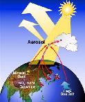
Aerosol Characterization Experiment
Barry Huebert, et al.
NSF/NCAR EC-130Q Hercules (N130AR)
 Flight Summary Information Matrix
For detailed information on a specific flight, click on its flight
number.
RAF
Flight
No. |
Start Date |
Flight Times (UTC) |
Mission Summary |
Mission Scientist |
Instrument Anomalies
* |
Get Data |
Whole-Flight Plots |
| FF01 |
03/22/2001 |
21:04:57
00:25:31
3.3 hours |
ferry to San Jose, CA |
Huebert |
Not Available
(Preliminary Data) |
Low-Rate Preliminary netCDF file |
Temp/Dew Point |
Reference Altitude |
X-Y Track |
X-Y-Z Track |
| FF02 |
03/24/2001 |
02:24:19
11:31:17
9.1 hours |
ferry to Honolulu, HI |
Huebert |
Not Available
(Preliminary Data) |
Low-Rate Preliminary netCDF file |
Temp/Dew Point |
Reference Altitude |
X-Y Track |
X-Y-Z Track |
| FF03 |
03/27/2001 |
20:26:29
04:24:00
8.0 hours |
ferry to Wake Island |
Huebert |
Not Available
(Preliminary Data) |
Low-Rate Preliminary netCDF file |
Temp/Dew Point |
Reference Altitude |
X-Y Track |
X-Y-Z Track |
| FF04 |
03/29/2001 |
02:29:20
11:28:27
9.0 hours |
ferry to Iwakuni, Japan |
Huebert |
Not Available
(Preliminary Data) |
Low-Rate Preliminary netCDF file |
Temp/Dew Point |
Reference Altitude |
X-Y Track |
X-Y-Z Track |
| FF05 |
05/07/2001 |
12:41:09
20:55:25
8.2 hours |
document dust/pollution in Pacific troposphere,
ferry to Wake Island |
Huebert |
Not Available
(Preliminary Data) |
Low-Rate Preliminary netCDF file |
Temp/Dew Point |
Reference Altitude |
X-Y Track |
X-Y-Z Track |
| FF06 |
05/08/2001 |
21:36:26
05:22:09
7.8 hours |
characterize central Pacific FT aerosols,
ferry to Honolulu, HI |
Huebert |
Not Available
(Preliminary Data) |
Low-Rate Preliminary netCDF file |
Temp/Dew Point |
Reference Altitude |
X-Y Track |
X-Y-Z Track |
| FF07 |
05/10/2001 |
17:39:27
01:59:52
8.3 hours |
ferry to Broomfield, CO |
unknown |
Not Available
(Preliminary Data) |
Low-Rate Preliminary netCDF file |
Temp/Dew Point |
Reference Altitude |
X-Y Track |
X-Y-Z Track |
-->
| RF01 |
03/30/2001 |
22:46:11
06:34:37
7.8 hours |
intercomparison with P-3,
MBL profile,
vertical dust/aerosols |
Huebert |
XUCN,
ADS,
SPP-300 |
Low-Rate netCDF file |
Temp/Dew Point |
Reference Altitude |
X-Y Track |
X-Y-Z Track |
| RF02 |
04/01/2001 |
23:35:18
08:13:30
8.6 hours |
profile near Terra overpass,
locate Chinese plume |
Huebert |
XUCN,
XGLWC,
SPP-300,
Icing |
Low-Rate netCDF file |
Temp/Dew Point |
Reference Altitude |
X-Y Track |
X-Y-Z Track |
| RF03 |
04/03/2001 |
23:13:34
09:00:55
9.8 hours |
column closure w/Terra overpass,
intercomparison w/Ron Brown,
aerosol characterization |
P. Russell |
XUCN,
SPP-300,
GALT |
Low-Rate netCDF file |
Temp/Dew Point |
Reference Altitude |
X-Y Track |
X-Y-Z Track |
| RF04 |
04/05/2001 |
23:34:49
09:48:26
10.2 hours |
intercomparison w/Kosan,
aerosol gradients in Yellow Sea |
Huebert |
XUCN,
ADS,
MRLA,
RHOLA,
SPP-300 |
Low-Rate netCDF file |
Temp/Dew Point |
Reference Altitude |
X-Y Track |
X-Y-Z Track |
| RF05 |
04/08/2001 |
03:04:10
10:39:31
7.6 hours |
intercomparison w/Ron Brown,
sample in Sea of Japan,
investigate dust/radiation gradients,
sample sulfate/organic pollution |
P. Russell |
XUCN,
SPP-300 |
Low-Rate netCDF file |
Temp/Dew Point |
Reference Altitude |
X-Y Track |
X-Y-Z Track |
| RF06 |
04/10/2001 |
23:15:32
07:21:18
8.1 hours |
characterize aerosol from lg. dust storm |
Huebert |
XUCN,
PLWCC,
Icing |
Low-Rate netCDF file |
Temp/Dew Point |
Reference Altitude |
X-Y Track |
X-Y-Z Track |
| RF07 |
04/11/2001 |
23:42:06
09:14:12
9.5 hours |
measure radiation/aerosol over Yellow Sea,
intercomparison w/Kosan,
measure column optical depth w/Seawifs overpass |
P. Russell |
XUCN,
PLWCC |
Low-Rate netCDF file |
Temp/Dew Point |
Reference Altitude |
X-Y Track |
X-Y-Z Track |
| RF08 |
04/12/2001 |
23:38:22
08:47:25
9.2 hours |
intercomparison w/TERRA-MISR/Ron Brown,
intercomparison w/Amami ground station,
column closure,
intercomparison w/satellite & model,
chemical characterization |
Clarke |
XUCN,
SPP-300 |
Low-Rate netCDF file |
Temp/Dew Point |
Reference Altitude |
X-Y Track |
X-Y-Z Track |
| RF09 |
04/16/2001 |
23:58:16
09:27:22
9.5 hours |
intercomparison w/Ron Brown,
cross-island flow impact study |
Huebert |
ATRL,
DPBC |
Low-Rate netCDF file |
Temp/Dew Point |
Reference Altitude |
X-Y Track |
X-Y-Z Track |
| RF10 |
04/17/2001 |
23:36:05
09:03:26
9.5 hours |
column optical depth w/SeaWiFS overpass,
measure aerosols just west of Kosan |
P. Russell |
ATRL,
XGLWC |
Low-Rate netCDF file |
Temp/Dew Point |
Reference Altitude |
X-Y Track |
X-Y-Z Track |
| RF11 |
04/19/2001 |
23:33:07
09:20:30
9.8 hours |
gather data for comparison w/regional transport models |
Huebert |
DPBC,
DPTC,
DPXC,
IRS |
Low-Rate netCDF file |
Temp/Dew Point |
Reference Altitude |
X-Y Track |
X-Y-Z Track |
| RF12 |
04/22/2001 |
22:45:00
08:07:43
9.4 hours |
radiation intercomparison (at 100 ft) w/4 satellite overpasses,
characterize aerosol chemical composition,
intercomparison w/ 5 Lidars |
L. Russell |
ATRL,
MRLA,
RHOLA,
XGLWC,
SPP-300,
GALT |
Low-Rate netCDF file |
Temp/Dew Point |
Reference Altitude |
X-Y Track |
X-Y-Z Track |
| RF13 |
04/23/2001 |
23:30:09
09:13:27
9.7 hours |
measure predicted aerosol concentration gradient,
intercomparison w/Kosan |
Huebert |
ATRL,
DPTC,
MRLA,
RHOLA,
PLWCC,
PLWCC1,
XGLWC,
SPP-300,
GALT |
Low-Rate netCDF file |
Temp/Dew Point |
Reference Altitude |
X-Y Track |
X-Y-Z Track |
| RF14 |
04/24/2001 |
23:26:18
09:19:08
9.9 hours |
measure aerosol property variations near Kosan,
column closure incl. satellite overpasses |
P. Russell |
ATRL,
DPTC,
MRLA,
RHOLA,
SPP-300 |
Low-Rate netCDF file |
Temp/Dew Point |
Reference Altitude |
X-Y Track |
X-Y-Z Track |
| RF15 |
04/27/2001 |
00:03:57
10:11:11
10.1 hours |
chemical characterization upwind/downwind of Korea,
intercomparison w/Twin Otter,
radiation intercomparison at 100 ft w/satellite overpass |
L. Russell |
ATRL,
DPTC,
MRLA,
RHOLA |
Low-Rate netCDF file |
Temp/Dew Point |
Reference Altitude |
X-Y Track |
X-Y-Z Track |
| RF16 |
04/29/2001 |
23:31:44
08:45:54
9.2 hours |
precipitation's impacton Shanghai plume,
Intercomparison w/KingAir |
Huebert |
ATRL,
DPTC,
MRLA,
RHOLA,
XGLWC,
RSTB |
Low-Rate netCDF file |
Temp/Dew Point |
Reference Altitude |
X-Y Track |
X-Y-Z Track |
| RF17 |
04/30/2001 |
23:23:47
09:21:05
10.0 hours |
measure radiative fluxes and optical depths,
column closure,
measure full-column optical depths w/ satellite overpasses,
measure long-leg aerosol chemistry and physics |
P. Russell |
DPTC,
MRLA,
RHOLA,
GALT |
Low-Rate netCDF file |
Temp/Dew Point |
Reference Altitude |
X-Y Track |
X-Y-Z Track |
| RF18 |
05/02/2001 |
00:16:10
09:16:05
9.0 hours |
measure multiple variations and properties near the Kosan surface site,
column optical depth,
measure aerosol chemistry and physics over the Yellow Sea |
P. Russell |
ATRL,
DPTC,
MRLA,
RHOLA,
MRLA1,
RHOLA1,
GALT,
QCRC,
Icing |
Low-Rate netCDF file |
Temp/Dew Point |
Reference Altitude |
X-Y Track |
X-Y-Z Track |
| RF19 |
05/03/2001 |
22:56:05
07:37:29
8.7 hours |
measure radiation gradient due to aerosol gradient,
long-leg integrated aerosol samples |
Huebert/Valero |
ATRL,
ATWH,
DPTC,
MRLA,
RHOLA,
SPP-300 |
Low-Rate netCDF file |
Temp/Dew Point |
Reference Altitude |
X-Y Track |
X-Y-Z Track |