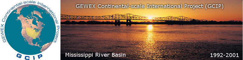
The Global Energy and Water Cycle Experiment (GEWEX) Continental-Scale International Project (GCIP) took place over the Mississippi River basin of the central United States over the period 1995-2001, with some additional data collected back to 1992. It was a multifaceted program of activities designed primarily to improve scientific understanding and the ability to model for climate prediction purposes the coupling between the atmosphere and the land surface on a continental scale.
Within the overall goal, GCIP set out the following science objectives:
The GCIP Enhanced Observing Period (EOP) commenced in October 1995 and ended in March 2001. GCIP conducted research over multiple scales in a four-tiered framework as follows:
Large-Scale Area (LSA) activities cover 105 to 106 km2. Four such areas were defined for GCIP that in aggregate cover most of the GCIP domain. These activities occured in a phased timetable, examining each regions characteristics over a two year period. These regions were the LSA-Southwest (LSA-SW) covering the Arkansas-Red River basin, the LSA-North Central (LSA-NC) covering the Upper Mississippi River basin, the LSA-East (LSA-E) covering the Ohio-Tennessee River basin, and the LSA-Northwest (LSA-NW) covering the Missouri River basin.
Intermediate-scale area (ISA) activities cover 103 to 104 km2. These occured in conjunction with the LSA activities.
Small-scale area (SSA) activities cover 102 km2 and typically occured over concentrated regions to study a focused set of issues.

The boundaries of the GCIP LSA regions. (Click Image for Full Resolution)
The GCIP data collection periods were as follows:

The temporal phasing of the GCIP LSA regions. (Click Image for Full Resolution)
The GCIP Initial Data Set (GIDS-1) covered the period from 1 February to 30 April 1992 and included data from the STorm-scale Operational and Research Meteorology - Fronts Experiment Systems Test (STORM-FEST) project augmented by an additional six weeks of atmospheric, hydrological, and land surface data from existing data centers for the central Mississippi River basin.
The LSA-SW region was the initial focus for GCIP and the following data sets were developed for the region:
GCIP Integrated Systems Test (GIST) (also known as GIDS-3) - 1 April to 31 August 1994.
Enhanced Seasonal Observing Period 1995 (ESOP-95) - 1 April to 30 September 1995
ESOP-96 -1 April to 30 September 1996
Near Surface Observation Data Set 1996 (NESOB-96) - 1 April to 30 September 1996
NESOB-97 - 1 April 1997 to 31 March 1998
The focus was shifted to the LSA-NC region:
ESOP-97 - 1 October 1996 to 31 May 1997
ESOP-98 - 1 October 1997 to 31 May 1998
The LSA-E region followed with two annual cycles:
Enhanced Annual Observing Period 1998 (EAOP-98) - 1 October 1997 to 30 September 1998
EAOP-99 -1 October 1998 to 30 September 1999
GCIP closed with two annual cycles over the LSA-NW region:
EAOP-99 - 1 April 1999 to 31 March 2000
EAOP-00 - 1 April 2000 to 31 March 2001
Finally, GCIP developed a specialized Near Surface Observation Data Set (NESOB) over the LSA-SW region for the periods of 1 April to 30 September 1996 and 1 April 1997 to 31 March 1998.
Further information on GCIP is available in the overview article published in the Journal of Geophysical Research.
In-Situ Data Archive (NCAR/EOL)
Model Output Archive (NCAR/CISL/RDA)
GCIP/GAPP Legacy Data Sets

Misissippi River lock and dam number 18 near New Boston, Illinois.
(Courtesy: USACE)
(Click Image for Full Resolution)
Publications
GCIP: A Review of Progress and Opportunities (NRC)
Journal of Geophysical Research (JGR) Overview Paper
JGR Special Section 1
JGR Special Section 3
GEWEX Newsletters

The Missouri River at the Missouri Breaks in Montana.
(Click Image for Full Resolution)
GIST Tactical Data Collection and Management (TDCM) Report
ESOP-95 TDCM Report
ESOP-96 TDCM Report
ESOP-97 TDCM Report
EAOP-98 TDCM Report
LSA-NW TDCM Report
Major Activities Plan for 1997-1999
Major Activities Plan for 1998-2000
Major Activities Plan for the LSA-NW
1998 GCIP Status Report to GEWEX SSG

A barge on the Ohio River near Industry, Pennsylvania.
(Click Image for Full Resolution)
GIDS-1
GIST
ESOP-95
GCIP Reference Data Set (GREDS) (available online here)
GCIP Water and Energy Budget Synthesis (WEBS) (available online here)
Joint PACS/GCIP Modeling Workshop
GCIP Background and Accomplishments (NOAA Research)

An icy Upper Mississippi River near Coon Rapids, Minnesota.
(Click Image for Full Resolution)
NOAA/NCEP Eta Model Page for GCIP
Surface Radiation Budget Data (University of Maryland)

The Arkansas River and North Little Rock, Arkansas.
(Click Image for Full Resolution)
GEWEX
GEWEX Hydrometeorology Panel (GHP)
GHP Data Management Working Group
GAPP
International Soil Network
CASES-97
CASES-99
Lake-ICE
PACS
SGP97
SGP99
STORM-FEST
STORM-WAVE
UMRBPP
VORTEX1
John Leese (NOAA)
Rick Lawford (NOAA)
| © 2013 UCAR |
Privacy Policy |
Terms of Use|
About EOL |
NCAR/EOL GCIP Efforts Sponsored by |