Click on the thumbnail image to view the full-size image.
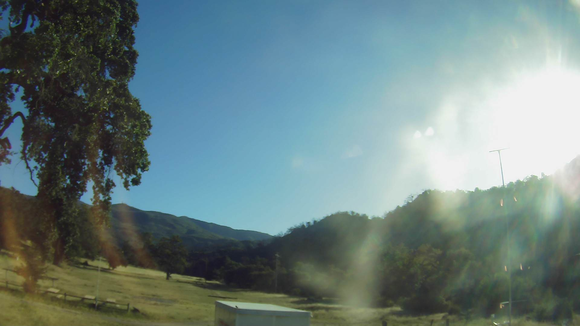
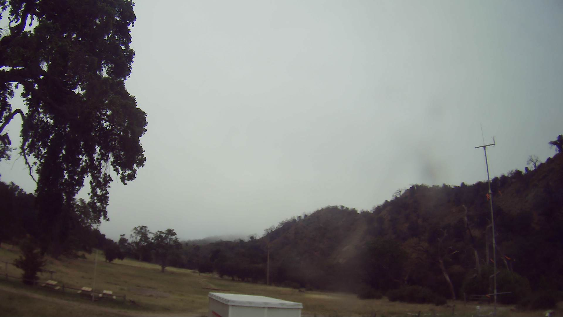
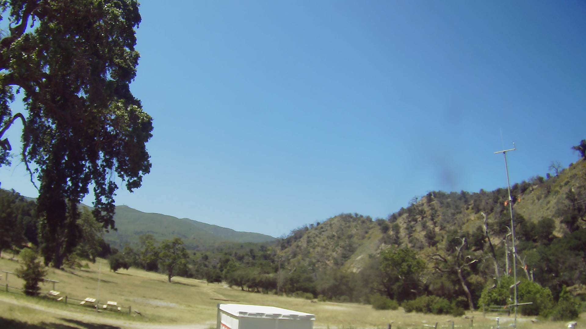
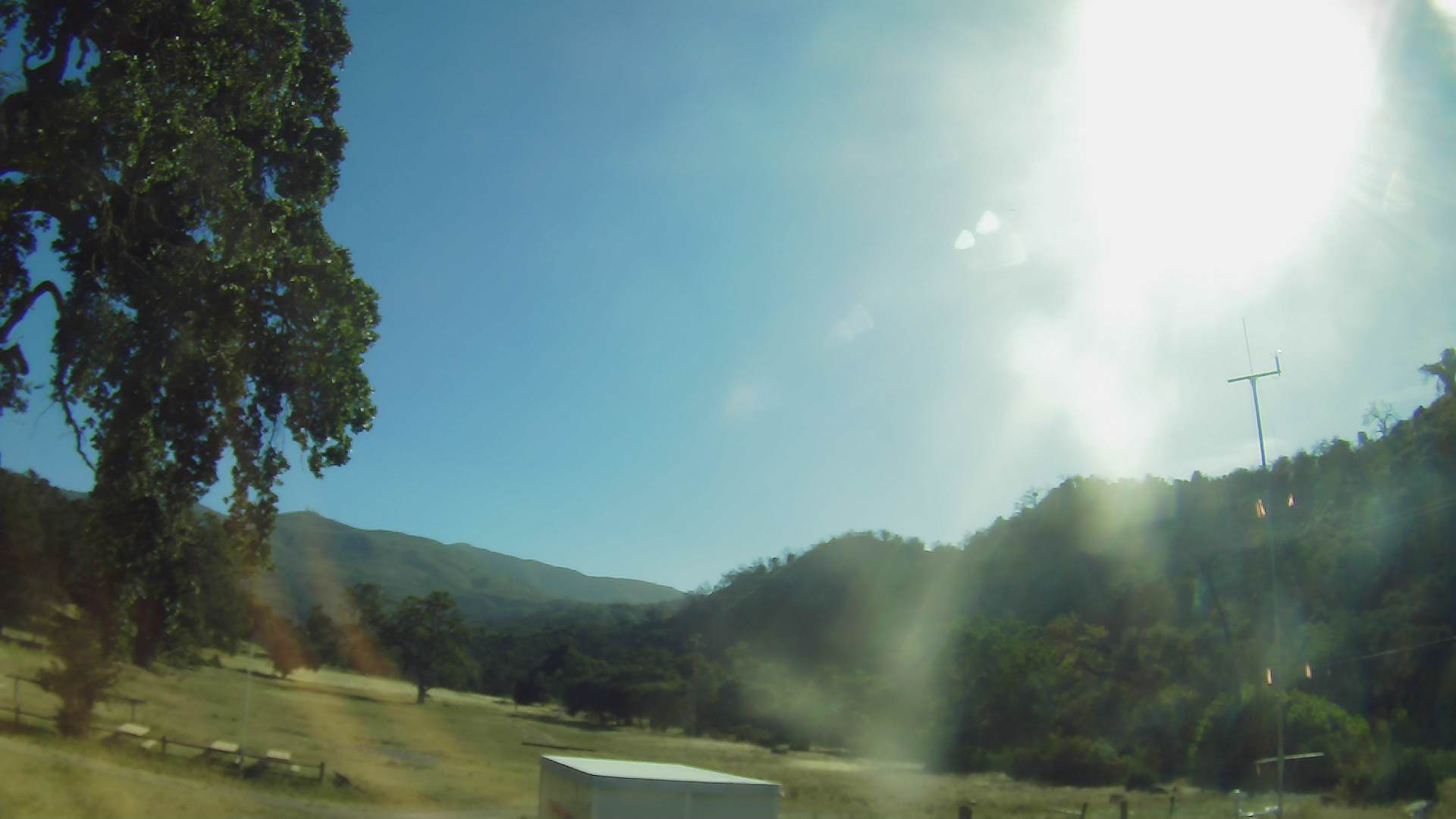
Camera photo 2022050701
|
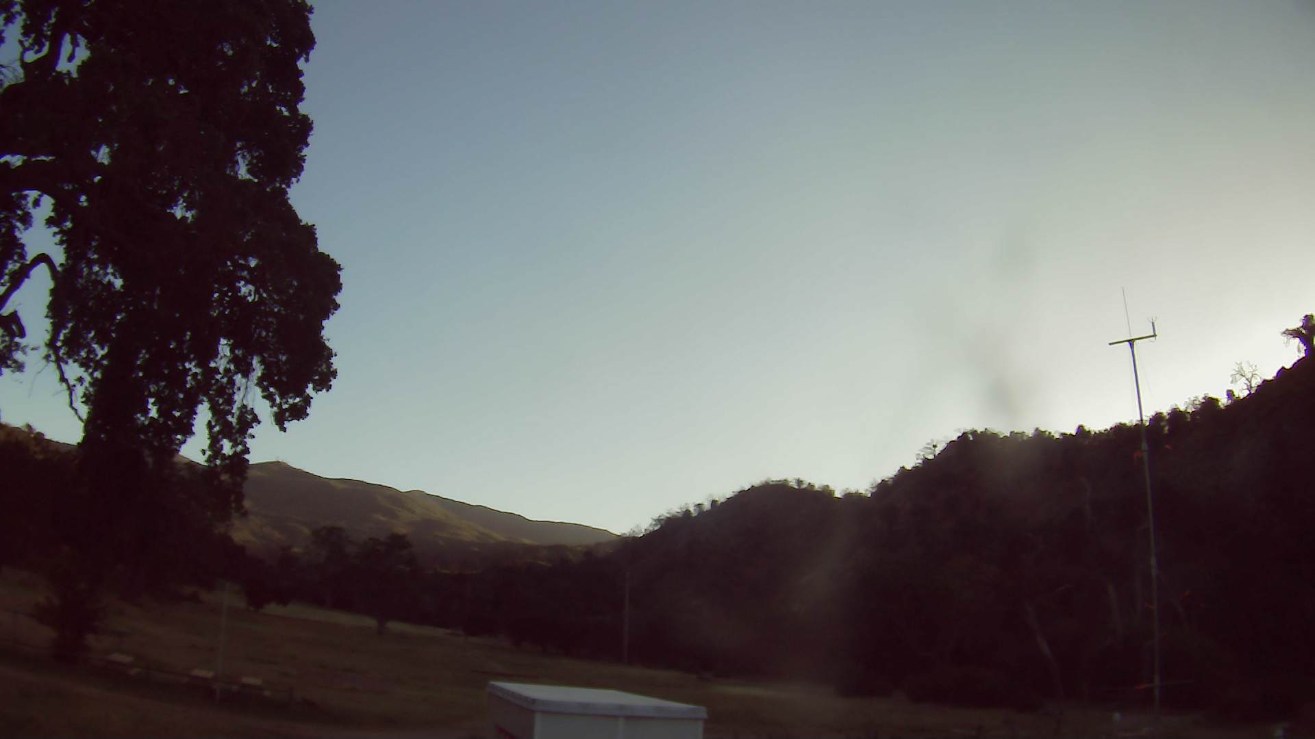
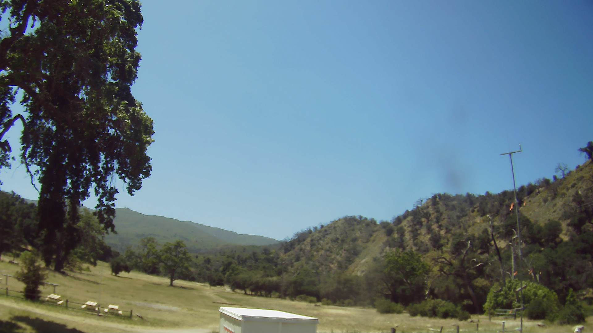
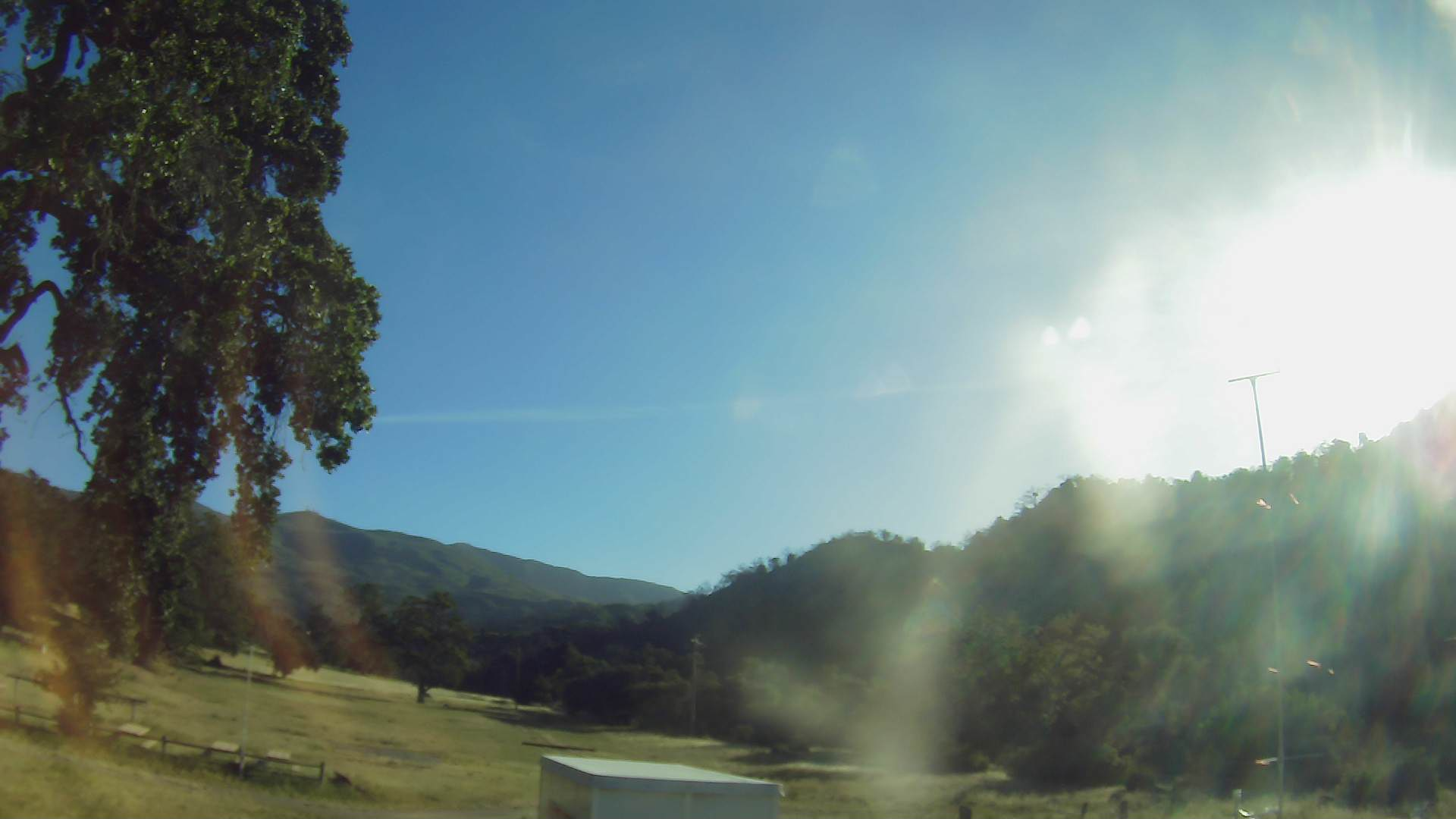
Camera photo 2022050702
|
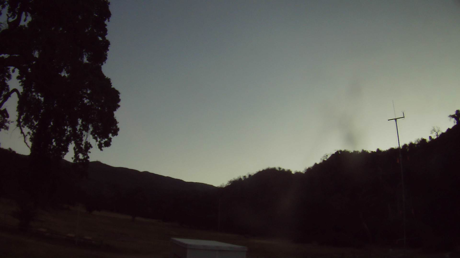
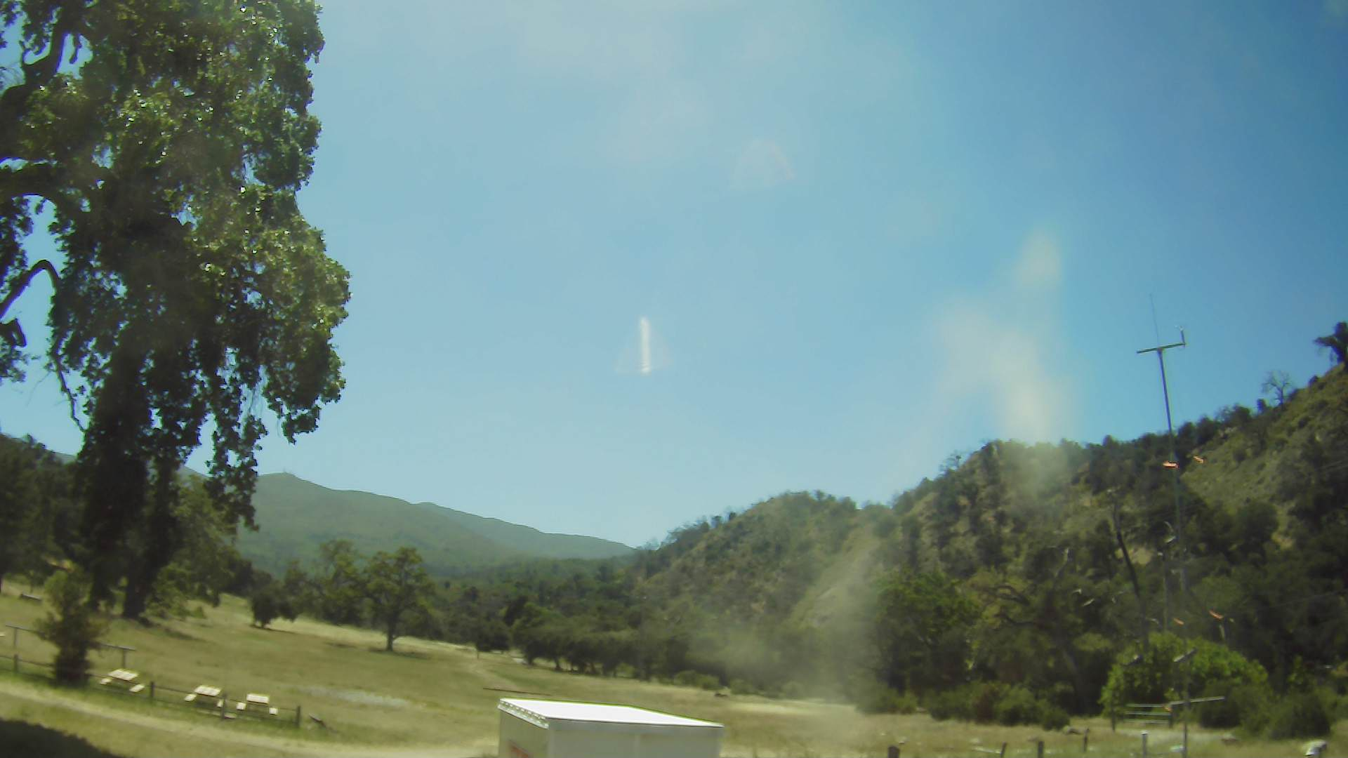
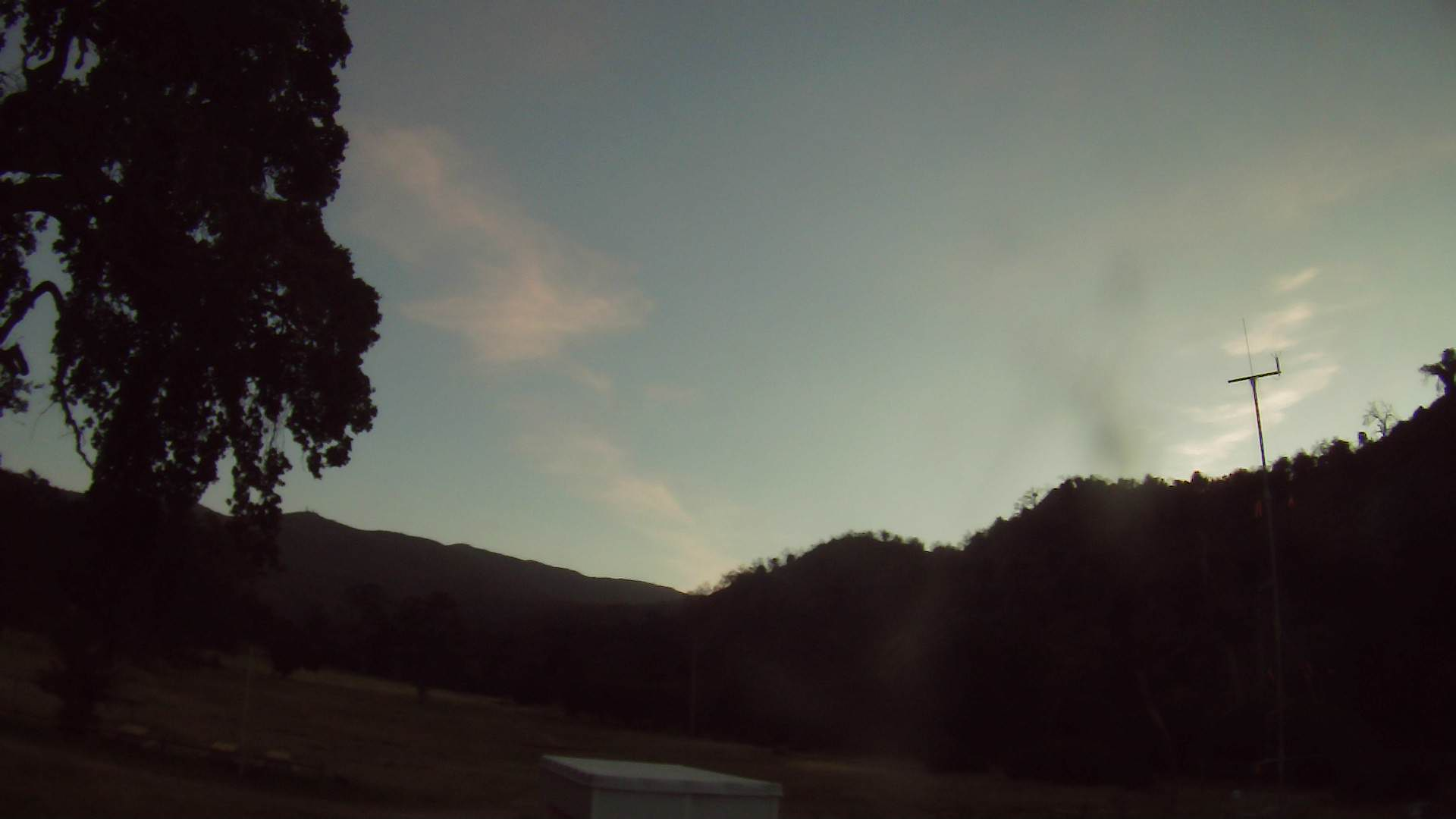
Camera photo 2022050703
|
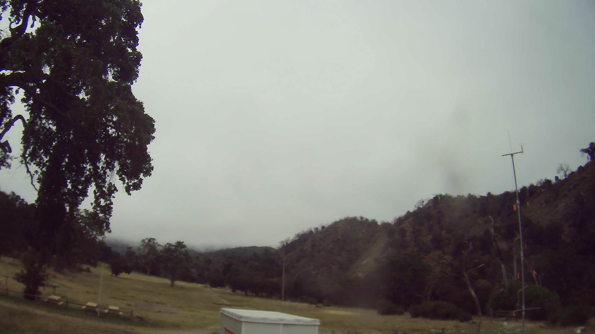
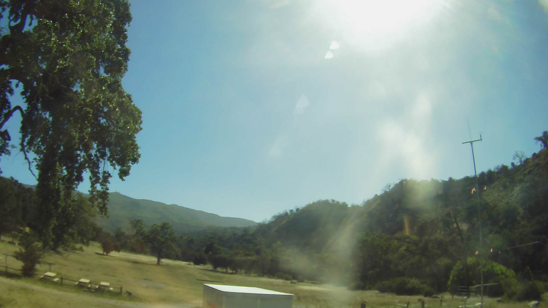
Camera photo 2022050713
|
Camera photo 2022050714
|
Camera photo 2022050715
|
Camera photo 2022050716
|
Camera photo 2022050717

|
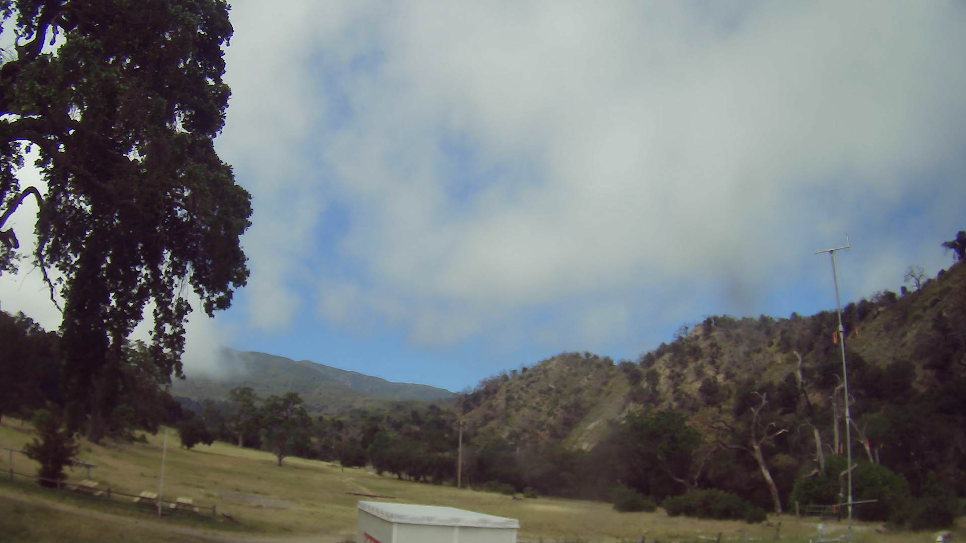
Camera photo 2022050718
|
Camera photo 2022050719
|
Camera photo 2022050720
|
Camera photo 2022050721
|
Camera photo 2022050722
|
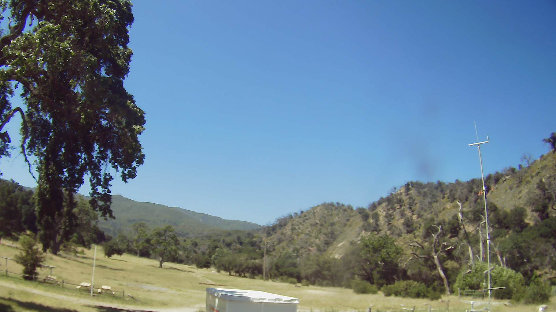
Camera photo 2022050723
|
Camera photo 20220508

|
Camera photo 2022050801
|
Camera photo 2022050802
|
Camera photo 2022050803
|
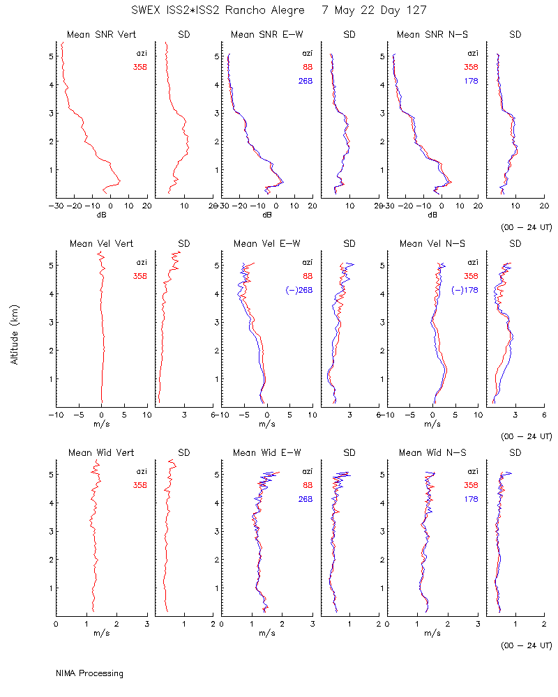
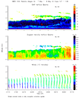
Profiler nima_moments 20220507
|
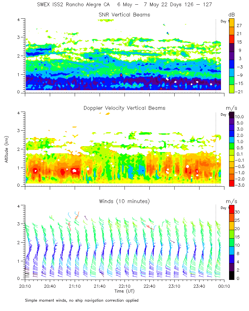
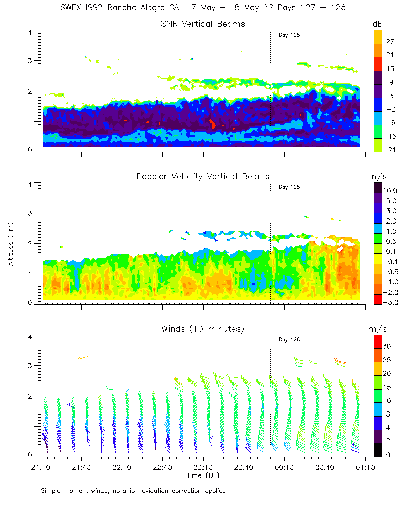
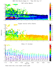
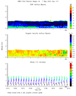
Profiler915 moments_4hr 2022050623
|
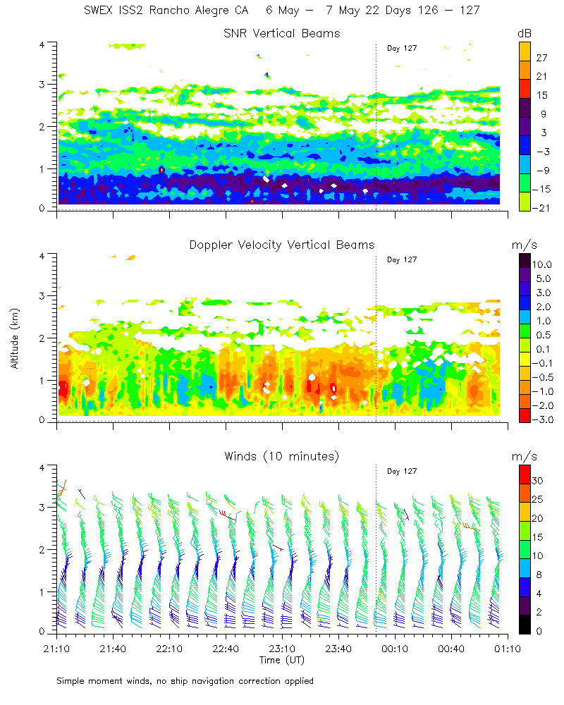
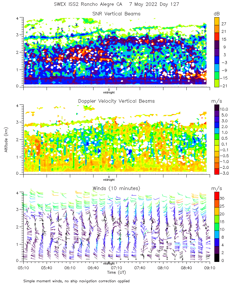
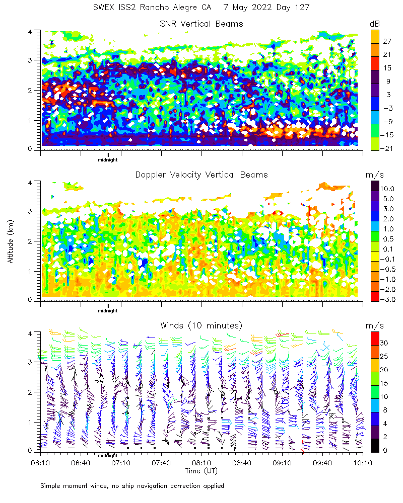
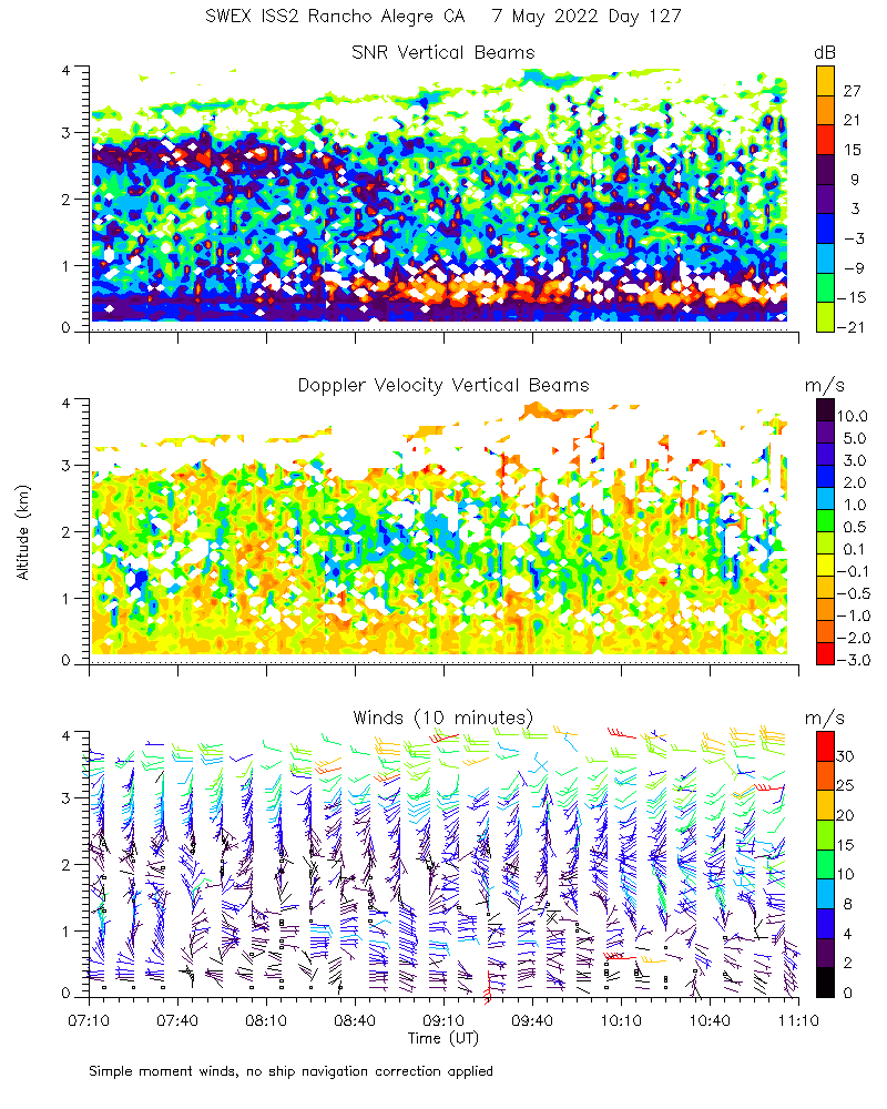
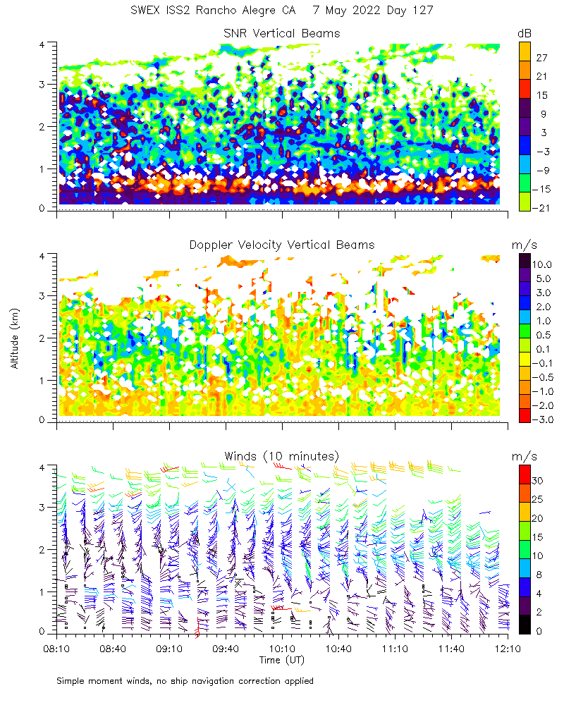
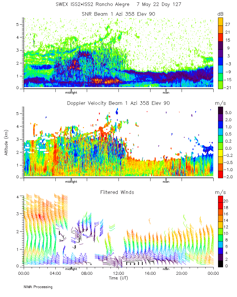
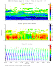
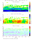
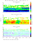
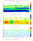
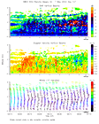
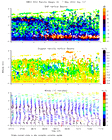
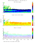
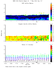
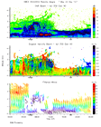
Profiler915 moments_4hr 20220507
|
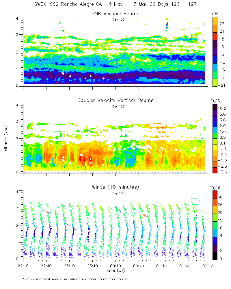
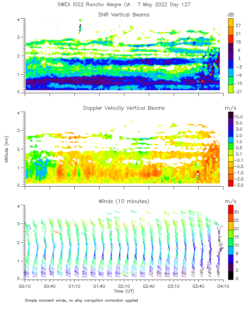
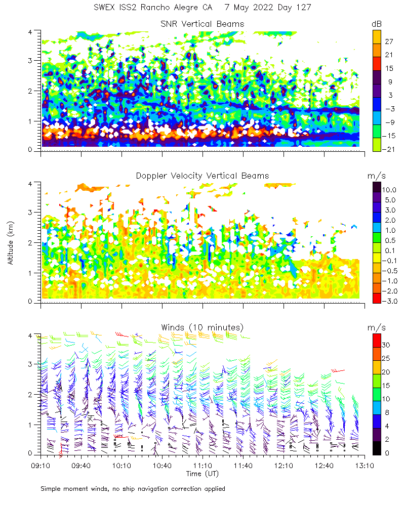
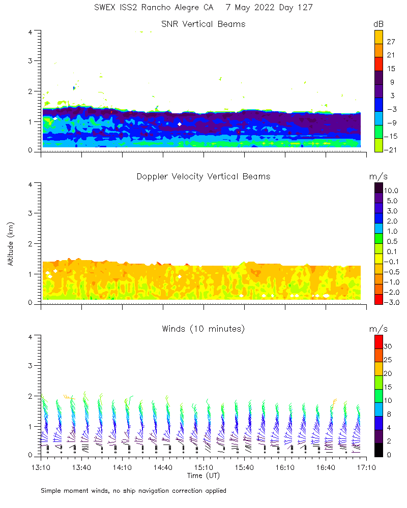
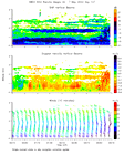
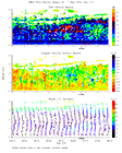
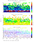
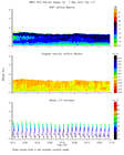
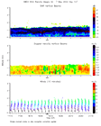
Profiler915 moments_4hr 2022050701
|
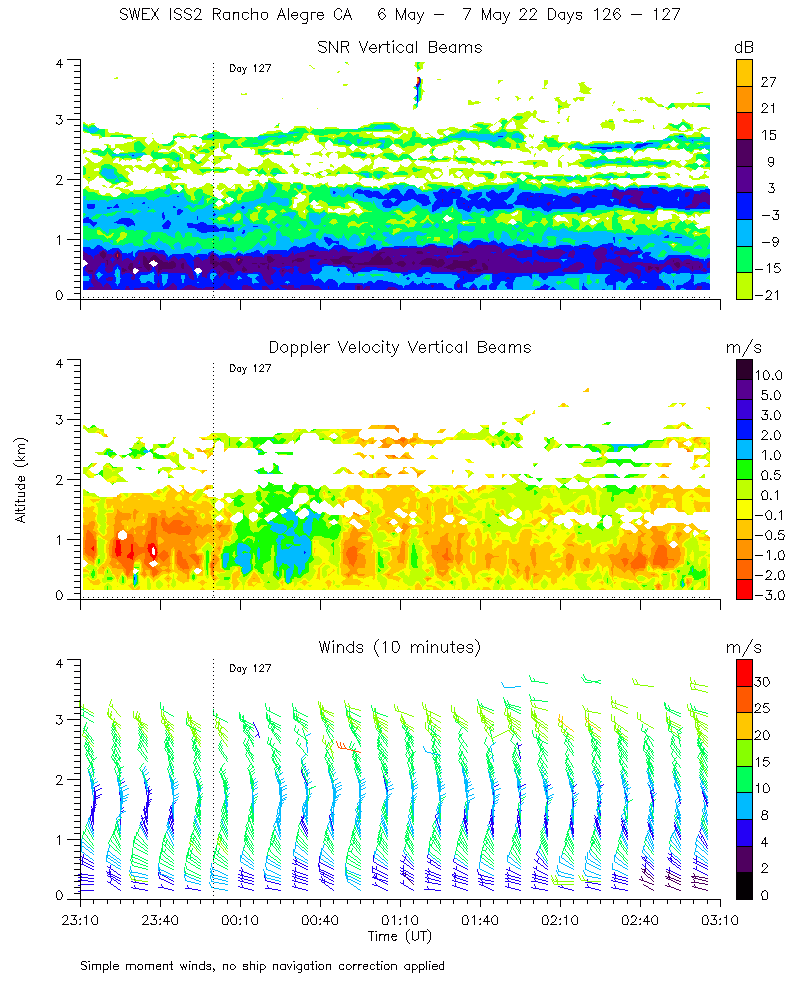
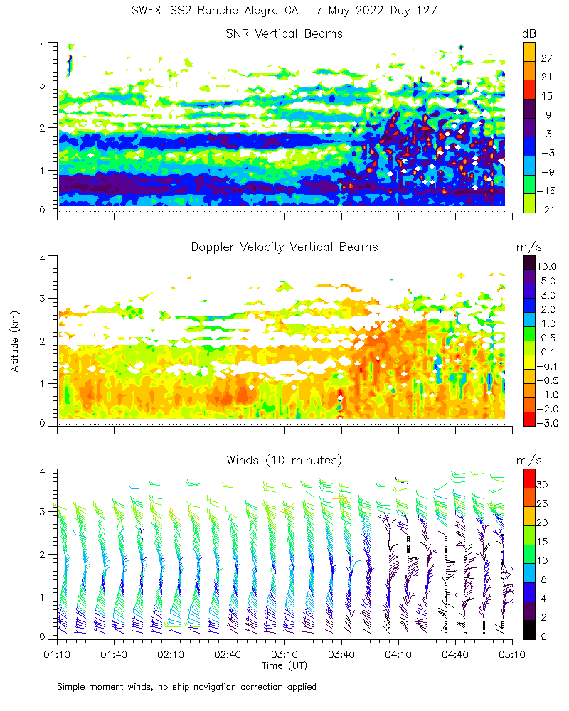
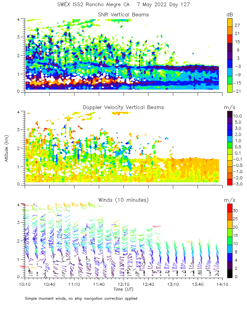
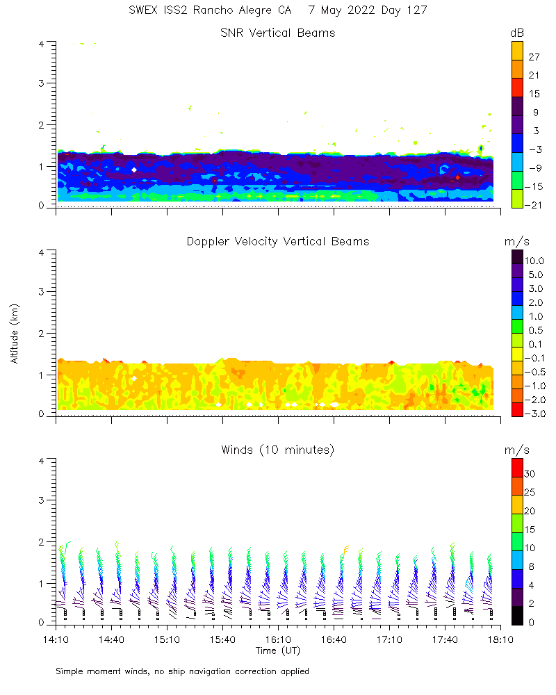
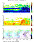
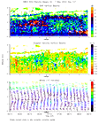
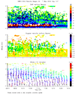
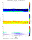
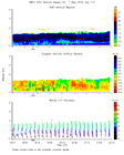
Profiler915 moments_4hr 2022050702
|
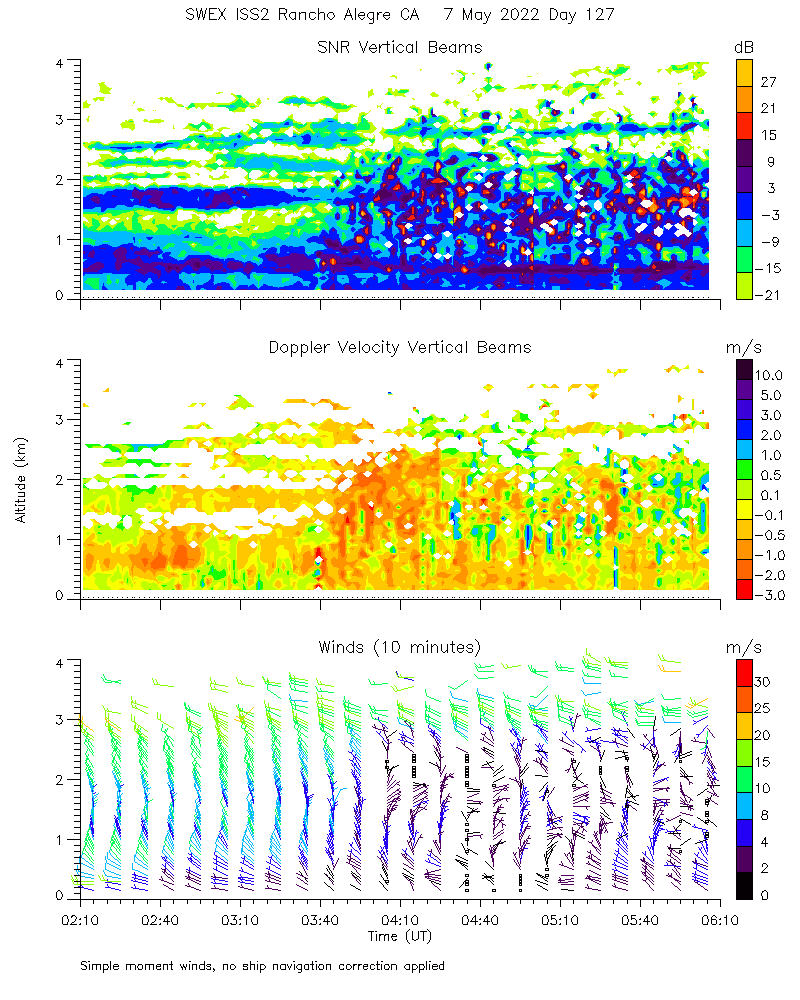
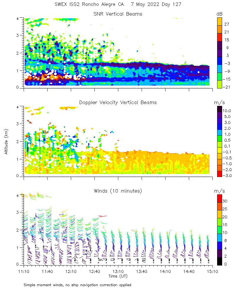
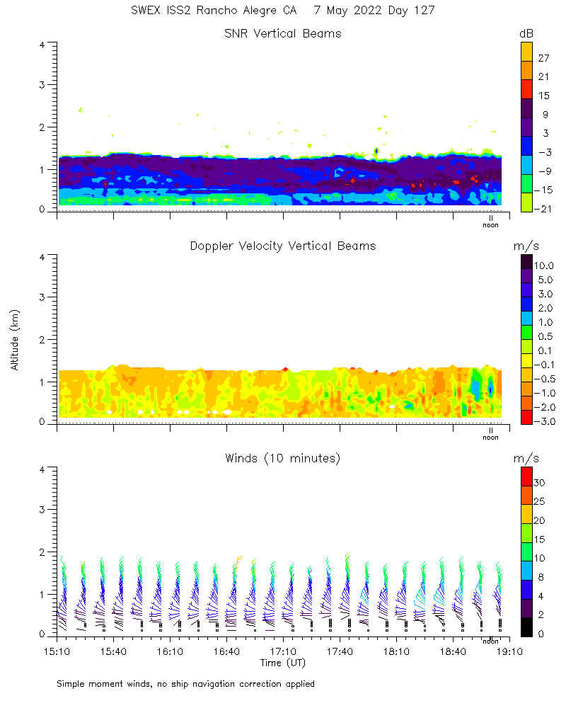
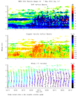
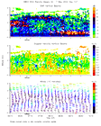
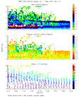
Profiler915 moments_4hr 2022050703
|
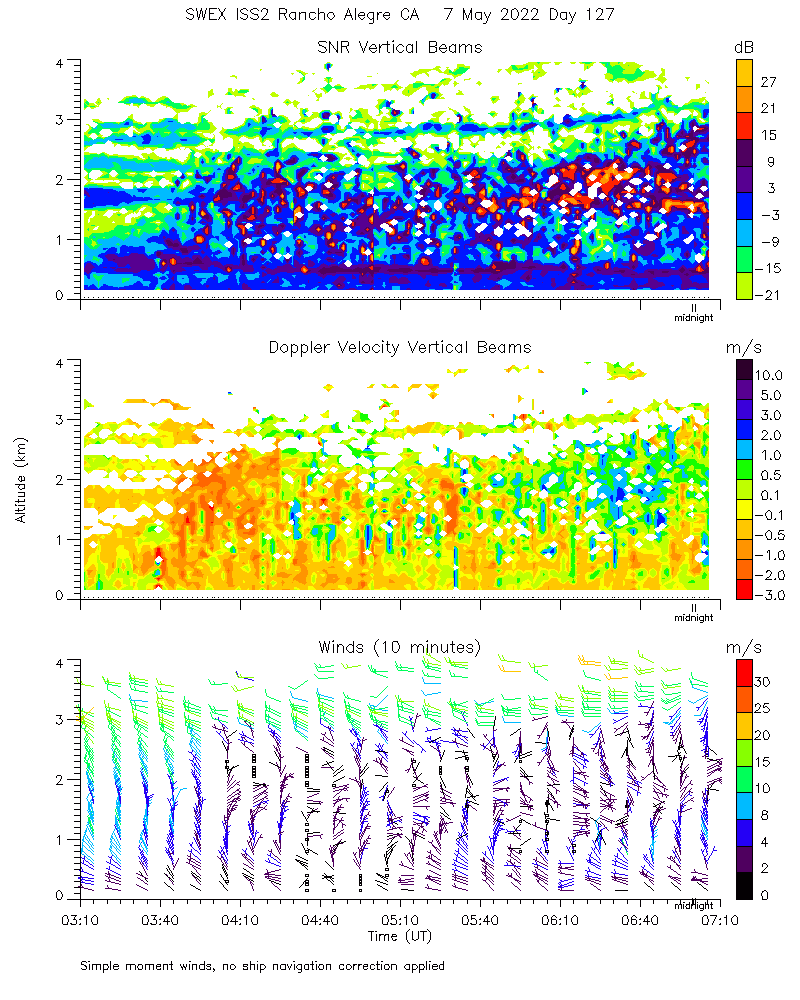
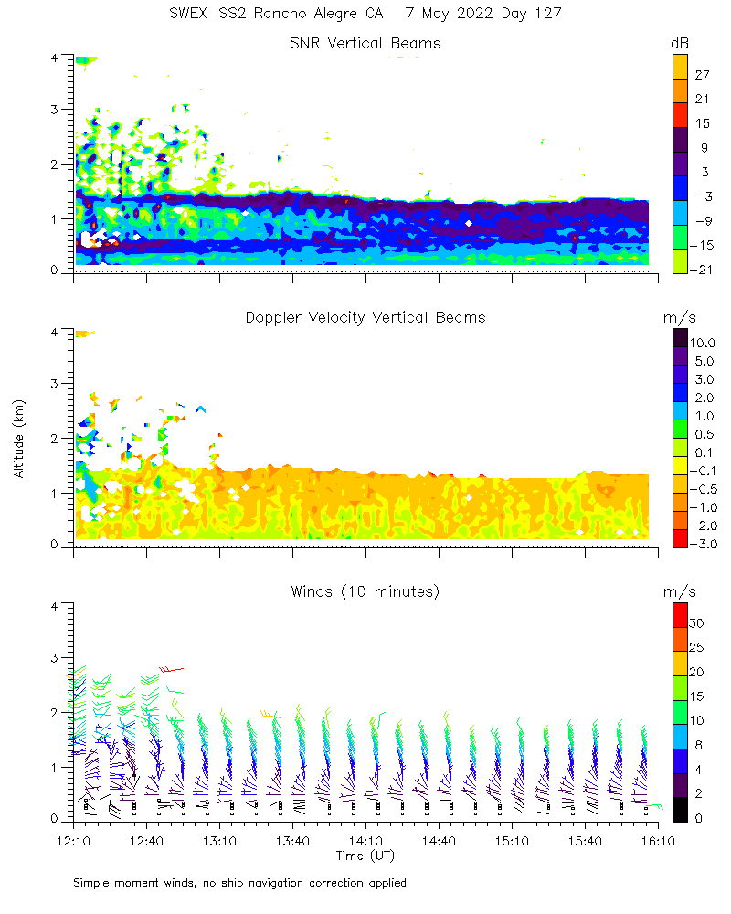
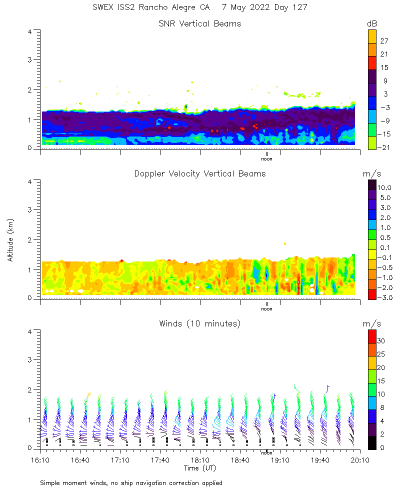
Profiler915 moments_4hr 2022050704
|
Profiler915 moments_4hr 2022050705
|
Profiler915 moments_4hr 2022050706
|
Profiler915 moments_4hr 2022050707
|
Profiler915 moments_4hr 2022050708
|
Profiler915 moments_4hr 2022050709
|
Profiler915 moments_4hr 2022050710
|
Profiler915 moments_4hr 2022050711
|
Profiler915 moments_4hr 2022050712
|
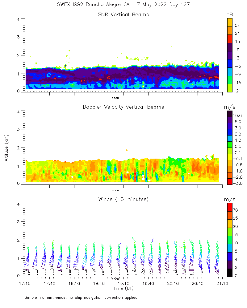
Profiler915 moments_4hr 2022050713
|
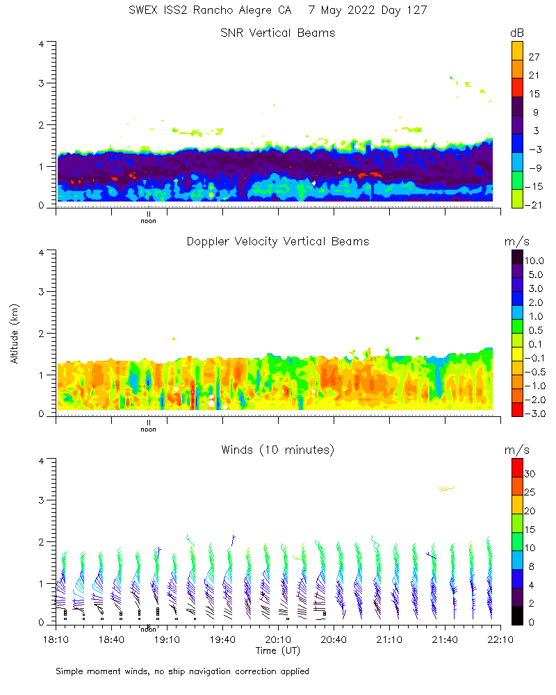
Profiler915 moments_4hr 2022050714
|
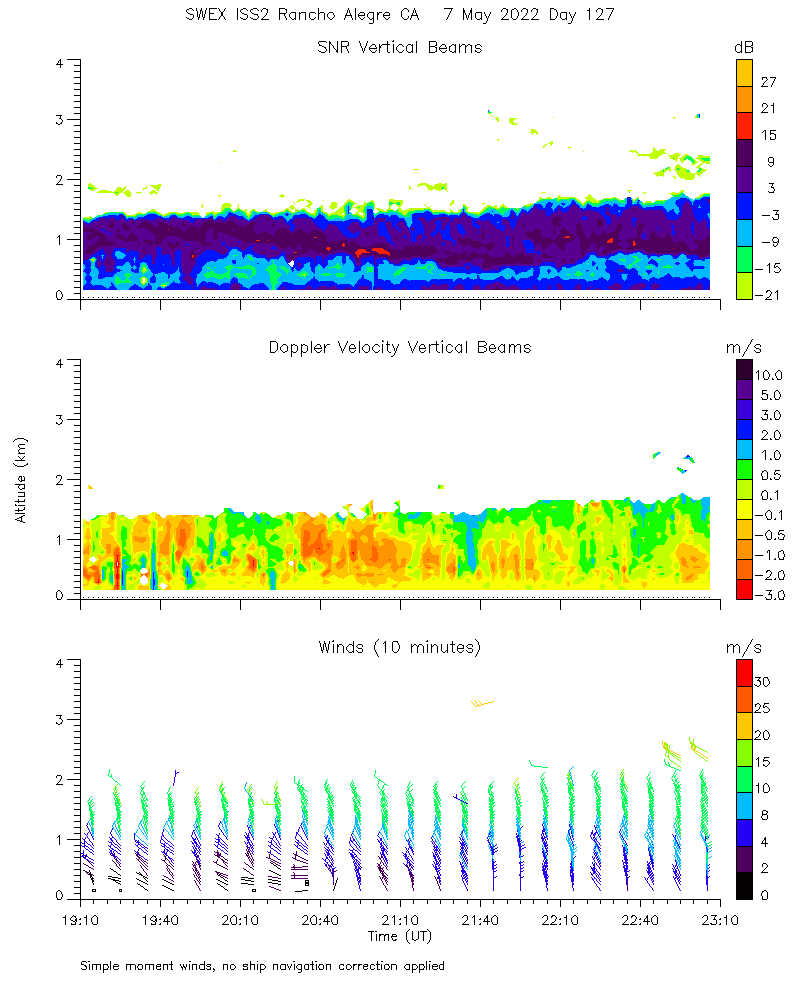
Profiler915 moments_4hr 2022050715
|
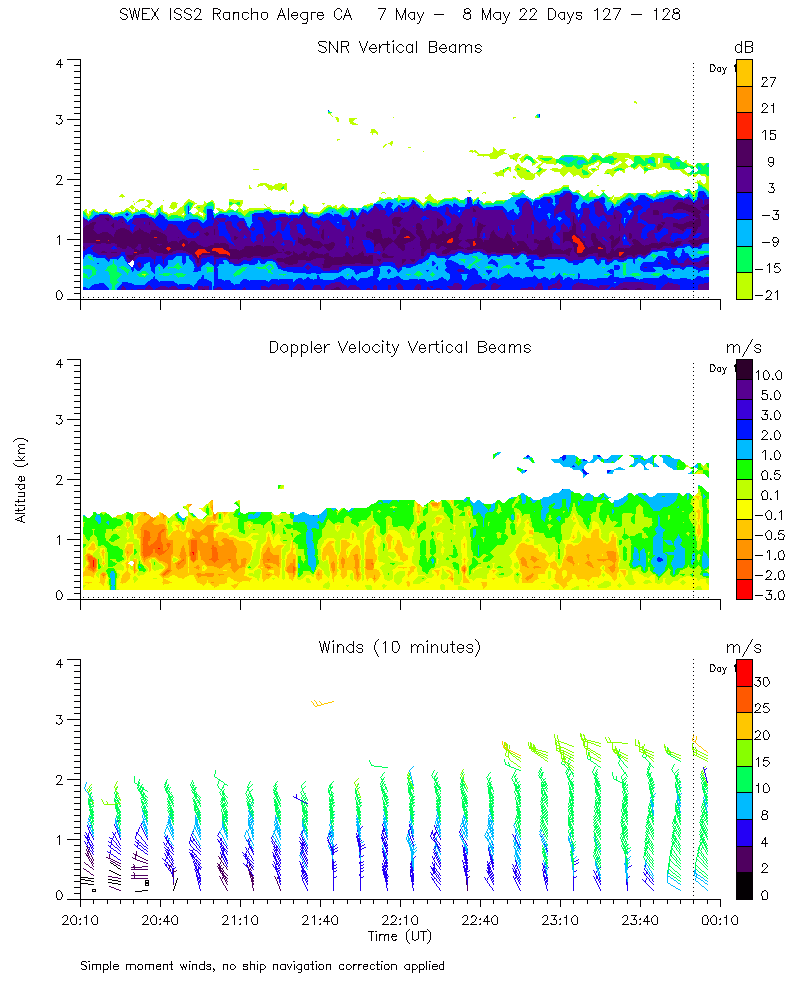
Profiler915 moments_4hr 2022050716
|
Profiler915 moments_4hr 2022050717
|
Profiler915 moments_4hr 2022050718
|
Profiler915 moments_4hr 2022050719
|
Profiler915 moments_4hr 2022050720
|
Profiler915 moments_4hr 2022050721
|
Profiler915 moments_4hr 2022050722

|
Profiler915 moments_4hr 2022050723

|
Profiler915 moments_4hr 20220508
|
Profiler915 snr_winds 20220507
|
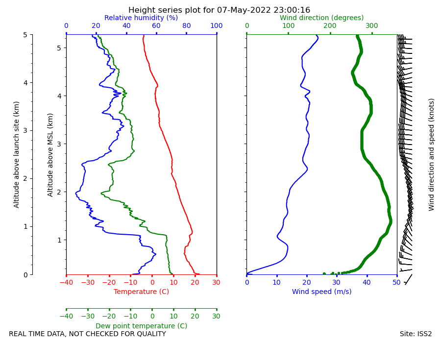
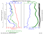
Sonde height_series 2022050723
|
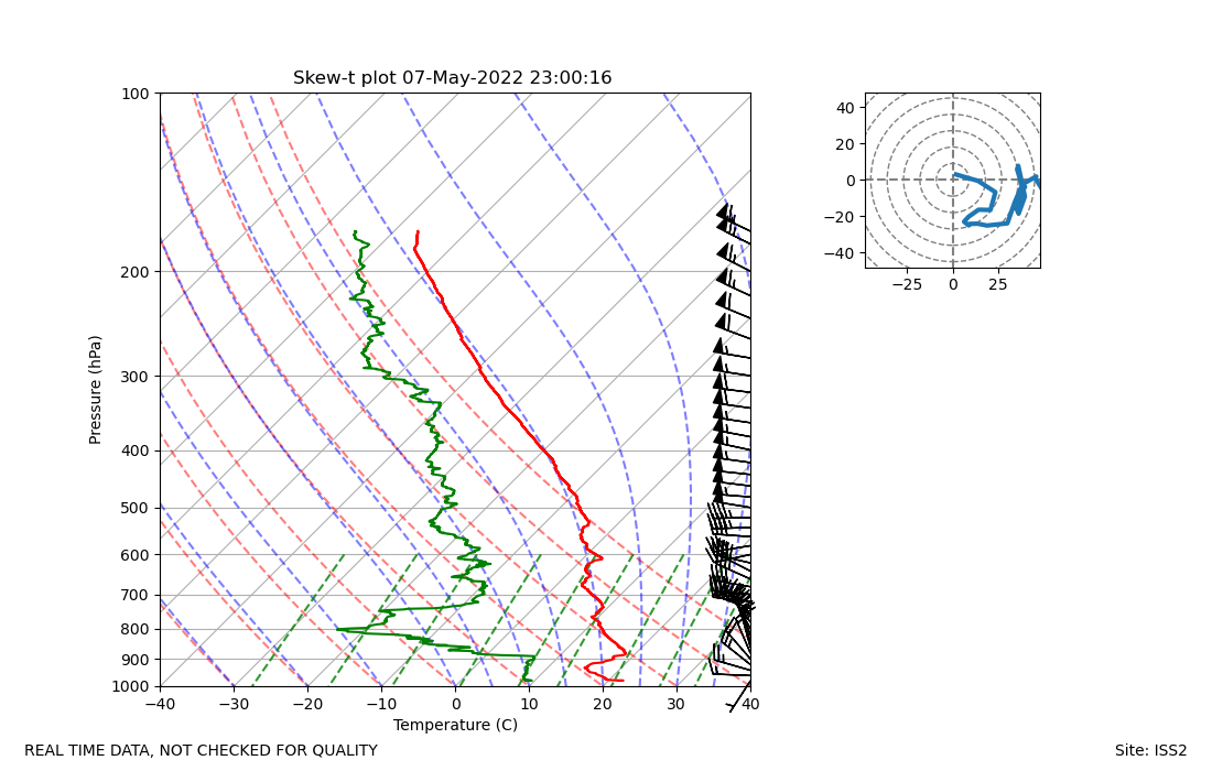
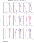
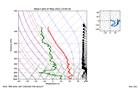
Sonde skewT 2022050723
|
Surface 4component_rad 2022050712
|
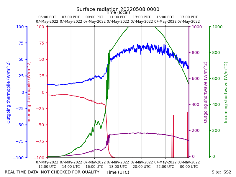
Surface 4component_rad 20220508
|
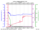
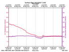
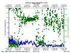
Surface pres 2022050712
|
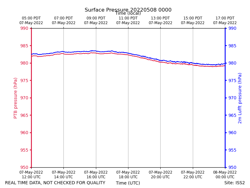
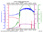
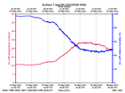
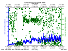
Surface pres 20220508
|
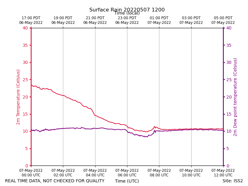
Surface rain 2022050712
|
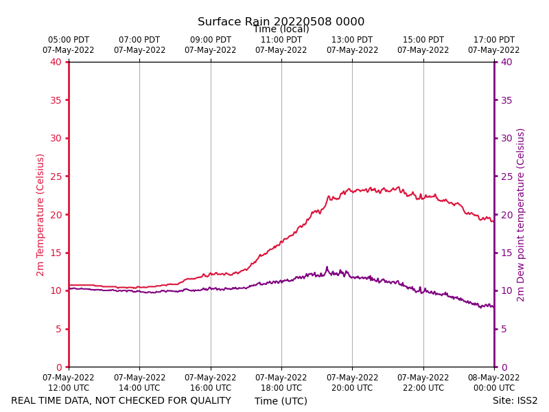
Surface rain 20220508
|
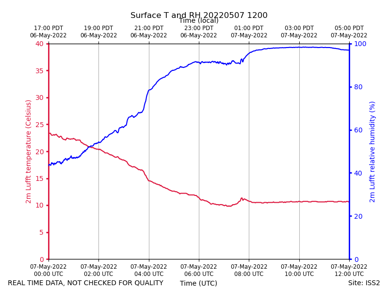
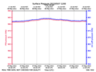
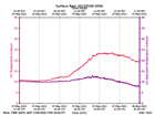
Surface trh 2022050712
|
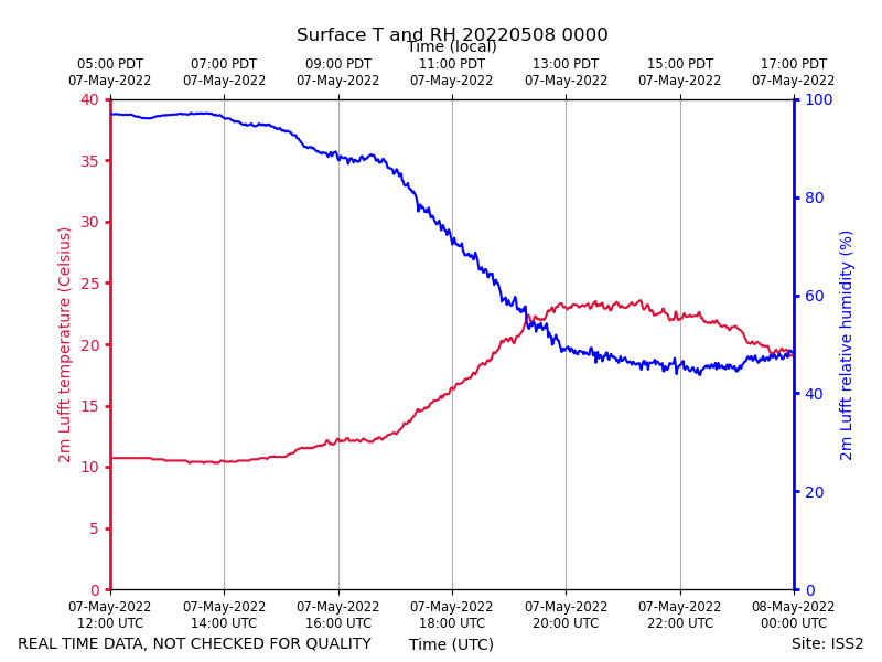
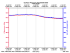
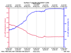
Surface trh 20220508
|
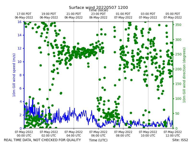
Surface wind 2022050712
|
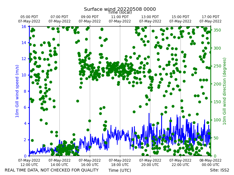
Surface wind 20220508
|