Click on the thumbnail image to view the full-size image.
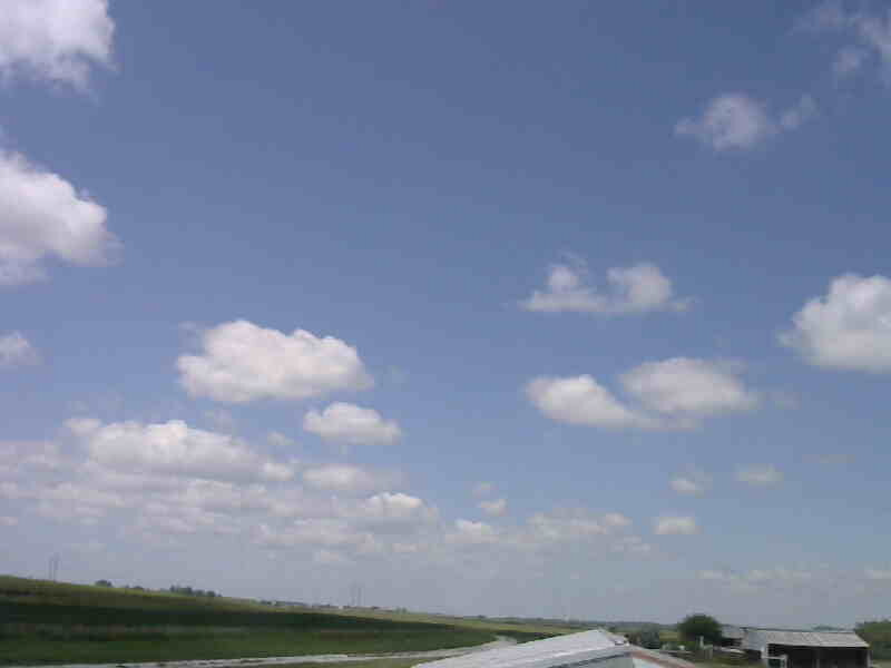
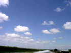
ISS2_Camera.201807210500.photo

|
ISS2_Camera.201807210600.photo

|
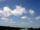
ISS2_Camera.201807210700.photo

|
ISS2_Camera.201807210800.photo

|
ISS2_Camera.201807210900.photo
|
ISS2_Camera.201807211000.photo

|
ISS2_Camera.201807211100.photo
|
ISS2_Camera.201807211200.photo
|
ISS2_Camera.201807211300.photo
|
ISS2_Camera.201807211400.photo
|
ISS2_Camera.201807211500.photo
|
ISS2_Camera.201807211600.photo
|
ISS2_Camera.201807211700.photo
|
ISS2_Camera.201807211800.photo
|
ISS2_Camera.201807211900.photo
|
ISS2_Camera.201807212000.photo
|
ISS2_Camera.201807212100.photo
|
ISS2_Camera.201807220500.photo

|
ISS2_Camera.201807220600.photo
|
ISS2_Camera.201807220700.photo

|
ISS2_Camera.201807220800.photo

|
ISS2_Camera.201807220900.photo

|
ISS2_Camera.201807221000.photo
|
ISS2_Camera.201807221100.photo
|
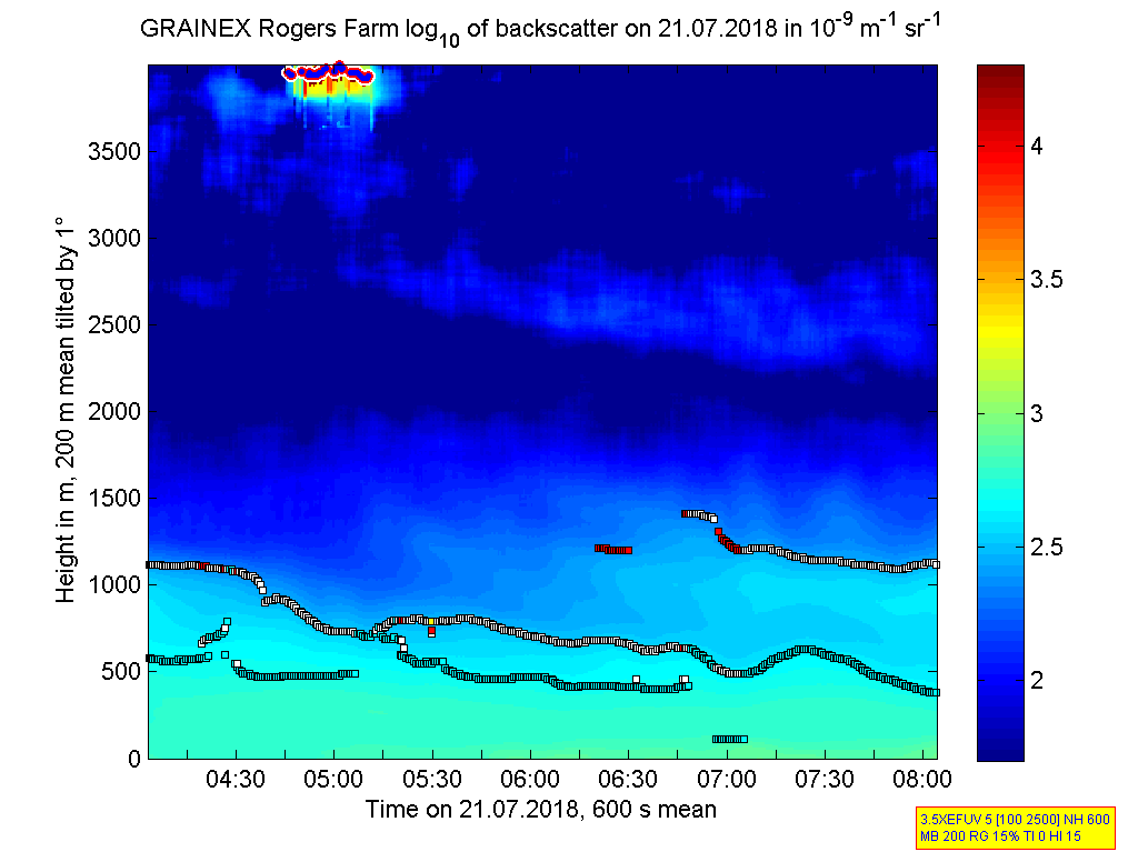
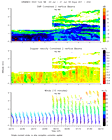
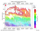
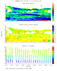
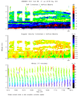
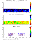
ISS2_Ceilometer.201807210000.de...
|
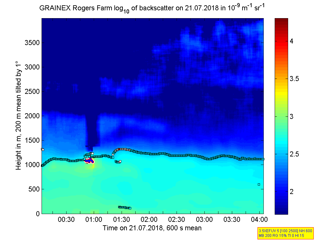
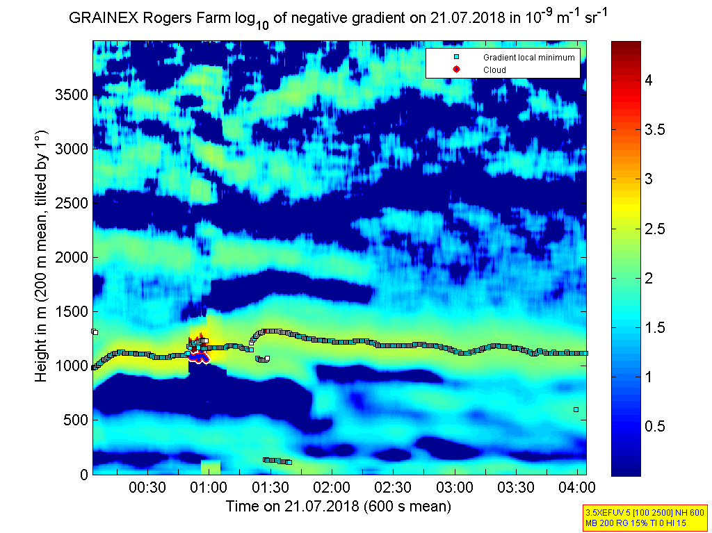
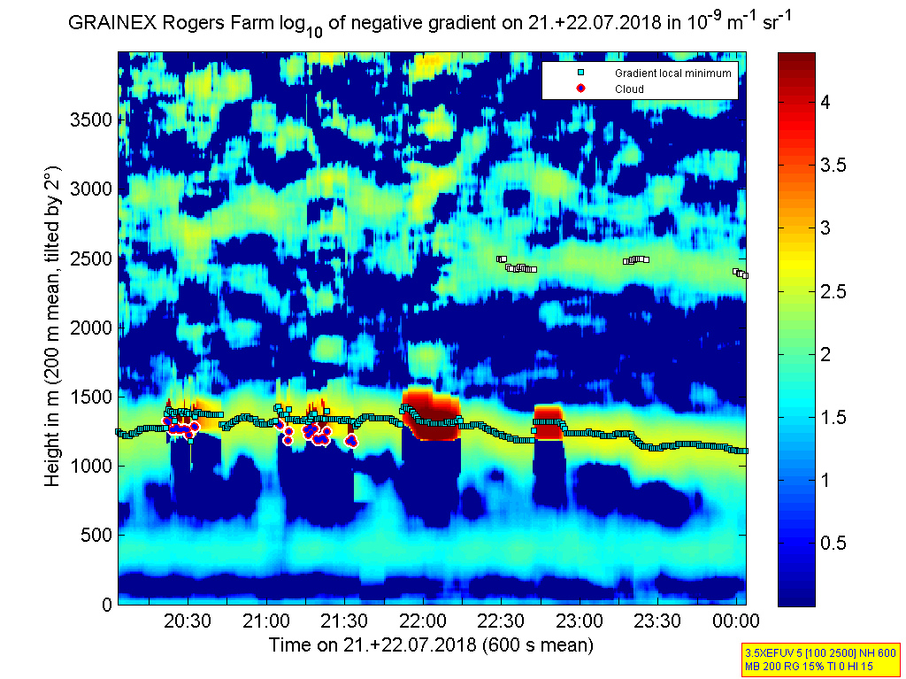
ISS2_Ceilometer.201807210000.gr...
|
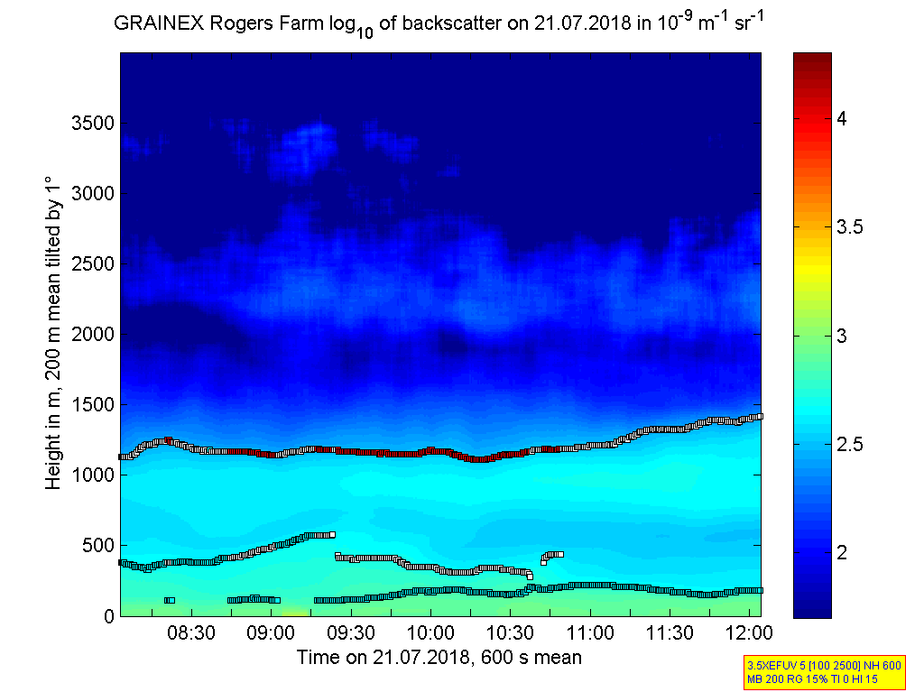
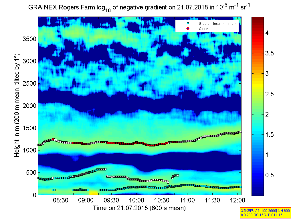
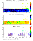
ISS2_Ceilometer.201807210400.de...
|
ISS2_Ceilometer.201807210400.gr...
|
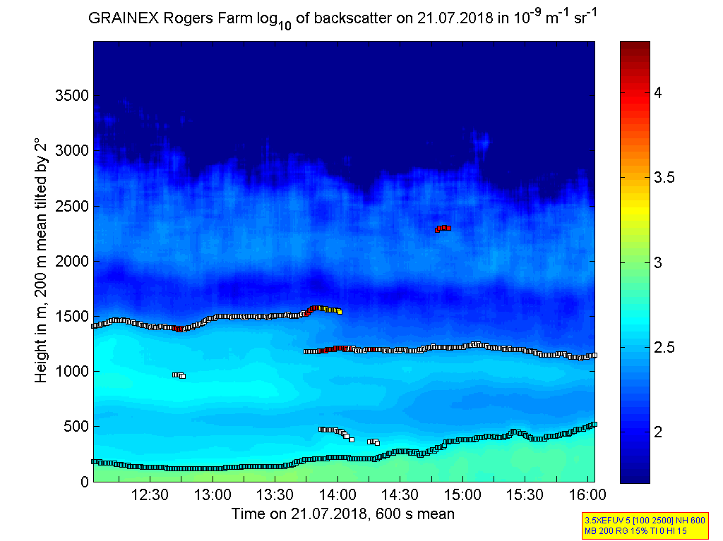
ISS2_Ceilometer.201807210800.de...
|
ISS2_Ceilometer.201807210800.gr...
|
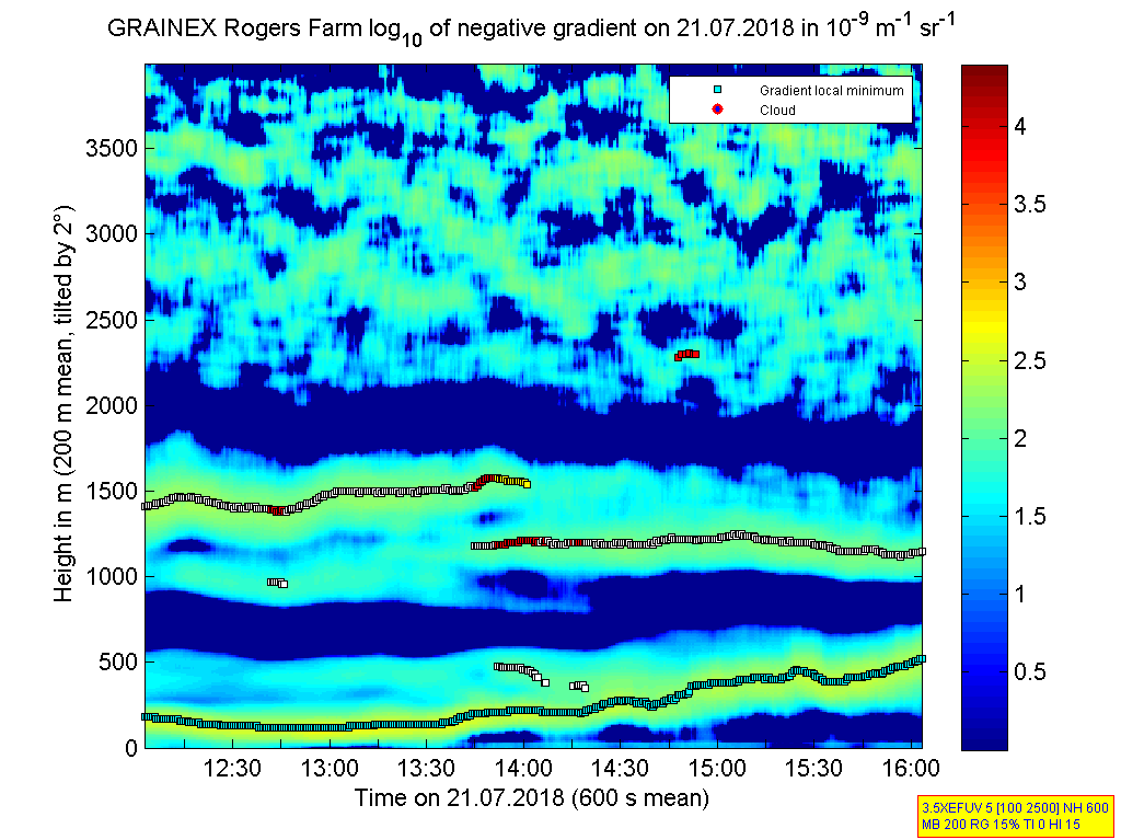
ISS2_Ceilometer.201807211200.de...
|
ISS2_Ceilometer.201807211200.gr...
|
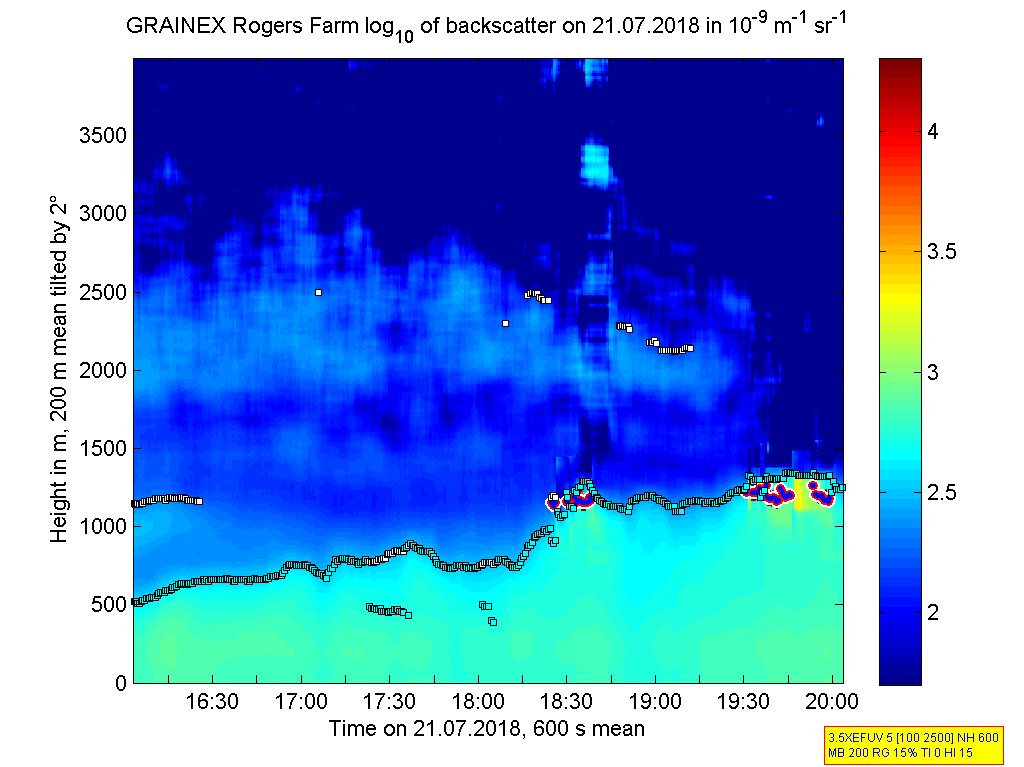
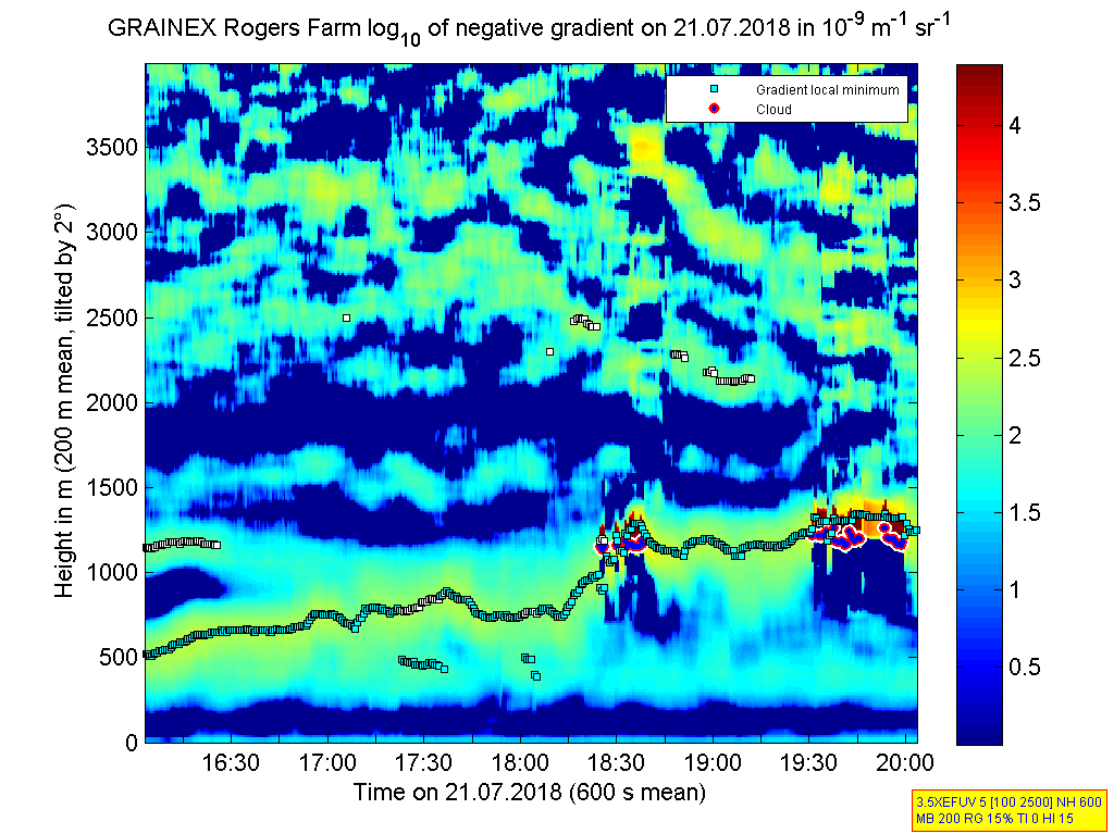
ISS2_Ceilometer.201807211600.de...
|
ISS2_Ceilometer.201807211600.gr...
|
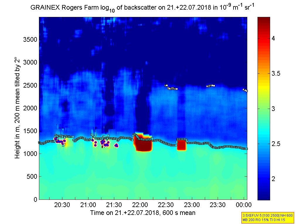
ISS2_Ceilometer.201807212000.de...
|
ISS2_Ceilometer.201807212000.gr...
|
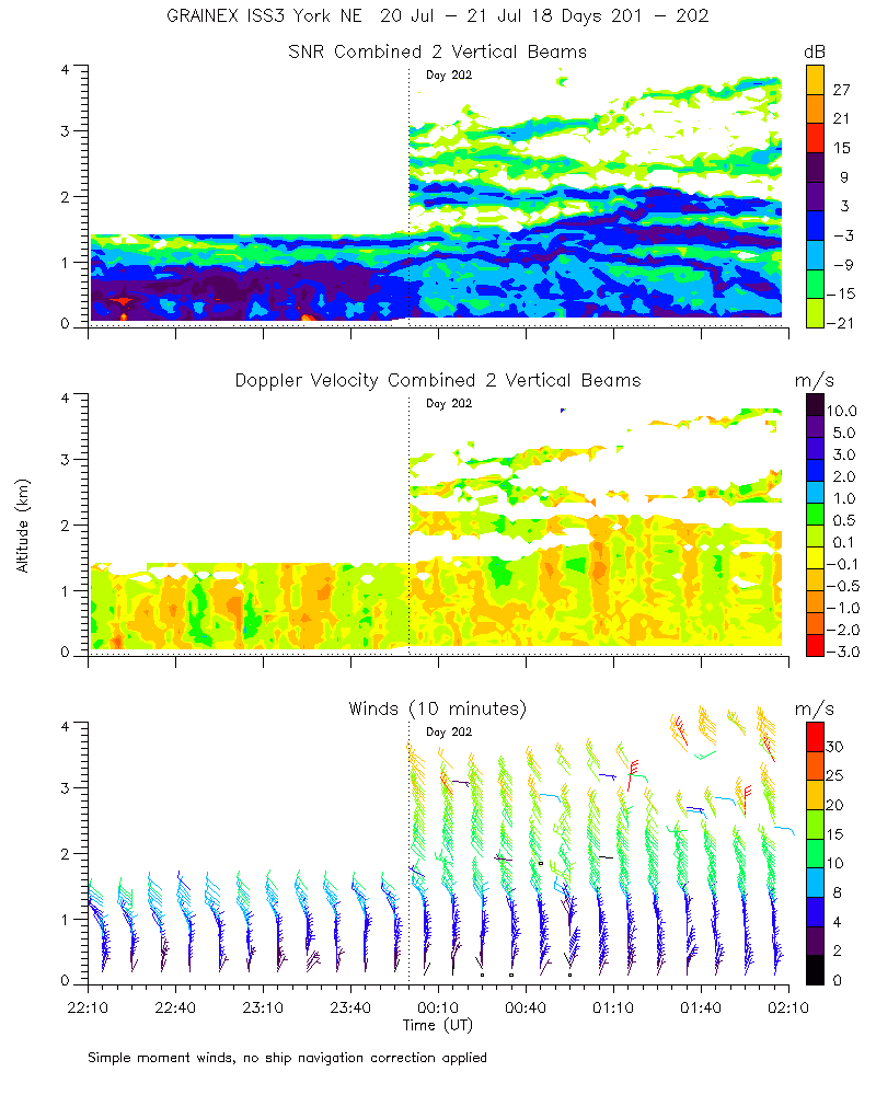
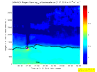
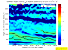
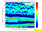
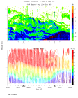
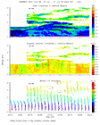
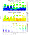
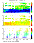
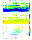
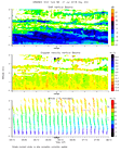
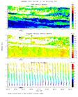
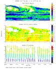
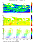
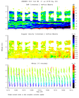
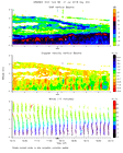
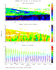
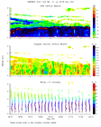
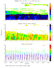
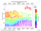
ISS2_Profiler.201807202300.mome...
|
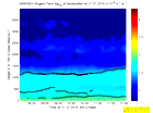
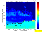
ISS2_Profiler.201807210000.mome...
|
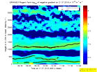
ISS2_Profiler.201807210000.nima...
|
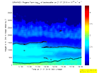
ISS2_Profiler.201807210000.nima...
|
ISS2_Profiler.201807210000.snr_...
|
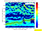
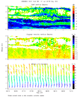
ISS2_Profiler.201807210100.mome...
|
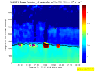
ISS2_Profiler.201807210200.mome...
|
ISS2_Profiler.201807210300.mome...
|
ISS2_Profiler.201807210400.mome...

|
ISS2_Profiler.201807210500.mome...
|
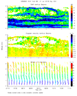
ISS2_Profiler.201807210600.mome...
|
ISS2_Profiler.201807210700.mome...
|
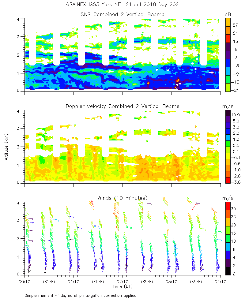
ISS2_Profiler.201807210800.mome...
|
ISS2_Profiler.201807210900.mome...
|
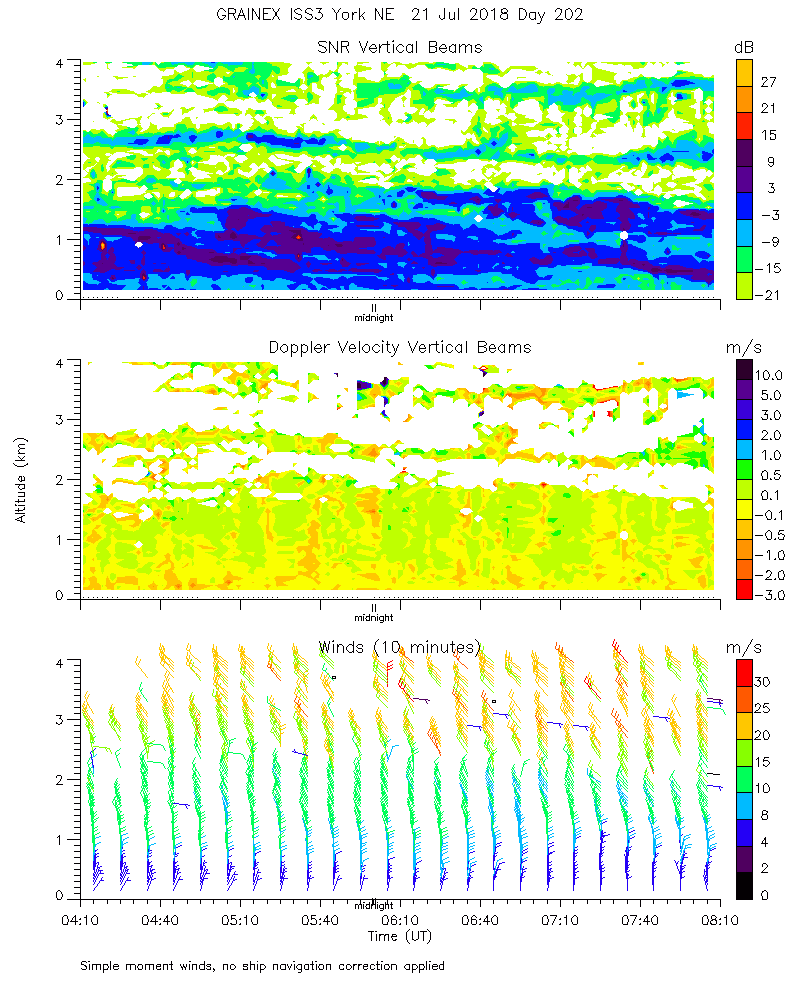
ISS2_Profiler.201807211000.mome...
|
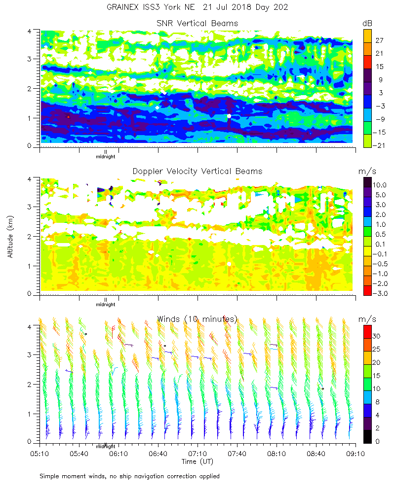
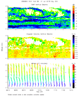
ISS2_Profiler.201807211100.mome...
|
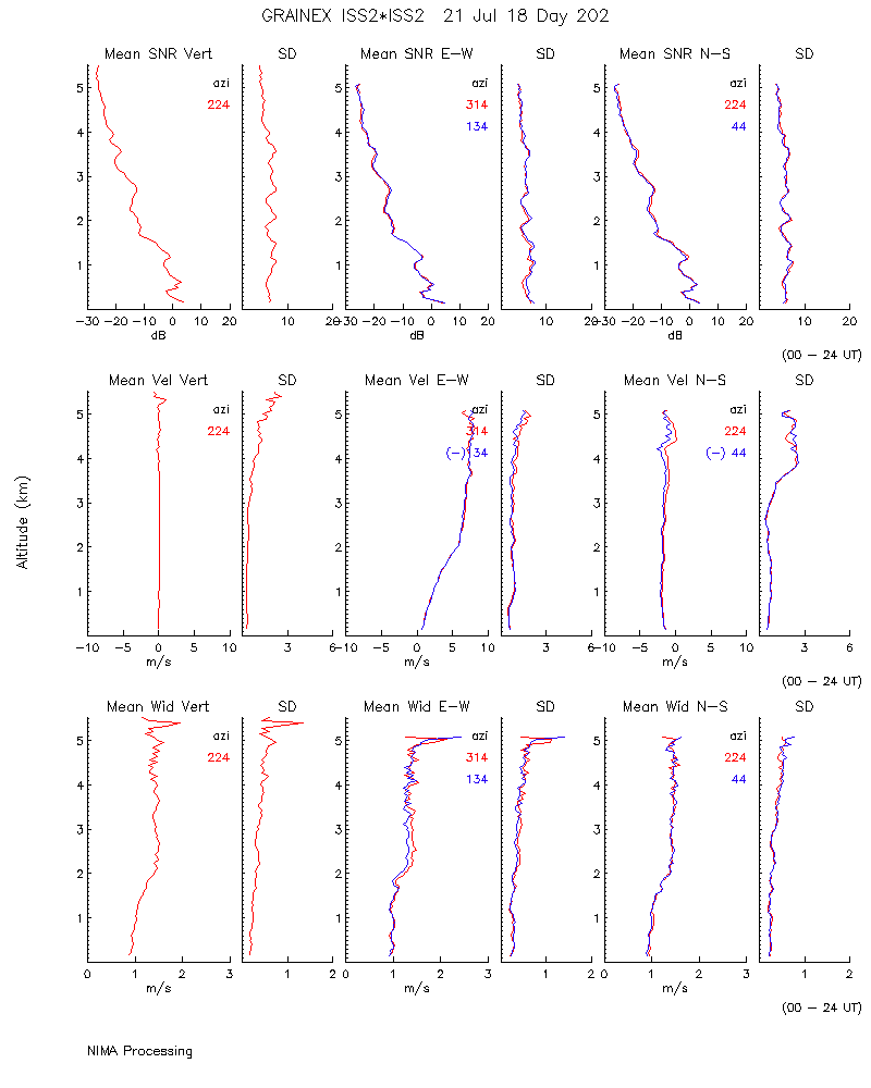
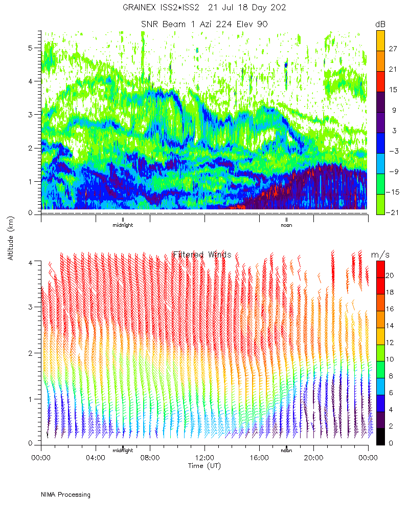
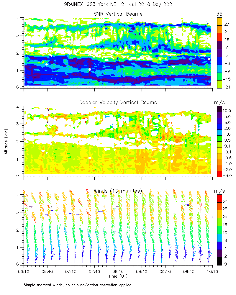
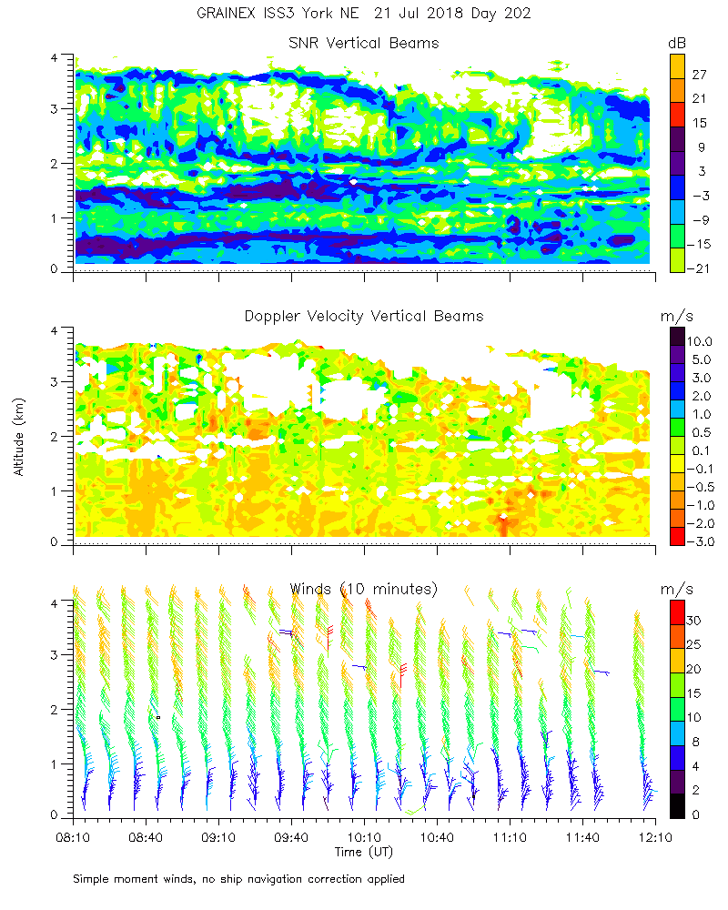
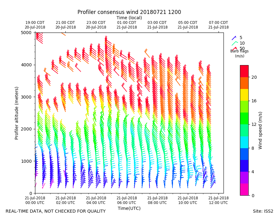
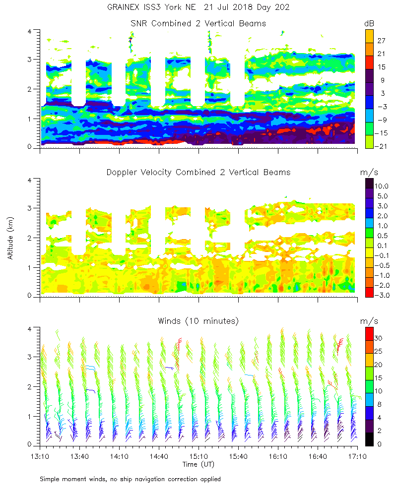
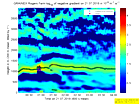
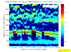
ISS2_Profiler.201807211200.mome...
|
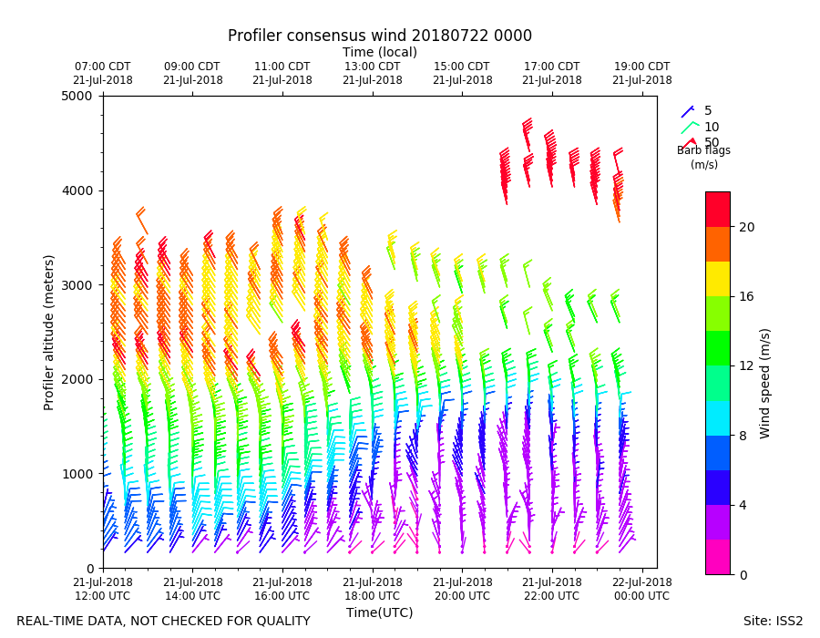
ISS2_Profiler.201807211200.wind...
|
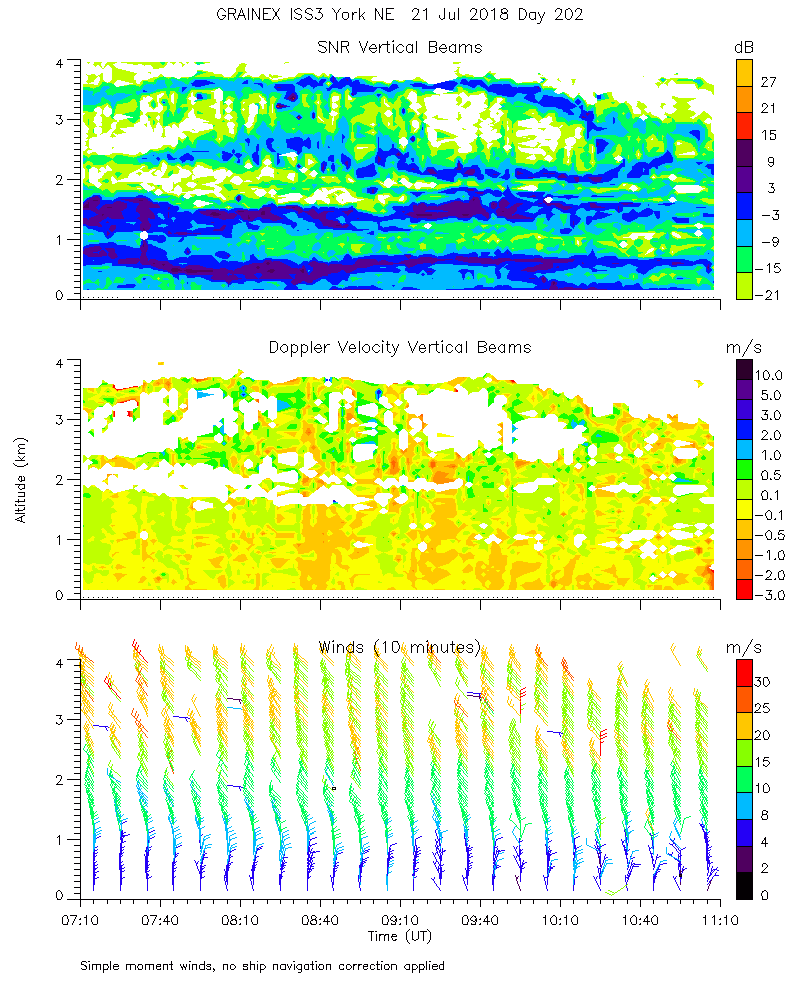
ISS2_Profiler.201807211300.mome...
|
ISS2_Profiler.201807211400.mome...
|
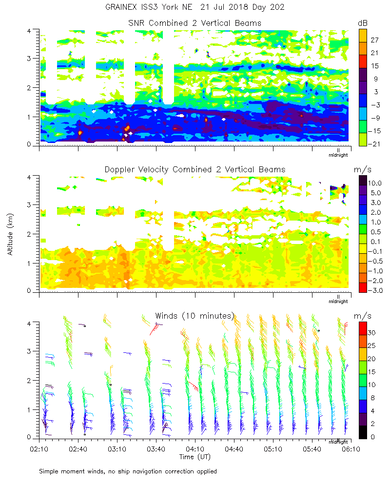
ISS2_Profiler.201807211500.mome...
|
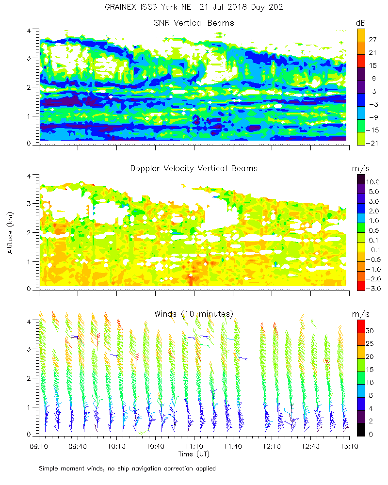
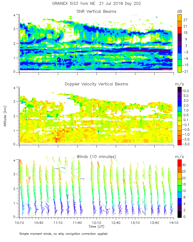
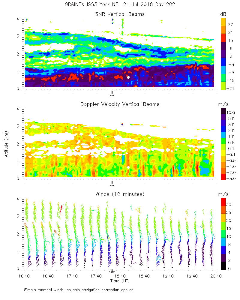
ISS2_Profiler.201807211600.mome...
|
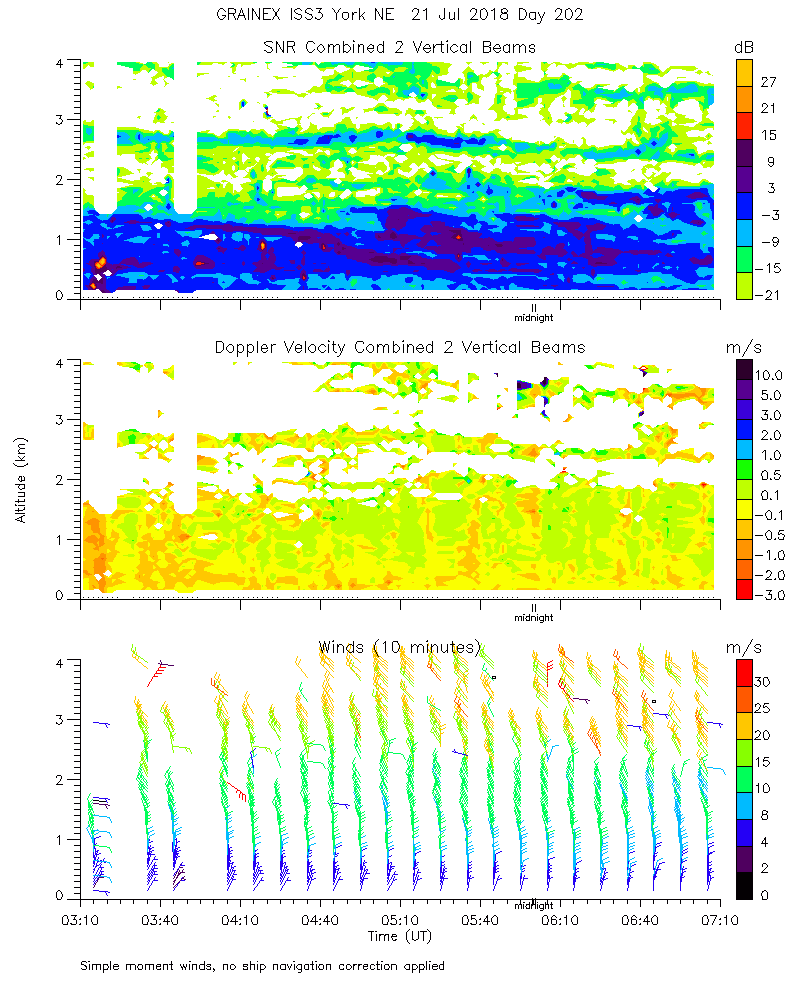
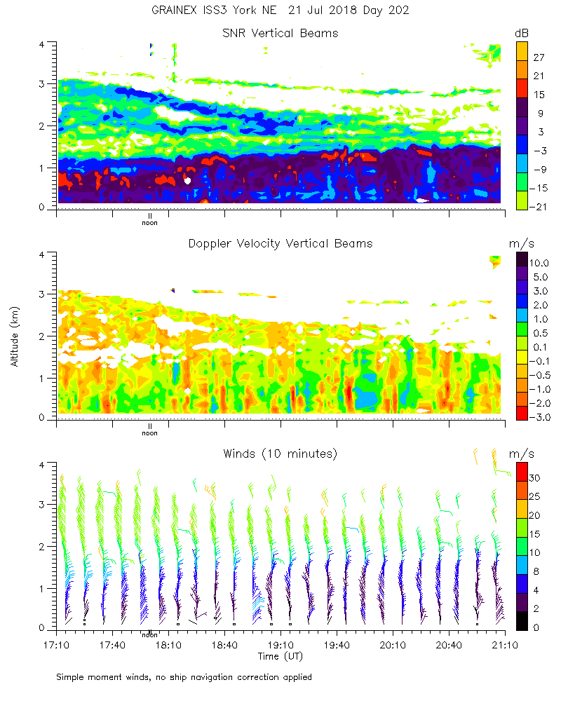
ISS2_Profiler.201807211700.mome...
|
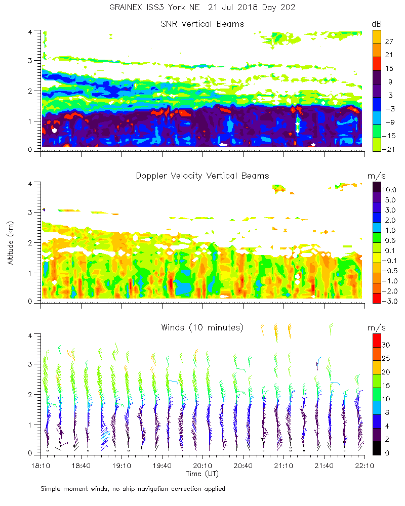
ISS2_Profiler.201807211800.mome...
|
ISS2_Profiler.201807211900.mome...
|
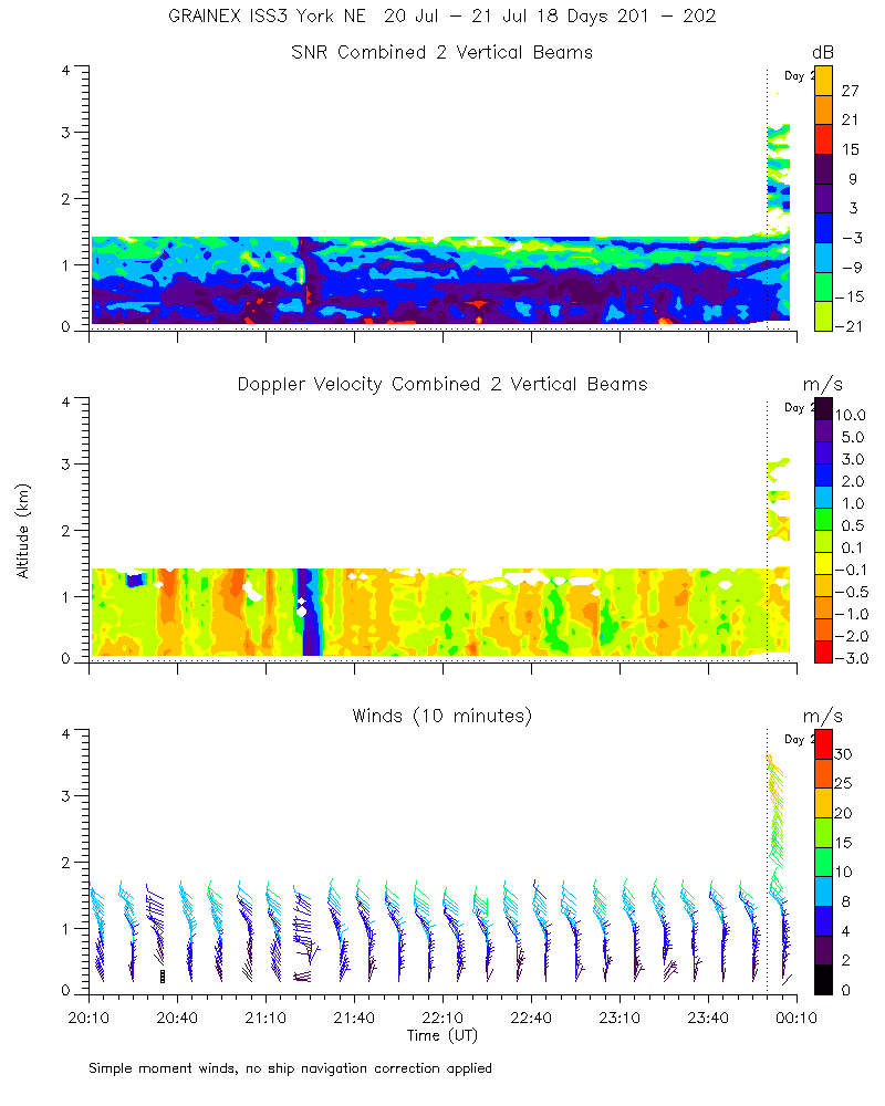
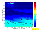
ISS2_Profiler.201807212000.mome...
|
ISS2_Profiler.201807212100.mome...
|
ISS2_Profiler.201807212200.mome...
|
ISS2_Profiler.201807212300.mome...
|
ISS2_Profiler.201807220000.mome...
|
ISS2_Profiler.201807220000.wind...
|
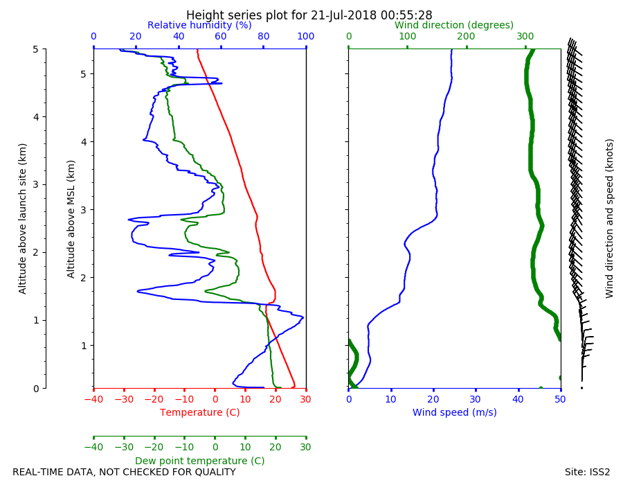
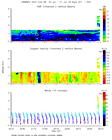
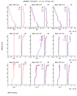
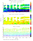
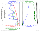
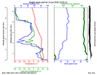
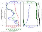
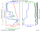
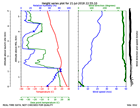
ISS2_Sonde.201807210055.height_...
|
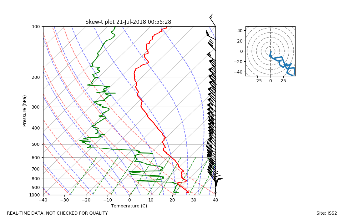
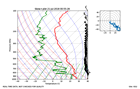
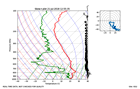
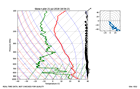
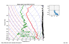
ISS2_Sonde.201807210055.skewT
|
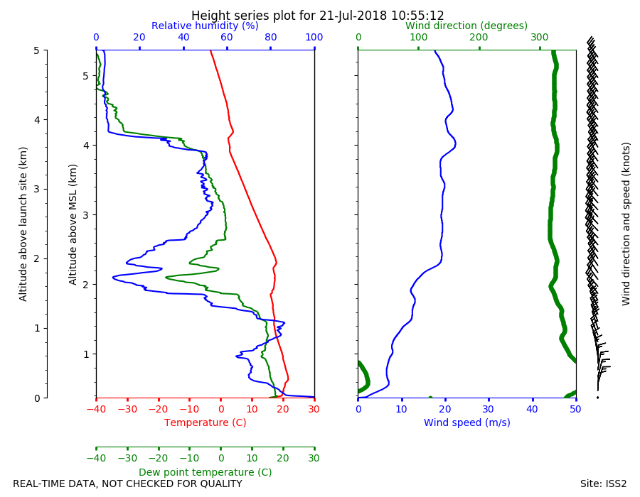
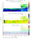
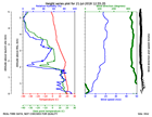
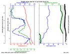
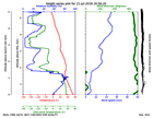
ISS2_Sonde.201807211055.height_...
|
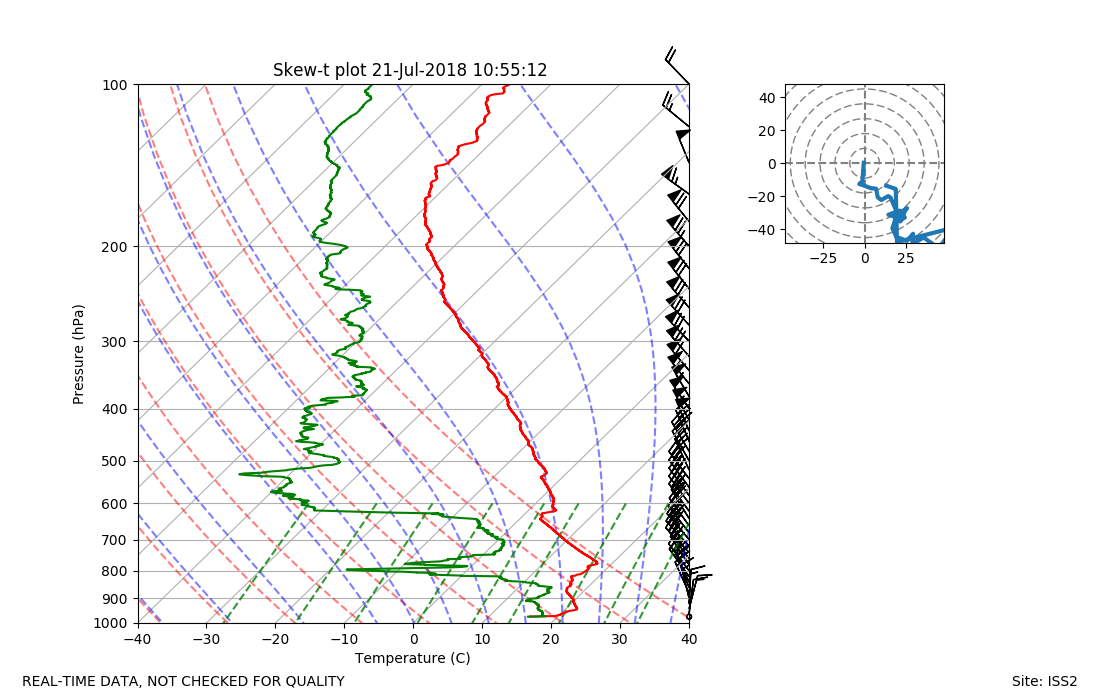
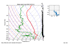
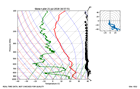
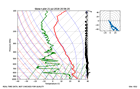
ISS2_Sonde.201807211055.skewT
|
ISS2_Sonde.201807211255.height_...
|
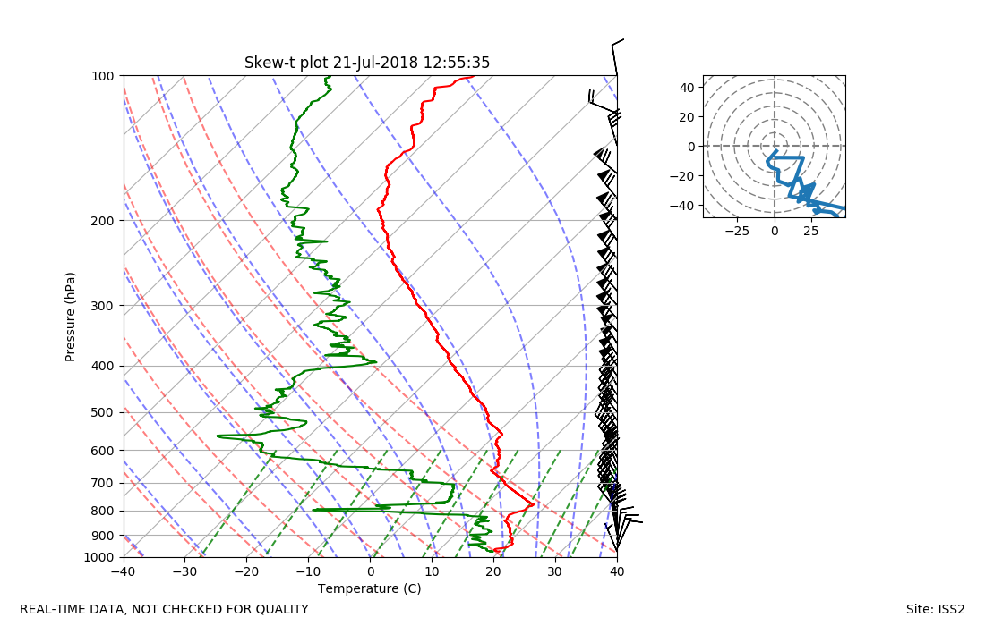
ISS2_Sonde.201807211255.skewT
|
ISS2_Sonde.201807211509.height_...
|
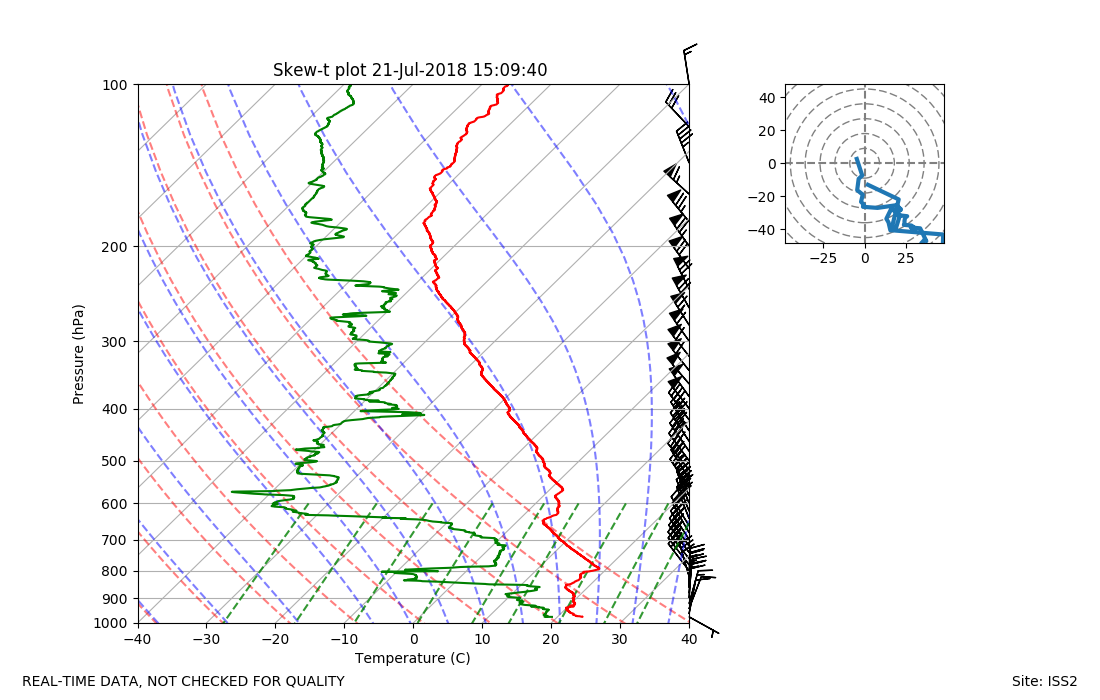
ISS2_Sonde.201807211509.skewT

|
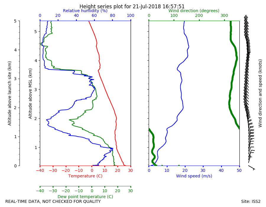
ISS2_Sonde.201807211657.height_...
|
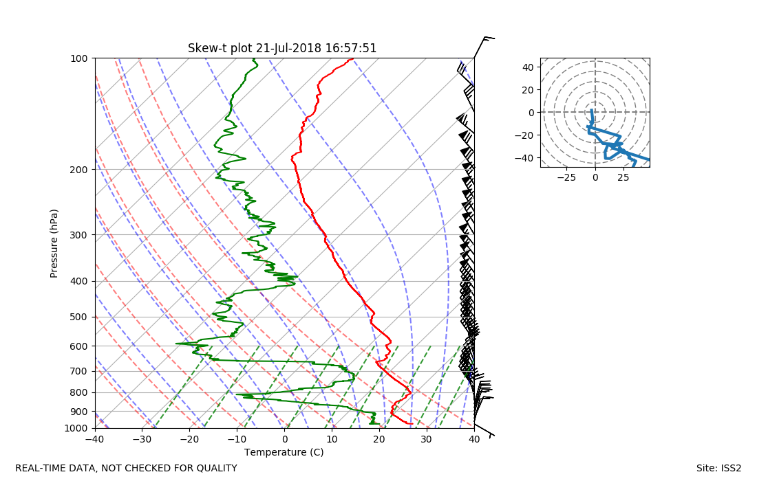
ISS2_Sonde.201807211657.skewT
|
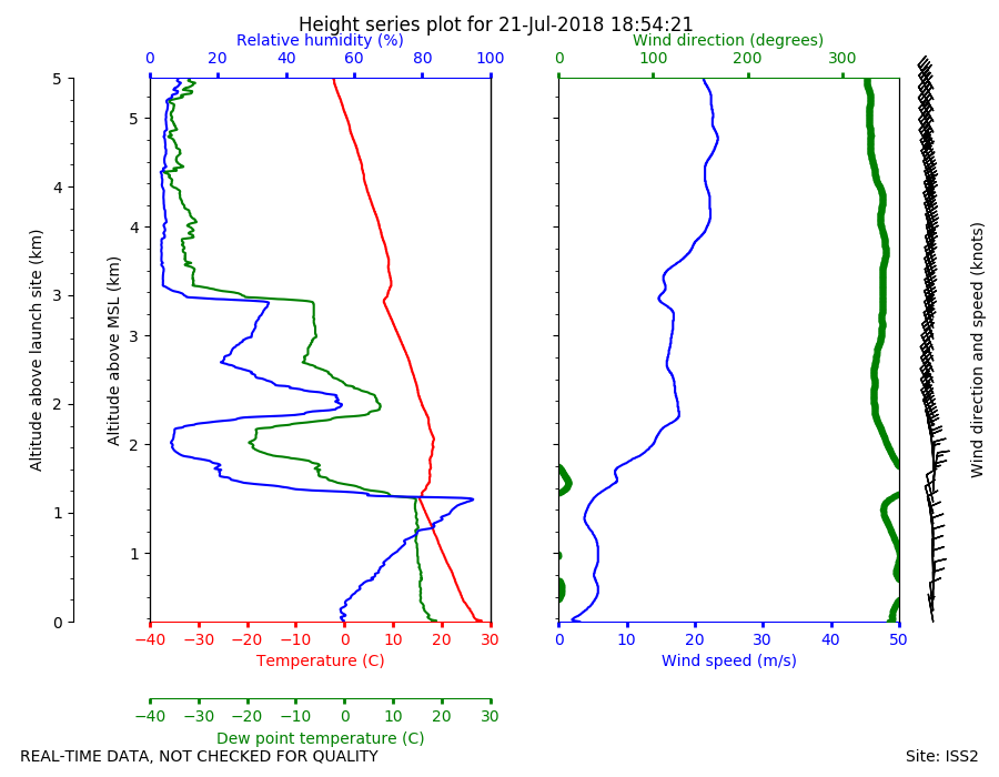
ISS2_Sonde.201807211854.height_...
|
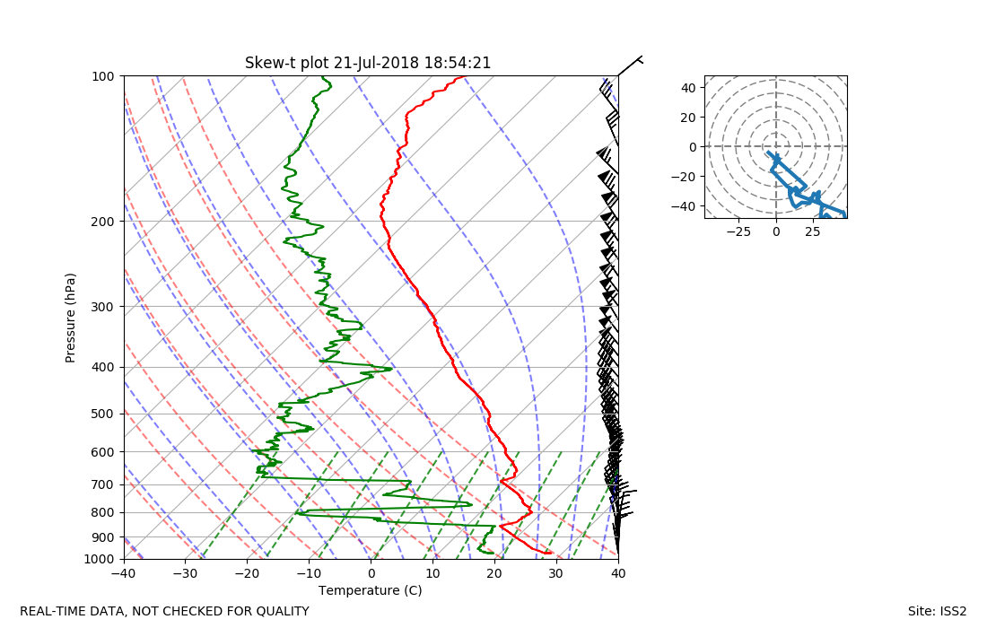
ISS2_Sonde.201807211854.skewT
|
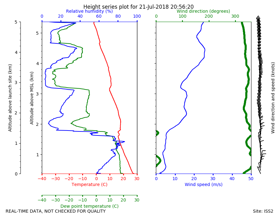
ISS2_Sonde.201807212056.height_...
|
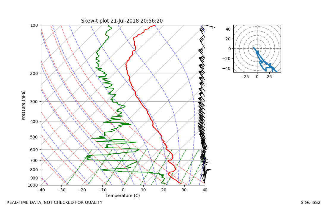
ISS2_Sonde.201807212056.skewT
|
ISS2_Sonde.201807212255.height_...
|
ISS2_Sonde.201807212255.skewT
|
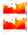
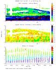
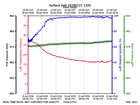
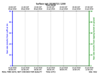
ISS2_Surface.201807211200.pth
|
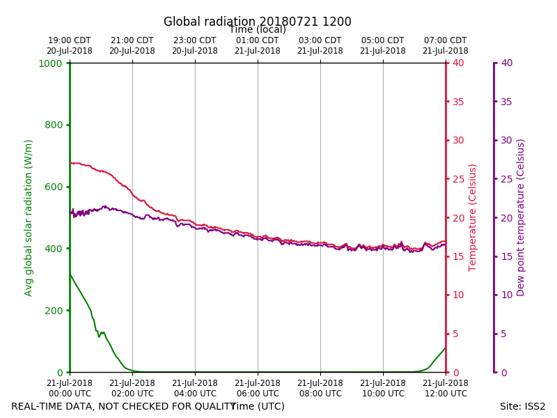
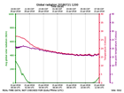
ISS2_Surface.201807211200.radia...
|
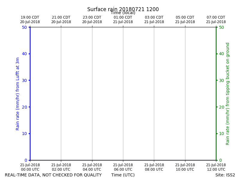
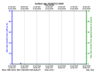
ISS2_Surface.201807211200.rain
|
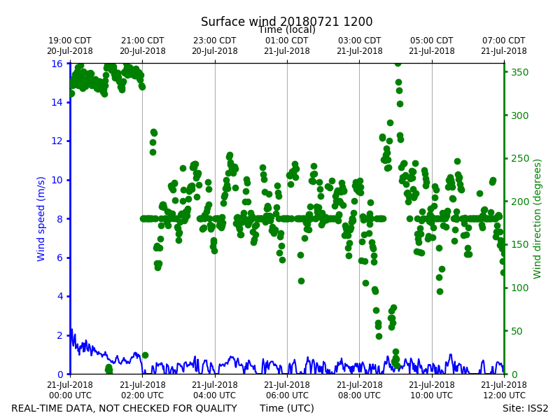
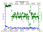
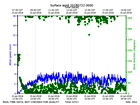
ISS2_Surface.201807211200.wind
|
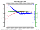
ISS2_Surface.201807220000.pth
|
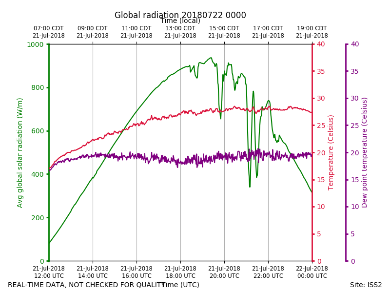
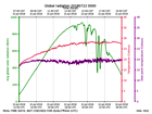
ISS2_Surface.201807220000.radia...
|
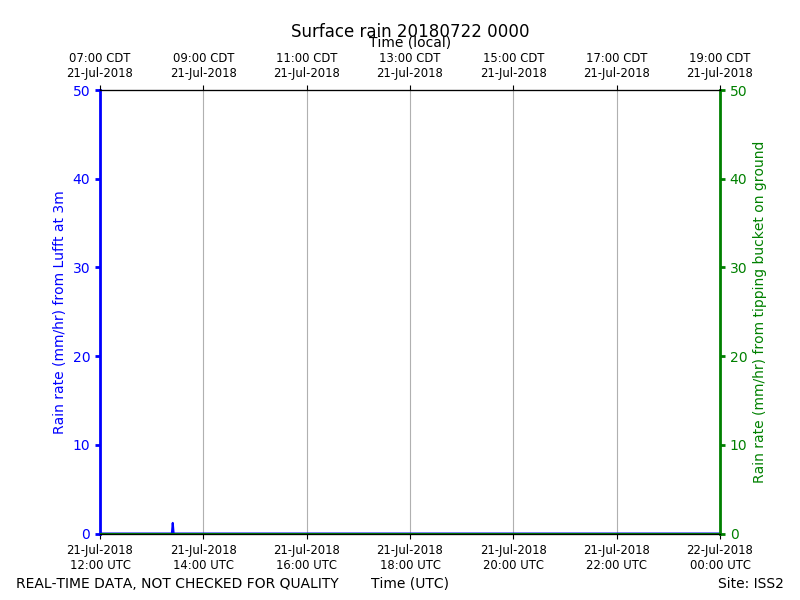
ISS2_Surface.201807220000.rain
|
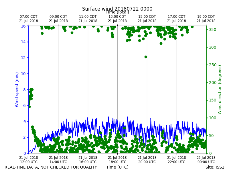
ISS2_Surface.201807220000.wind
|