Click on the thumbnail image to view the full-size image.
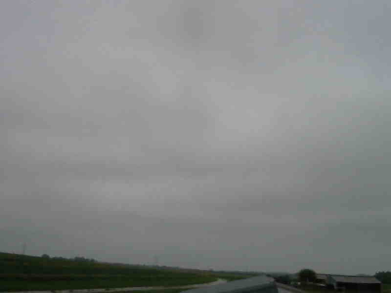
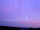
ISS2_Camera.201807160500.photo

|
ISS2_Camera.201807160600.photo

|
ISS2_Camera.201807160700.photo

|
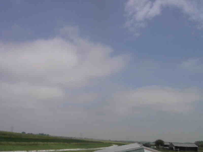
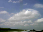
ISS2_Camera.201807160800.photo

|
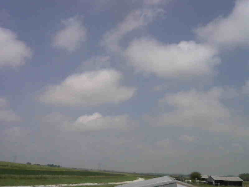
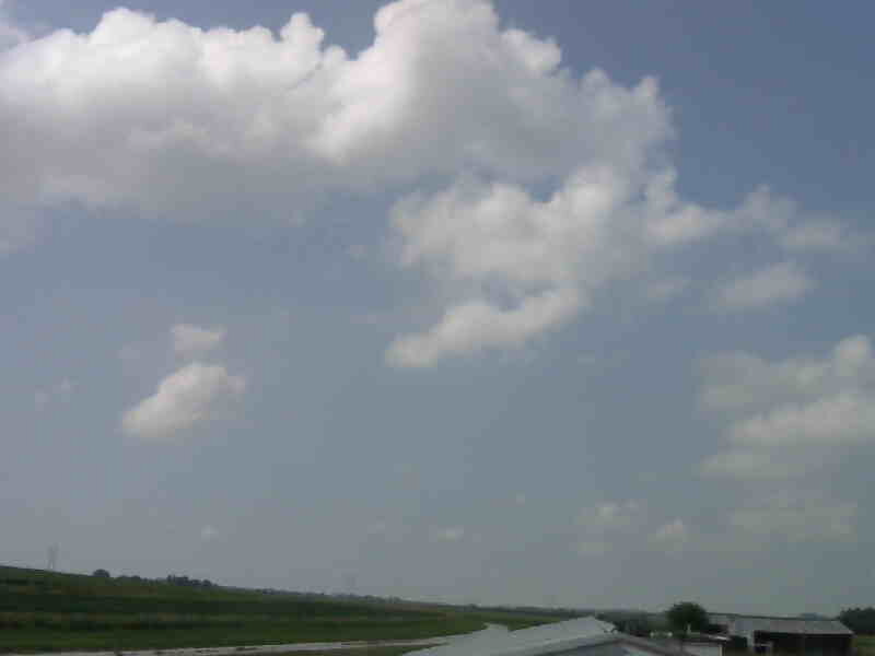
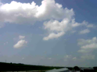
ISS2_Camera.201807160900.photo

|
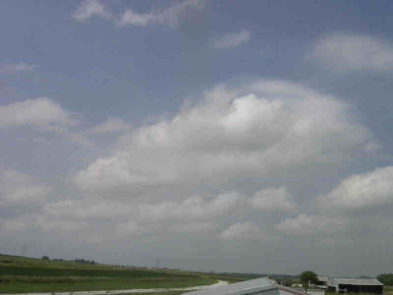
ISS2_Camera.201807161000.photo

|
ISS2_Camera.201807161100.photo
|
ISS2_Camera.201807161200.photo
|
ISS2_Camera.201807161300.photo
|
ISS2_Camera.201807161400.photo
|
ISS2_Camera.201807161500.photo
|
ISS2_Camera.201807161600.photo
|
ISS2_Camera.201807161700.photo
|
ISS2_Camera.201807161800.photo

|
ISS2_Camera.201807161900.photo
|
ISS2_Camera.201807162000.photo
|
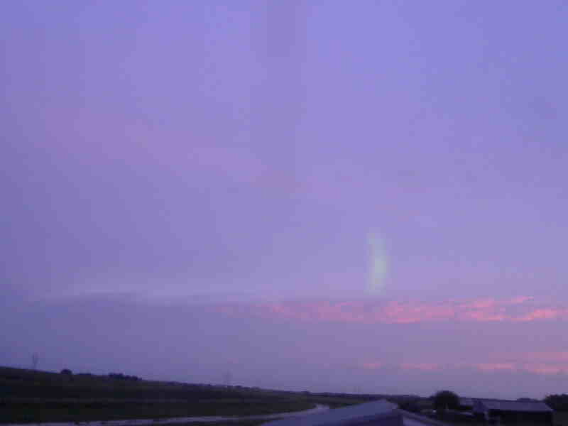
ISS2_Camera.201807162100.photo
|
ISS2_Camera.201807170500.photo

|
ISS2_Camera.201807170600.photo
|
ISS2_Camera.201807170700.photo

|
ISS2_Camera.201807170800.photo

|
ISS2_Camera.201807170900.photo

|
ISS2_Camera.201807171000.photo
|
ISS2_Camera.201807171100.photo
|
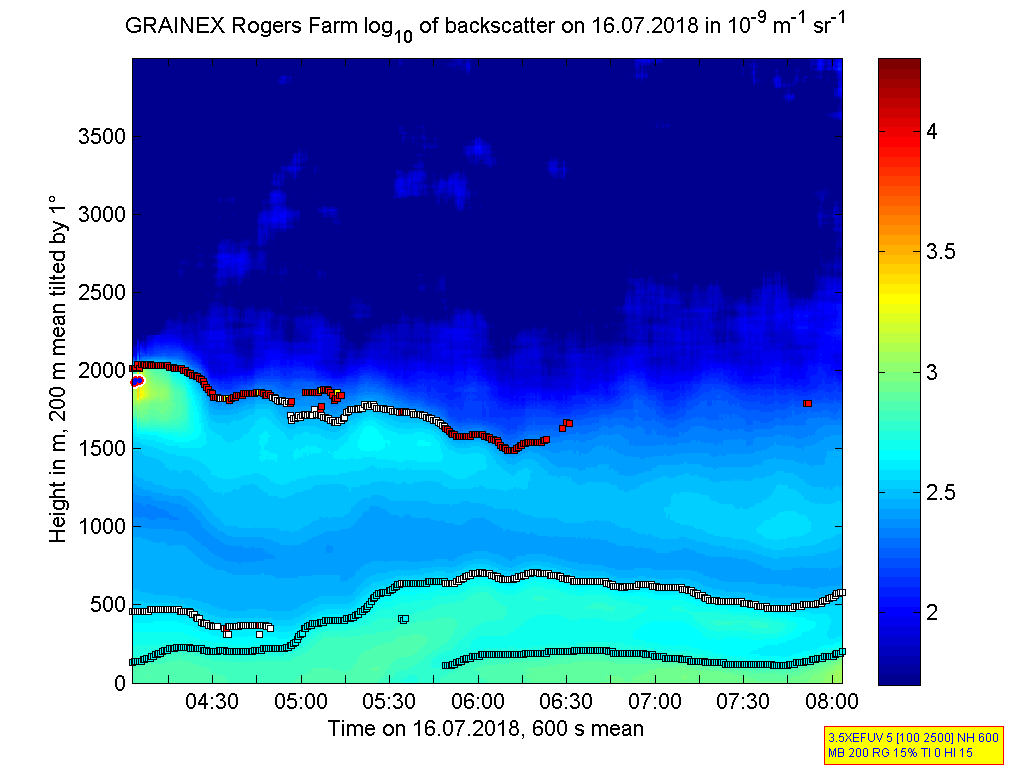
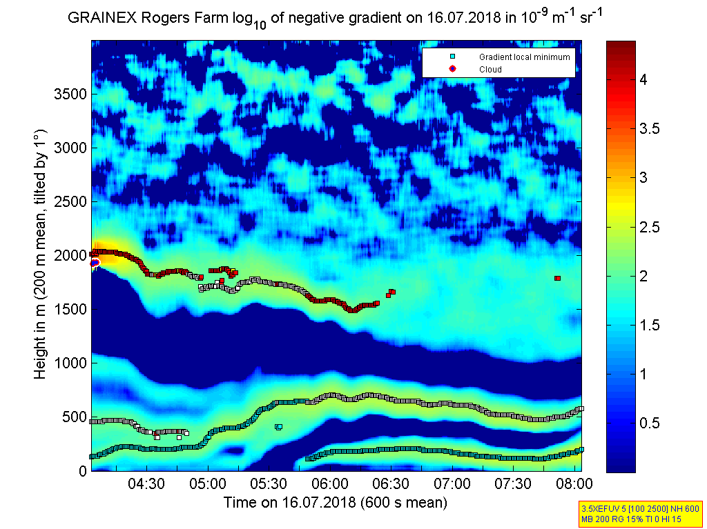
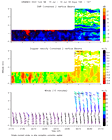
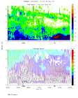
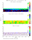
ISS2_Ceilometer.201807160000.de...
|
ISS2_Ceilometer.201807160000.gr...
|
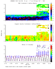
ISS2_Ceilometer.201807160400.de...
|
ISS2_Ceilometer.201807160400.gr...

|
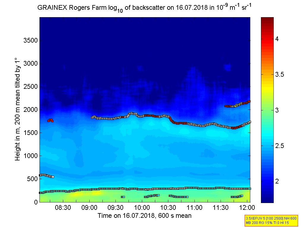
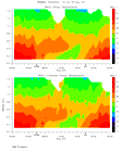
ISS2_Ceilometer.201807160800.de...
|
ISS2_Ceilometer.201807160800.gr...
|
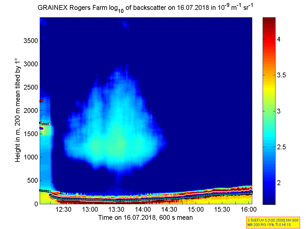
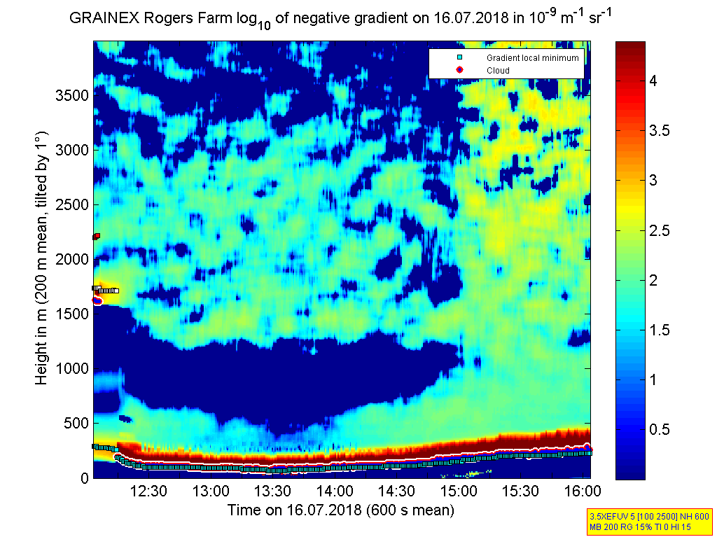
ISS2_Ceilometer.201807161200.de...
|
ISS2_Ceilometer.201807161200.gr...
|
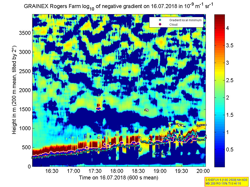
ISS2_Ceilometer.201807161600.de...
|
ISS2_Ceilometer.201807161600.gr...
|
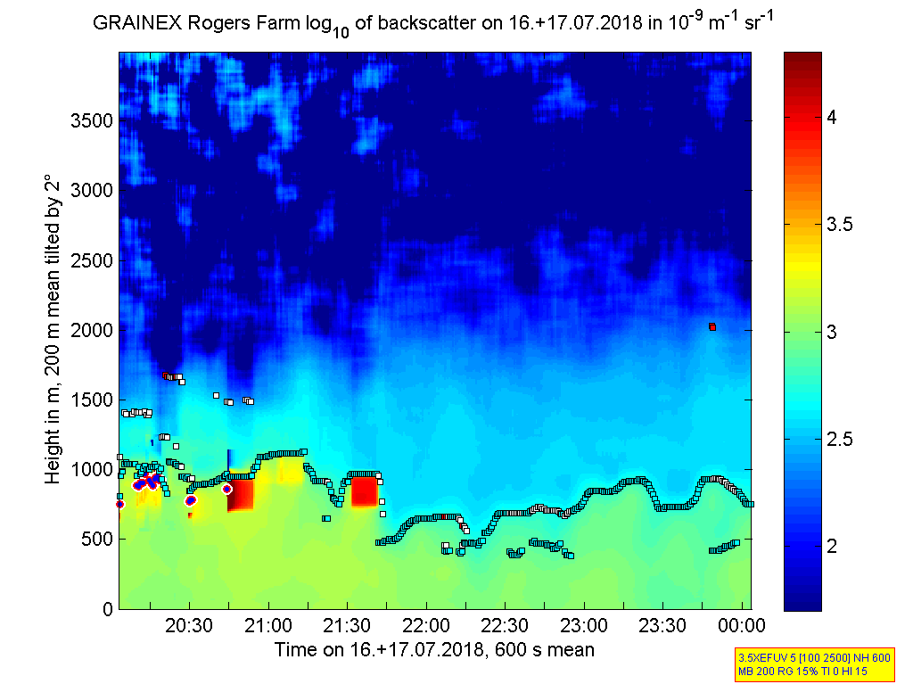
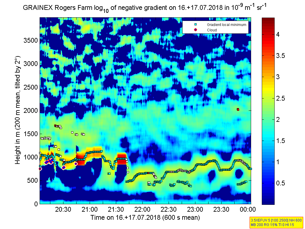
ISS2_Ceilometer.201807162000.de...
|
ISS2_Ceilometer.201807162000.gr...
|
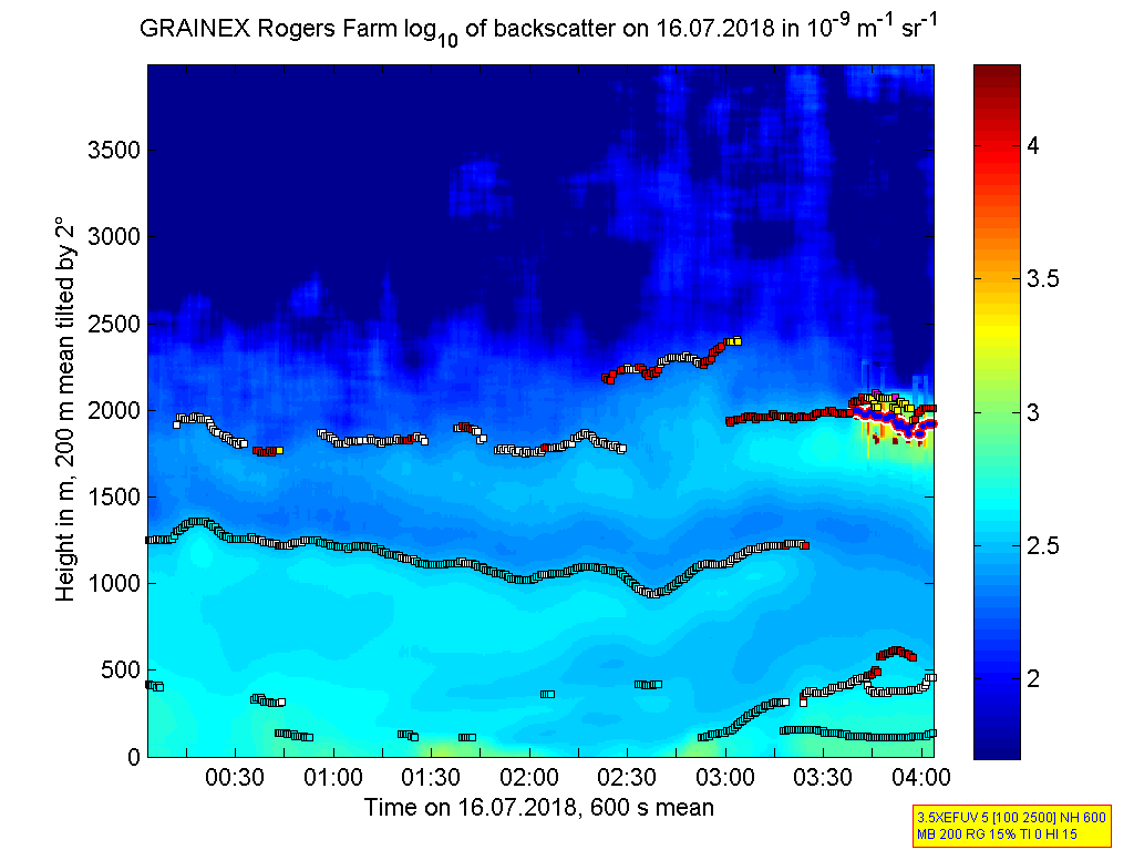
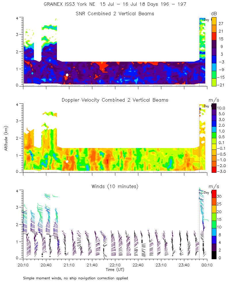
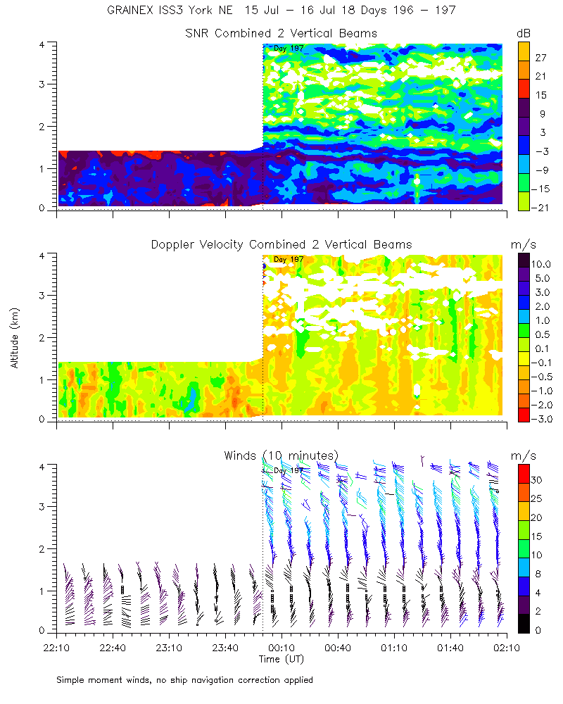
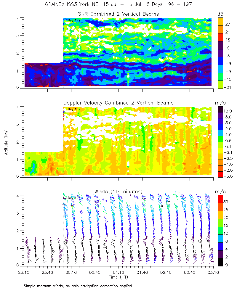
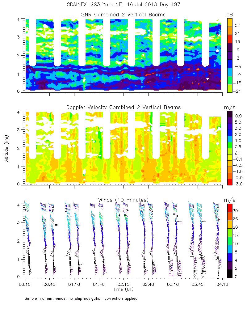
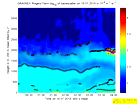
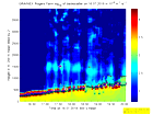
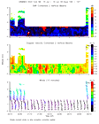
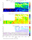
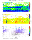
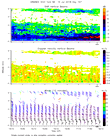
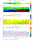
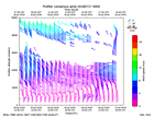
ISS2_Profiler.201807152300.mome...
|
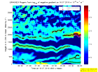
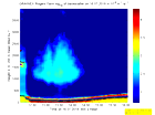
ISS2_Profiler.201807160000.mome...
|
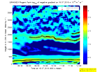
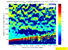
ISS2_Profiler.201807160000.nima...
|
ISS2_Profiler.201807160000.nima...
|
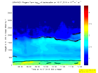
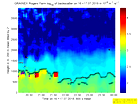
ISS2_Profiler.201807160000.snr_...
|
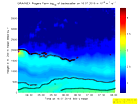
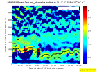
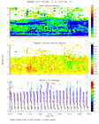
ISS2_Profiler.201807160100.mome...
|
ISS2_Profiler.201807160200.mome...
|
ISS2_Profiler.201807160300.mome...
|
ISS2_Profiler.201807160400.mome...
|
ISS2_Profiler.201807160500.mome...
|
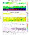
ISS2_Profiler.201807160600.mome...
|
ISS2_Profiler.201807160700.mome...
|
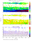
ISS2_Profiler.201807160800.mome...
|
ISS2_Profiler.201807160900.mome...
|
ISS2_Profiler.201807161000.mome...
|
ISS2_Profiler.201807161100.mome...
|
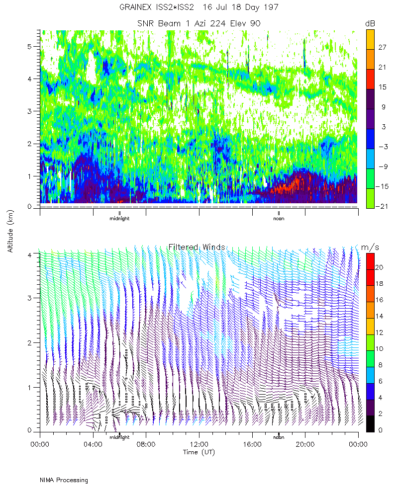
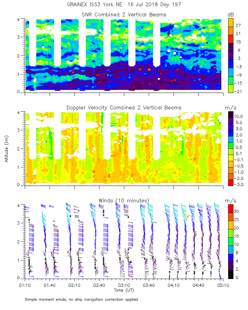
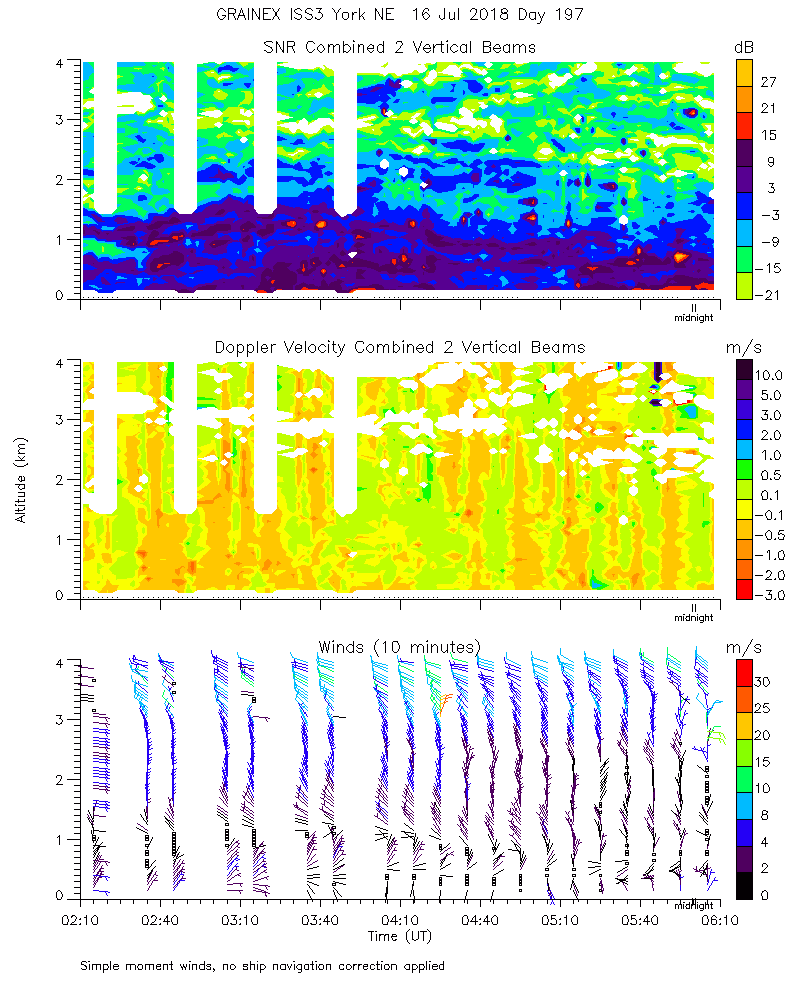
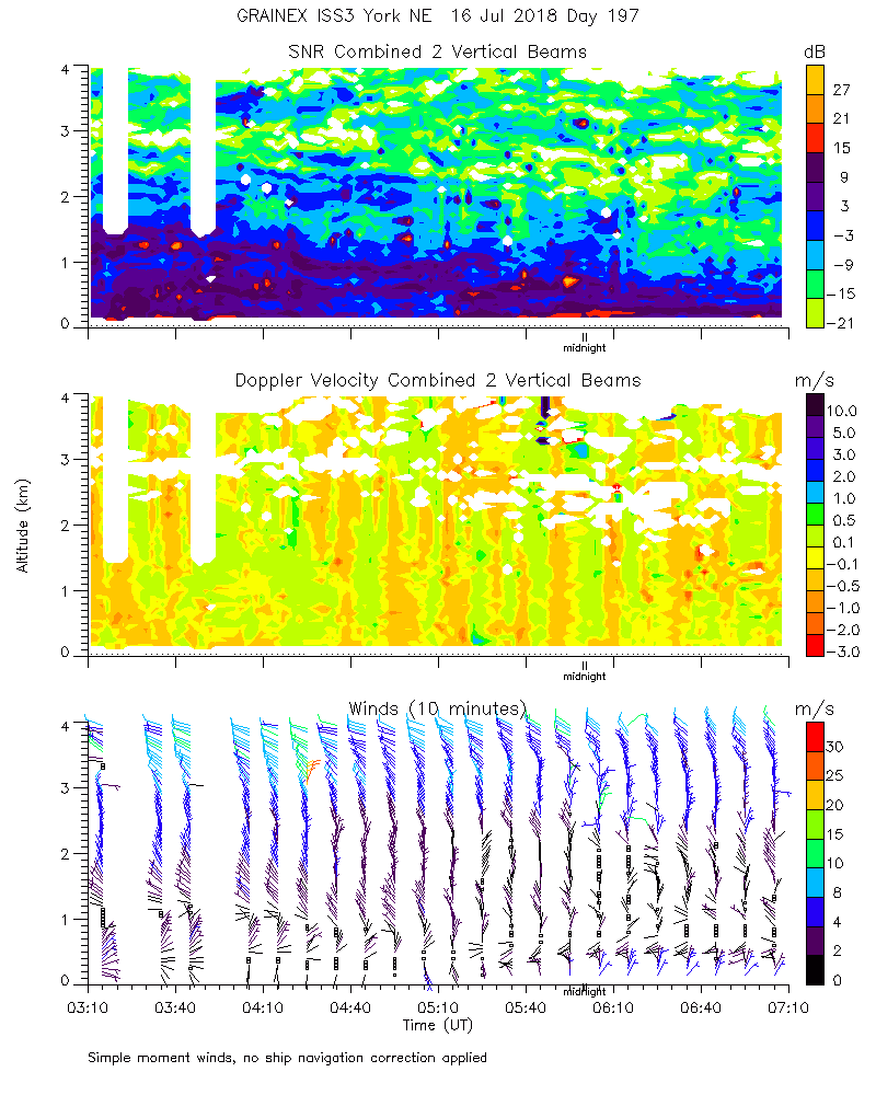
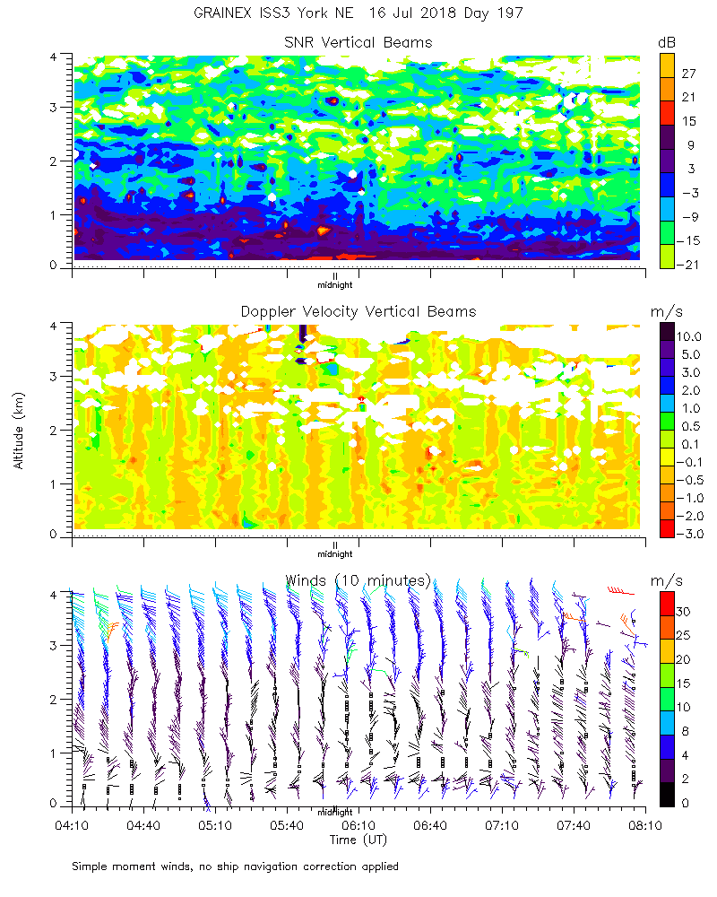
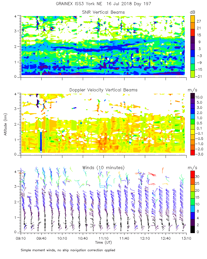
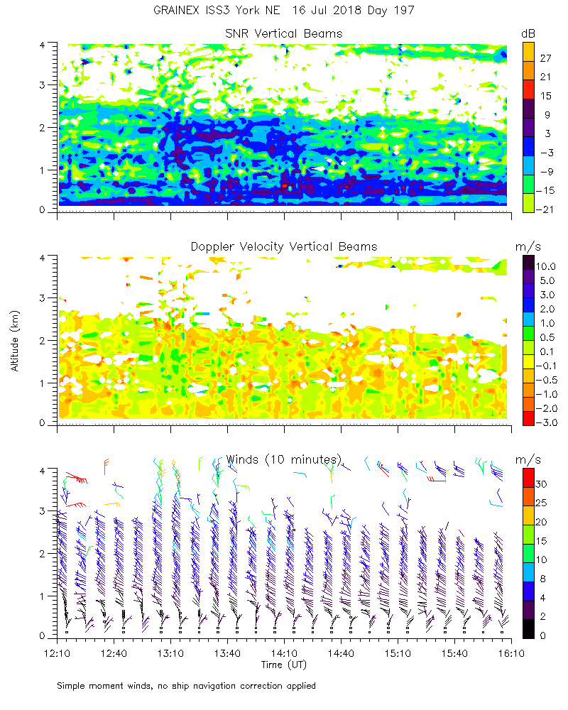
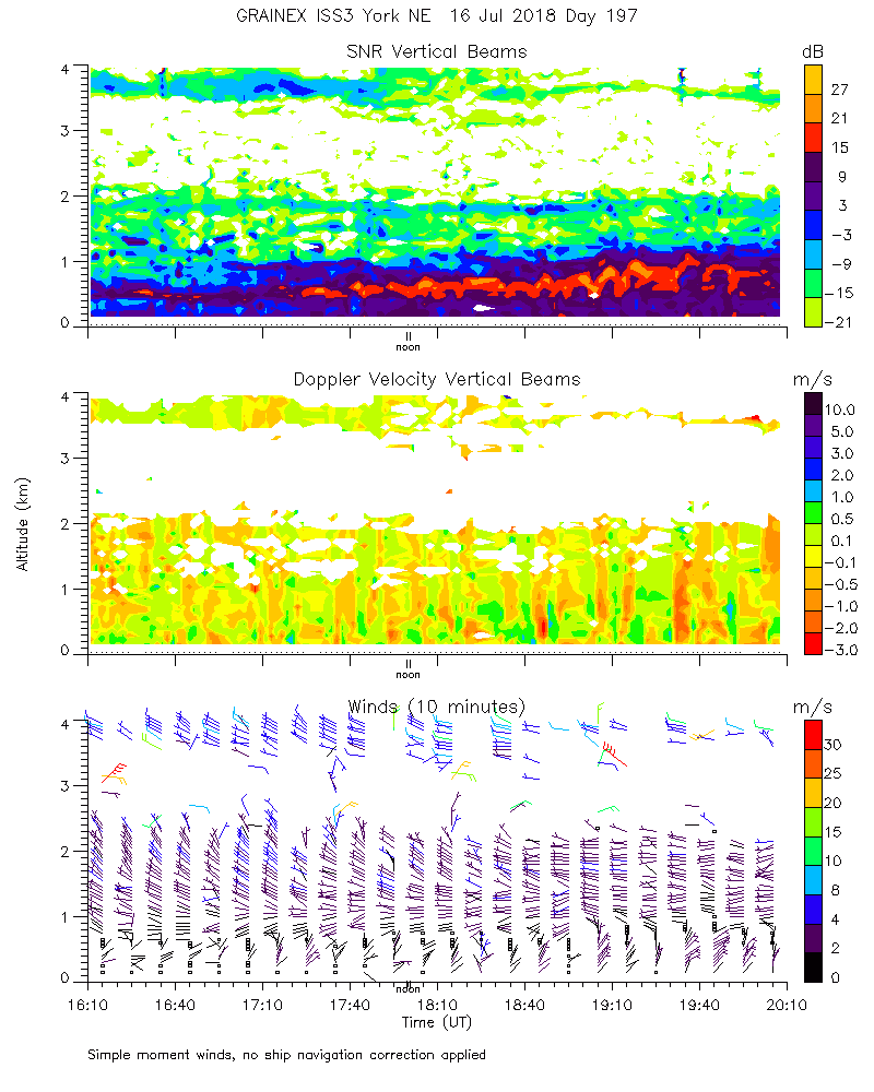
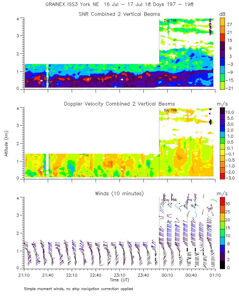
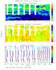
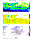
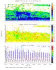
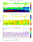
ISS2_Profiler.201807161200.mome...
|
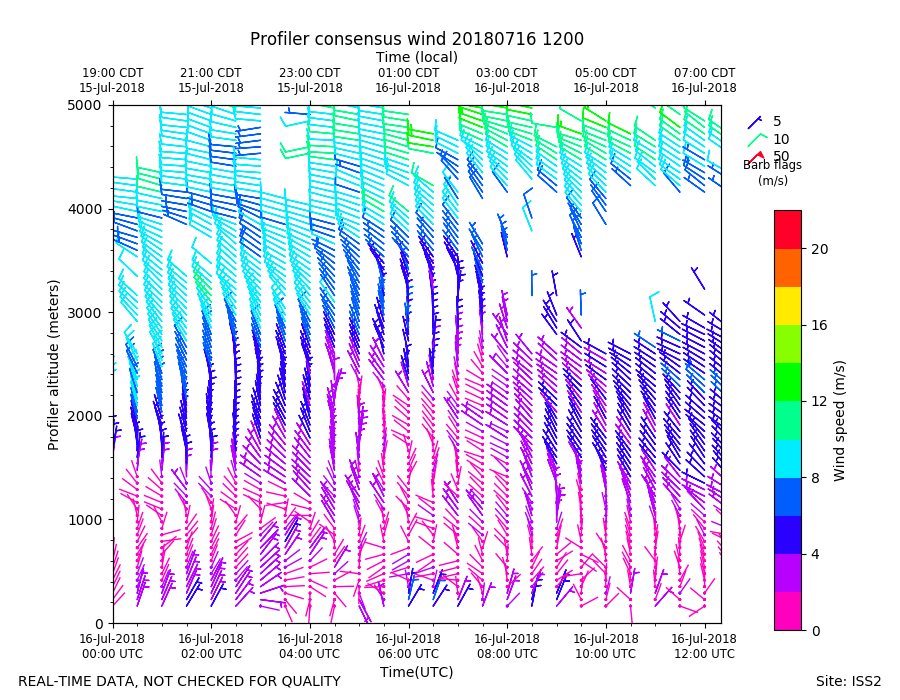
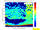
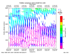
ISS2_Profiler.201807161200.wind...
|
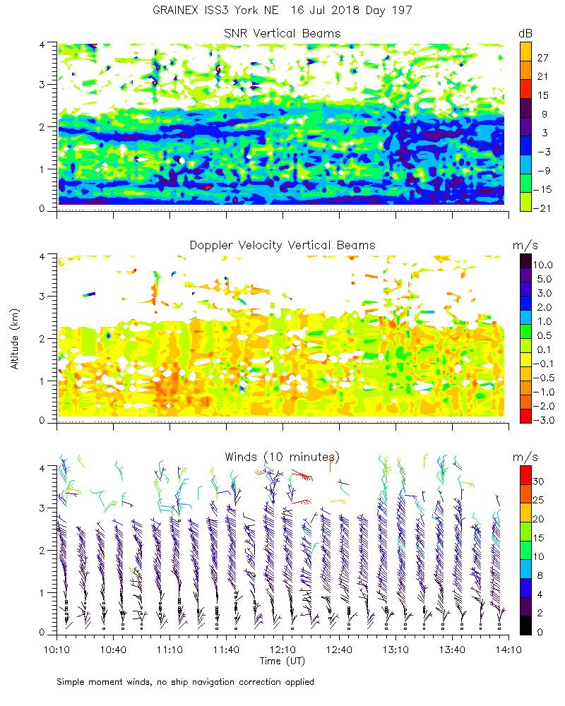
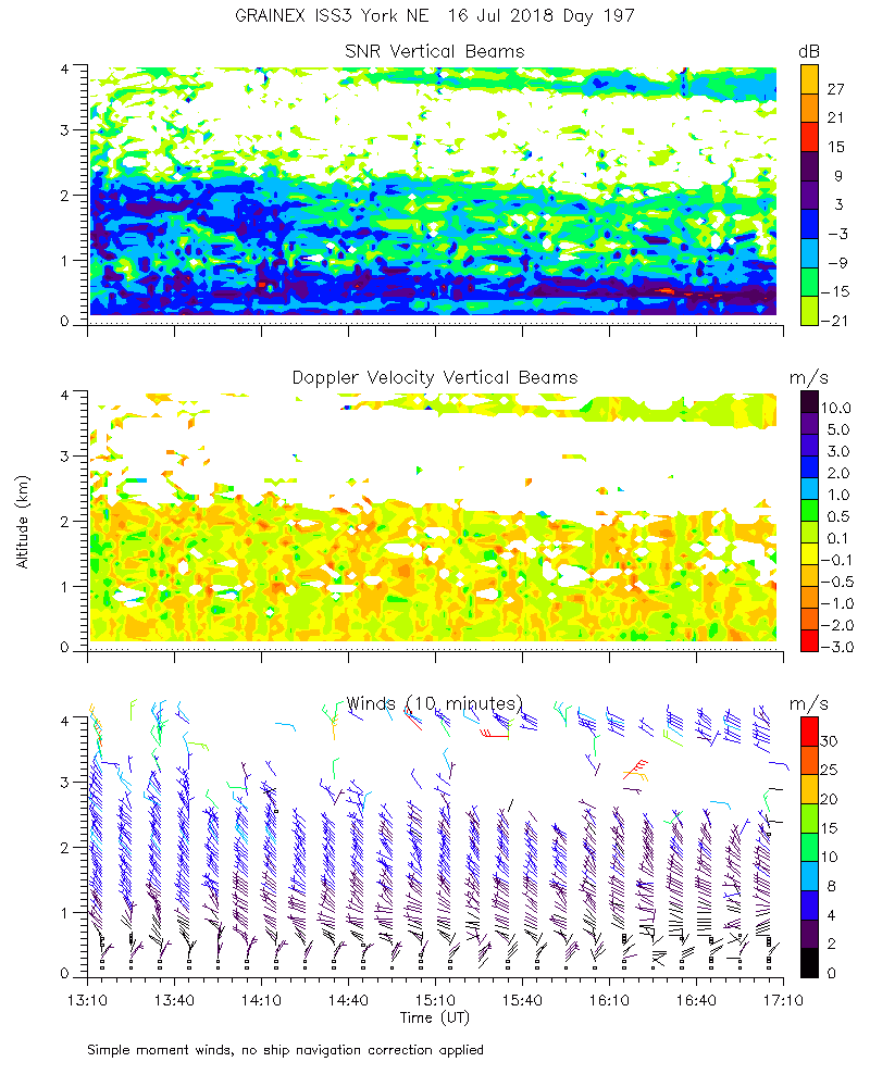
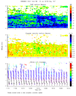
ISS2_Profiler.201807161300.mome...
|
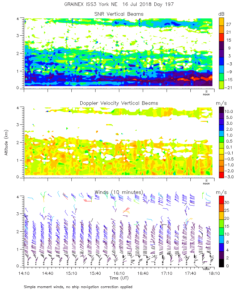
ISS2_Profiler.201807161400.mome...
|
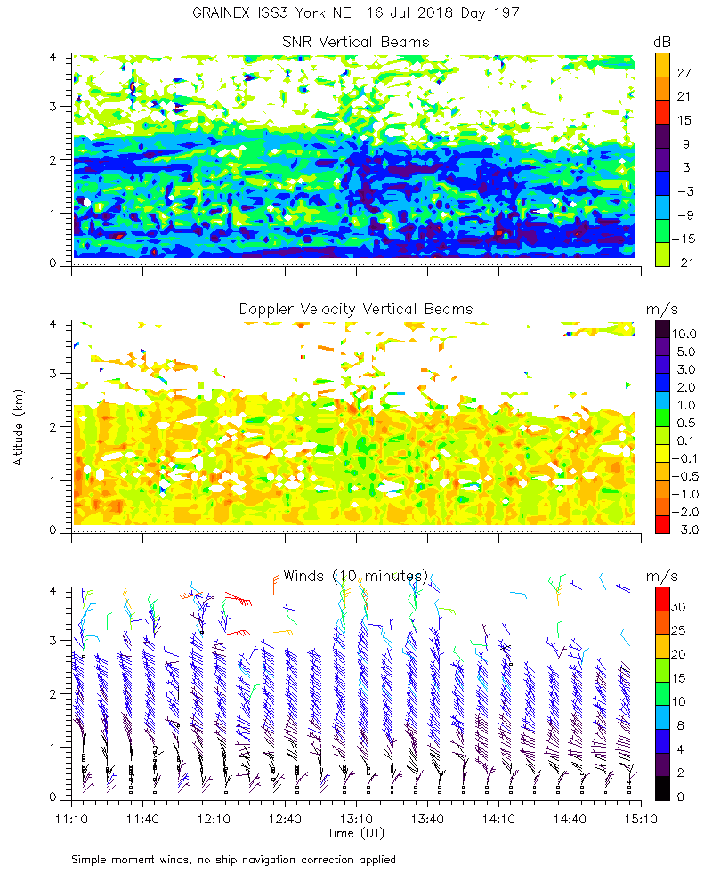
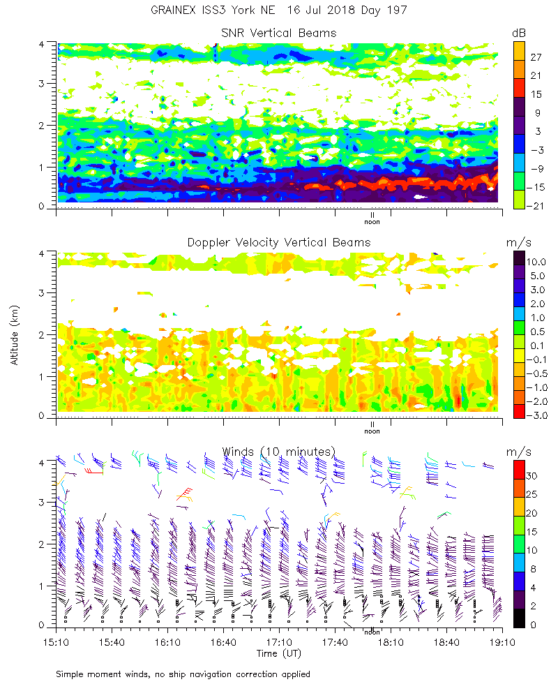
ISS2_Profiler.201807161500.mome...
|
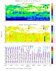
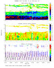
ISS2_Profiler.201807161600.mome...
|
ISS2_Profiler.201807161700.mome...
|
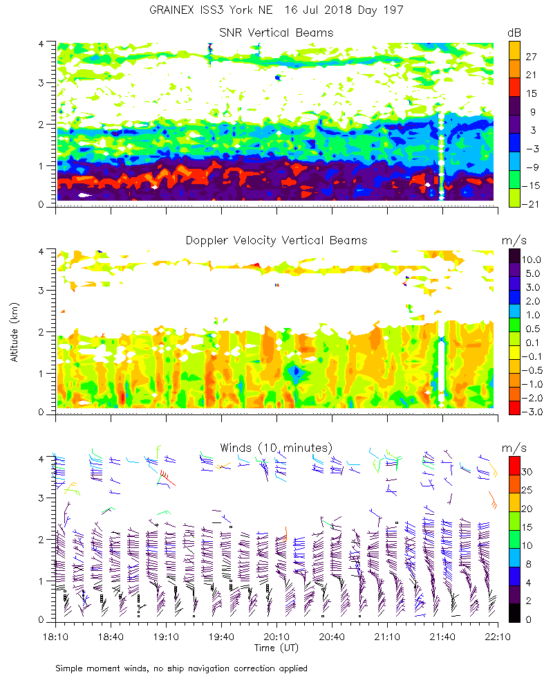
ISS2_Profiler.201807161800.mome...
|
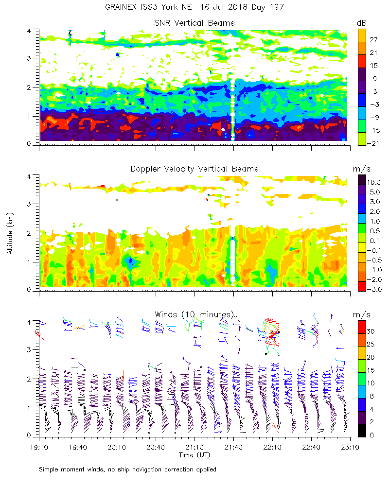
ISS2_Profiler.201807161900.mome...
|
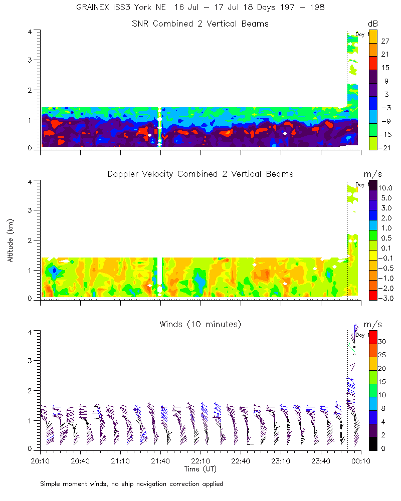
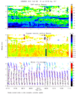
ISS2_Profiler.201807162000.mome...
|
ISS2_Profiler.201807162100.mome...
|
ISS2_Profiler.201807162200.mome...
|
ISS2_Profiler.201807162300.mome...
|
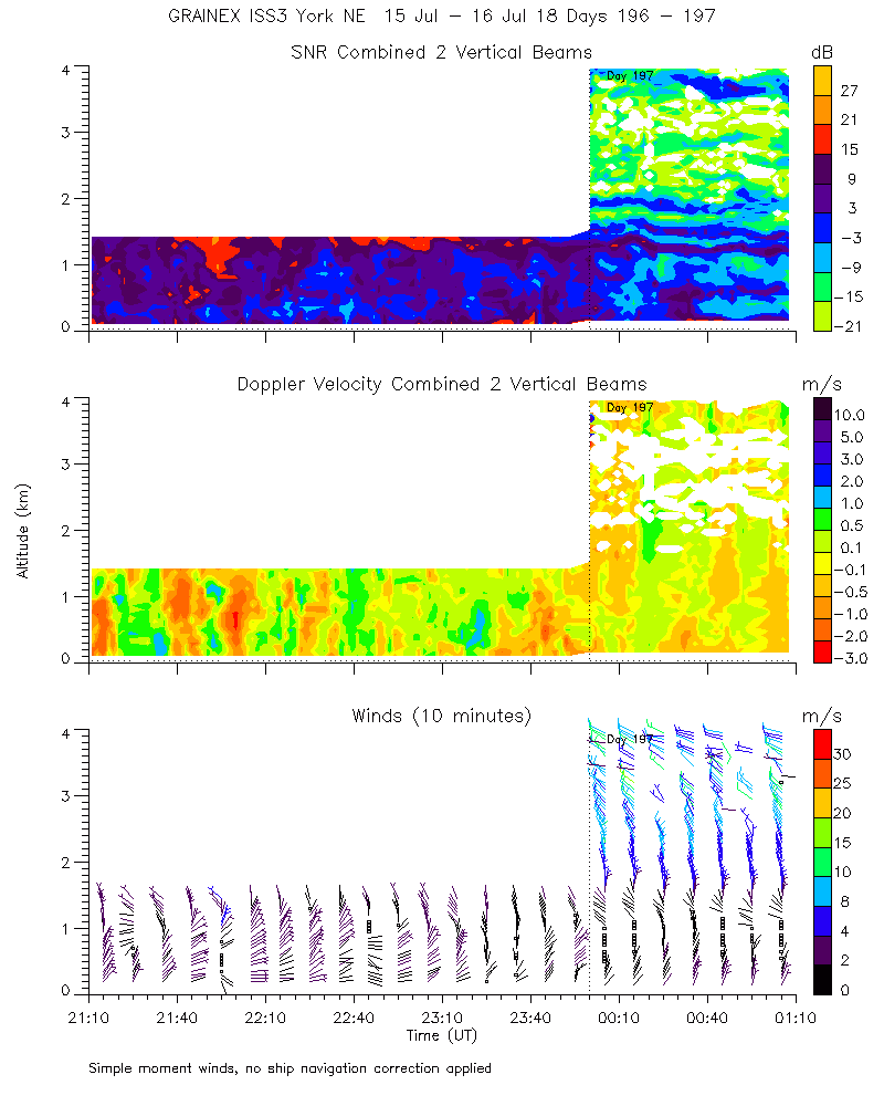
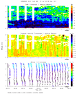
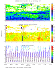
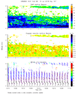
ISS2_Profiler.201807170000.mome...
|
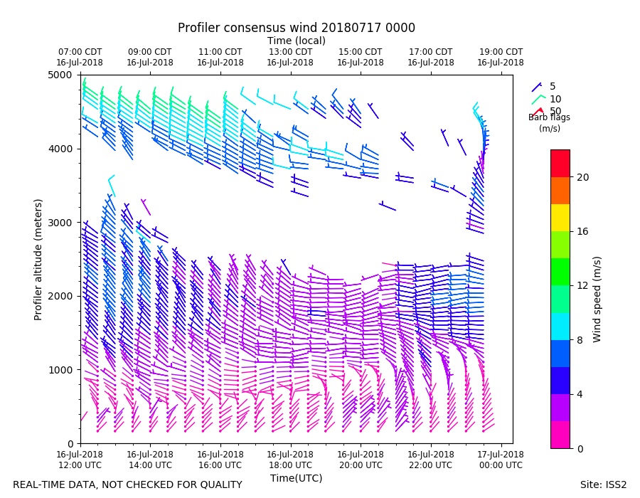
ISS2_Profiler.201807170000.wind...
|
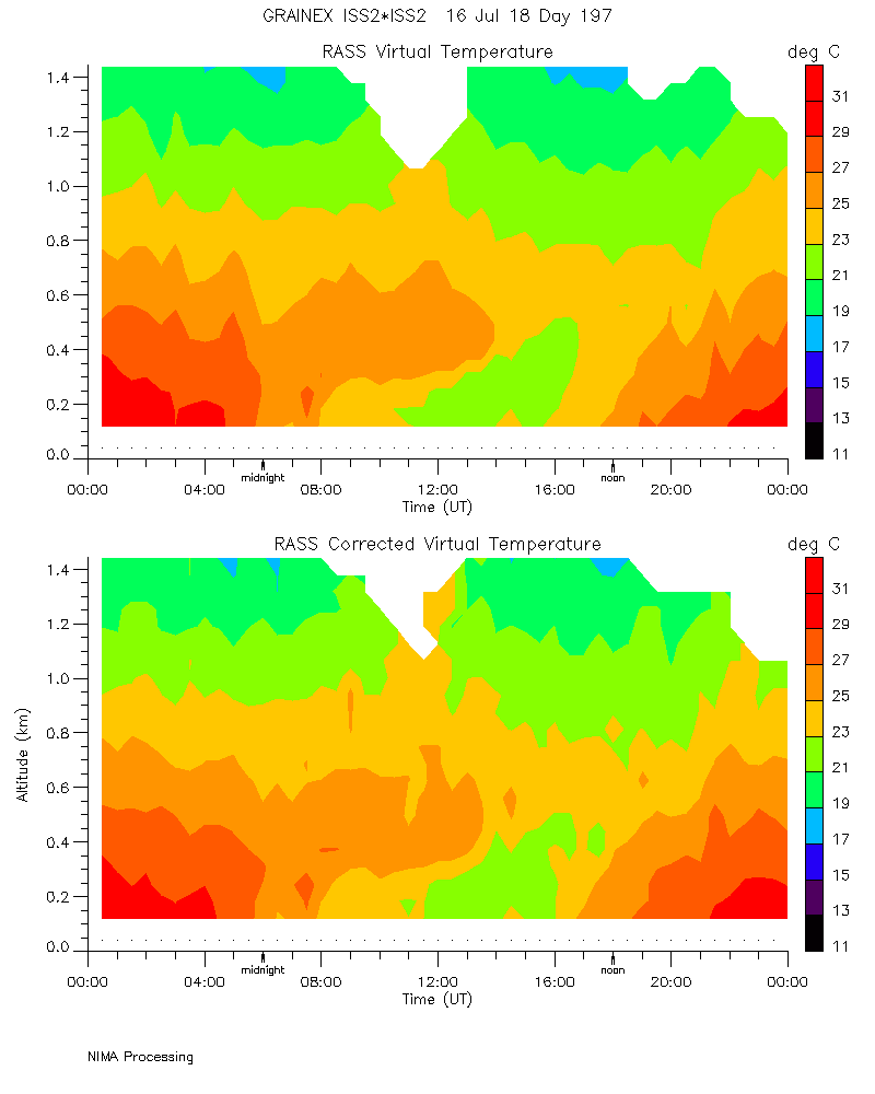
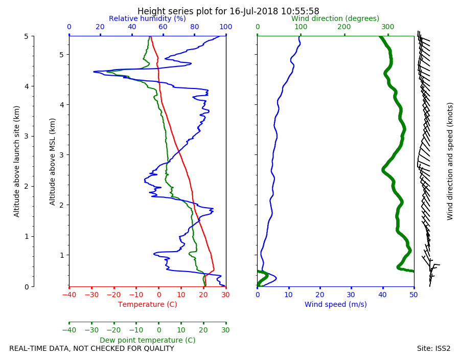
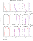
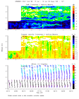
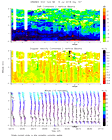
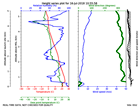
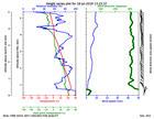
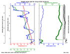
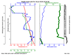
ISS2_Sonde.201807161055.height_...
|
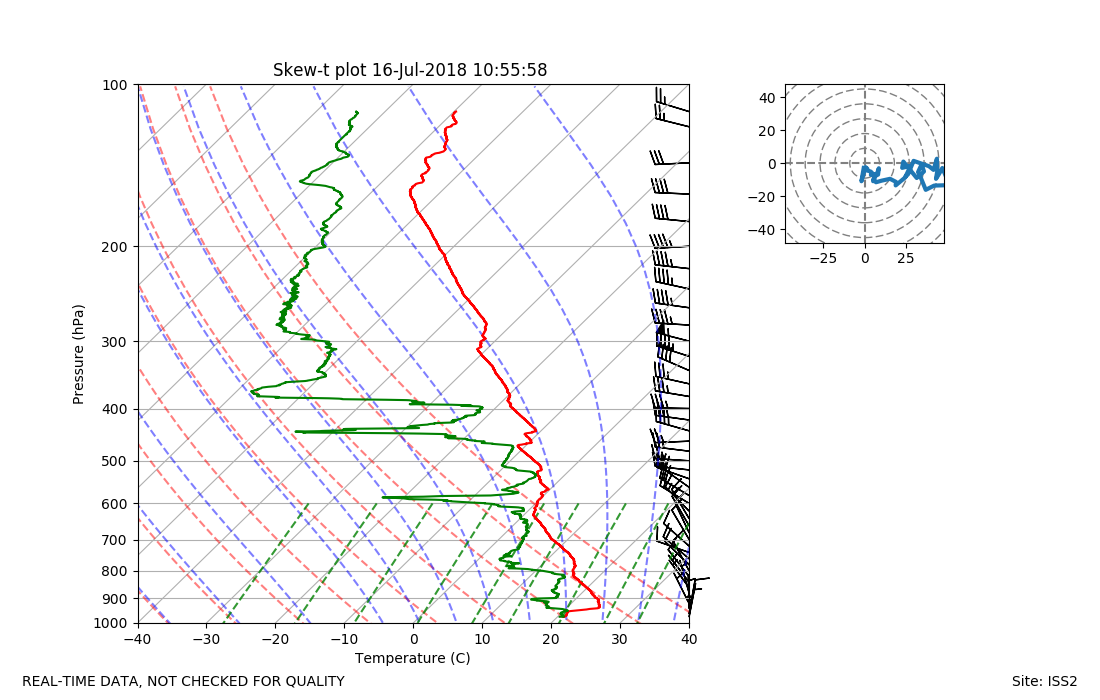
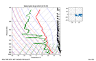
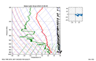
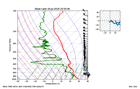
ISS2_Sonde.201807161055.skewT
|
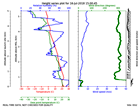
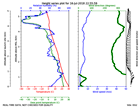
ISS2_Sonde.201807161315.height_...
|
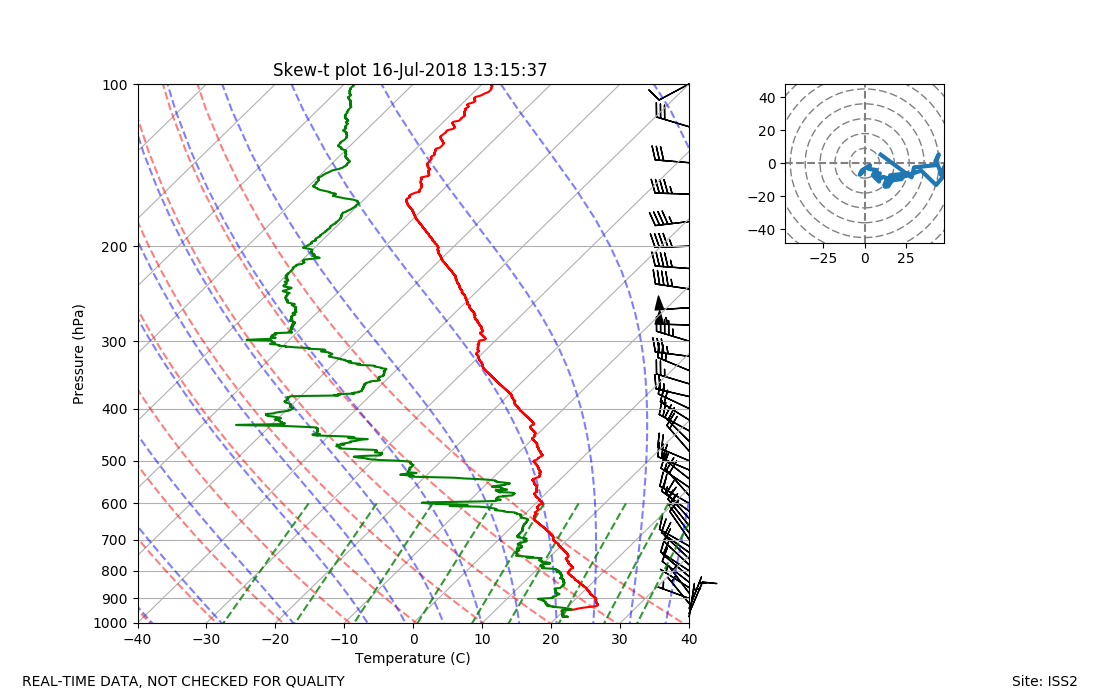
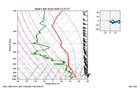
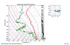
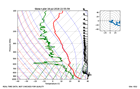
ISS2_Sonde.201807161315.skewT
|
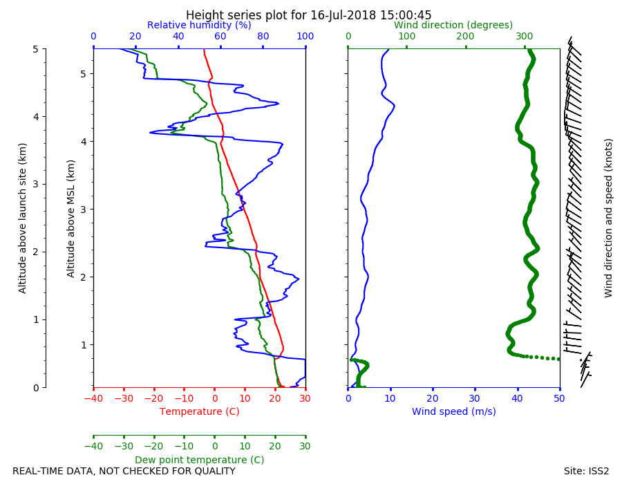
ISS2_Sonde.201807161500.height_...
|
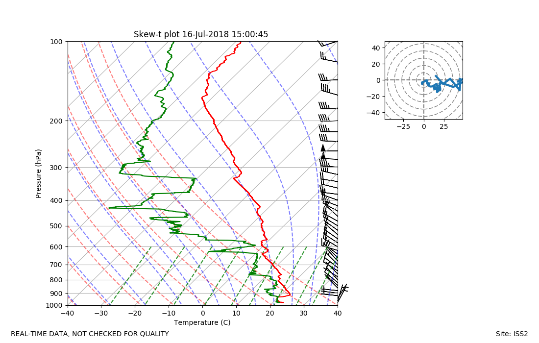
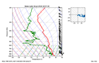
ISS2_Sonde.201807161500.skewT
|
ISS2_Sonde.201807161654.height_...
|
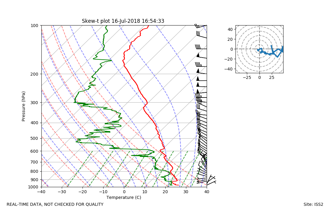
ISS2_Sonde.201807161654.skewT
|
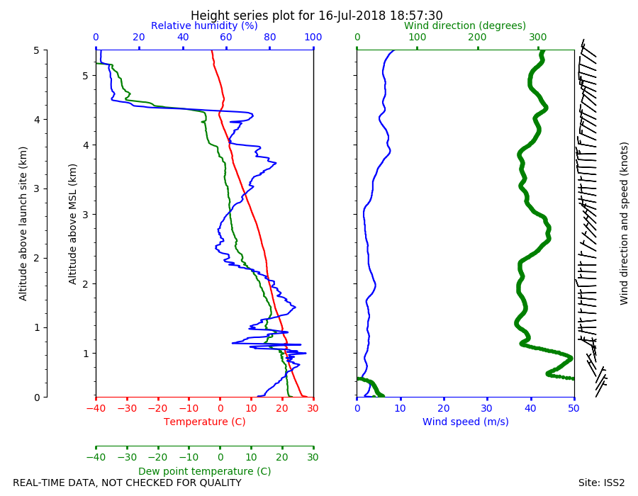
ISS2_Sonde.201807161857.height_...

|
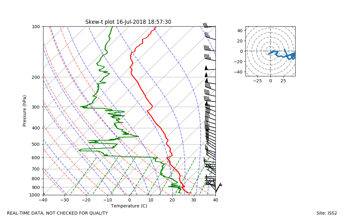
ISS2_Sonde.201807161857.skewT
|
ISS2_Sonde.201807162054.height_...
|
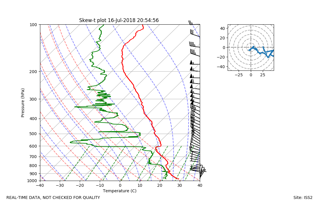
ISS2_Sonde.201807162054.skewT
|
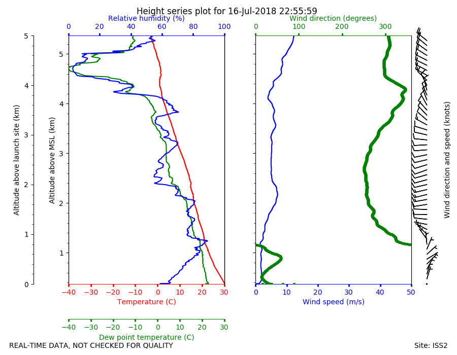
ISS2_Sonde.201807162255.height_...
|
ISS2_Sonde.201807162255.skewT
|
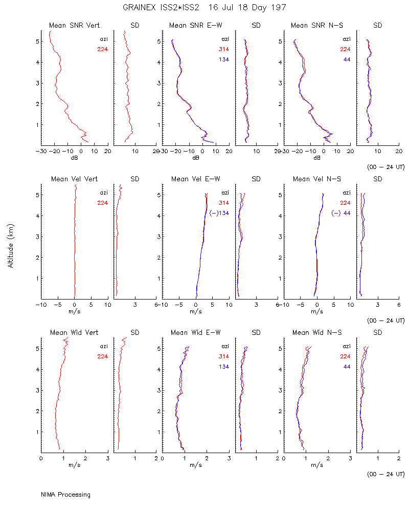
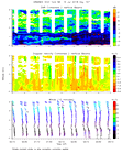
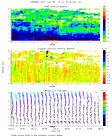
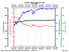
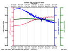
ISS2_Surface.201807161200.pth
|
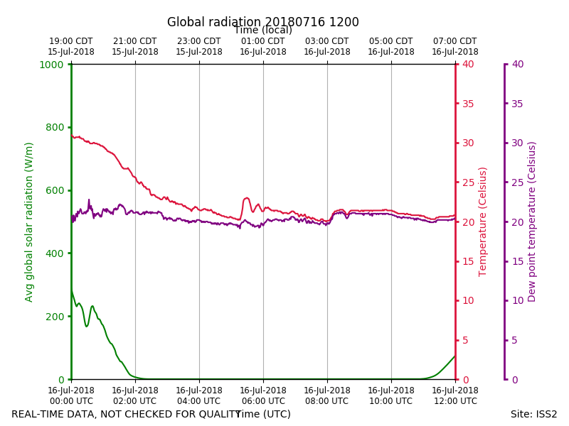
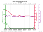
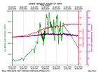
ISS2_Surface.201807161200.radia...
|
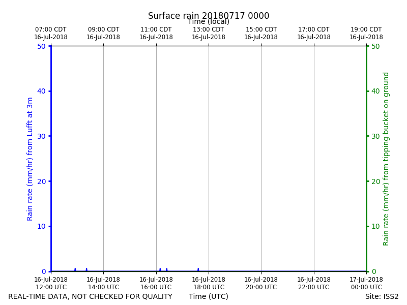
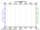
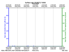
ISS2_Surface.201807161200.rain
|
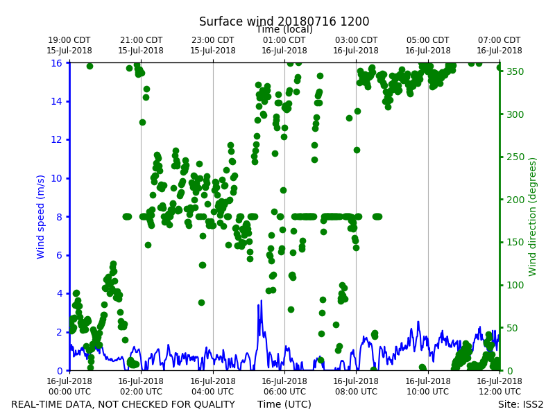
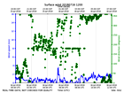
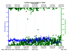
ISS2_Surface.201807161200.wind
|
ISS2_Surface.201807170000.pth
|
ISS2_Surface.201807170000.radia...
|
ISS2_Surface.201807170000.rain
|
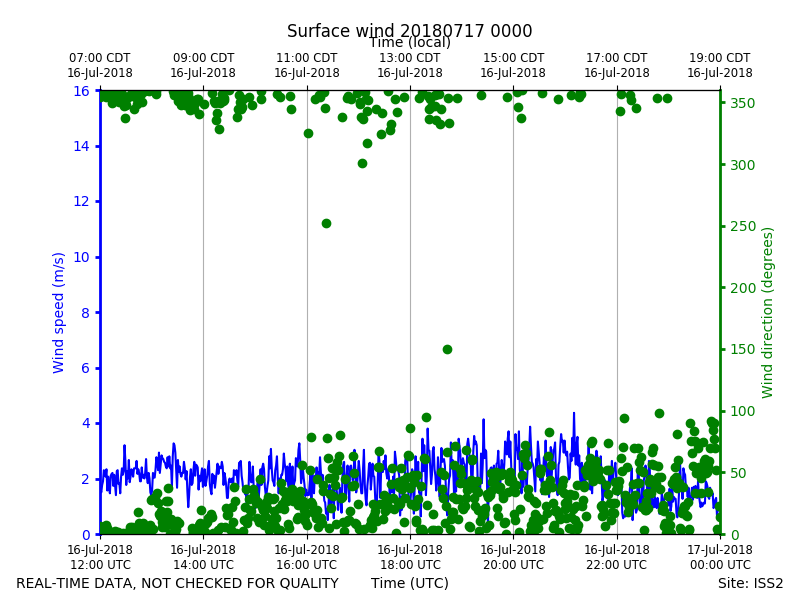
ISS2_Surface.201807170000.wind
|