Click on the thumbnail image to view the full-size image.
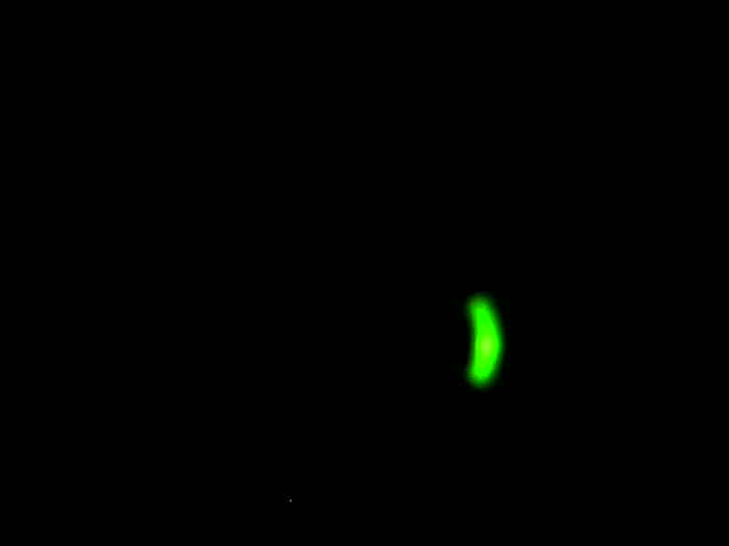
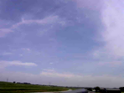
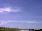
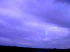
ISS2_Camera.201806060500.photo

|
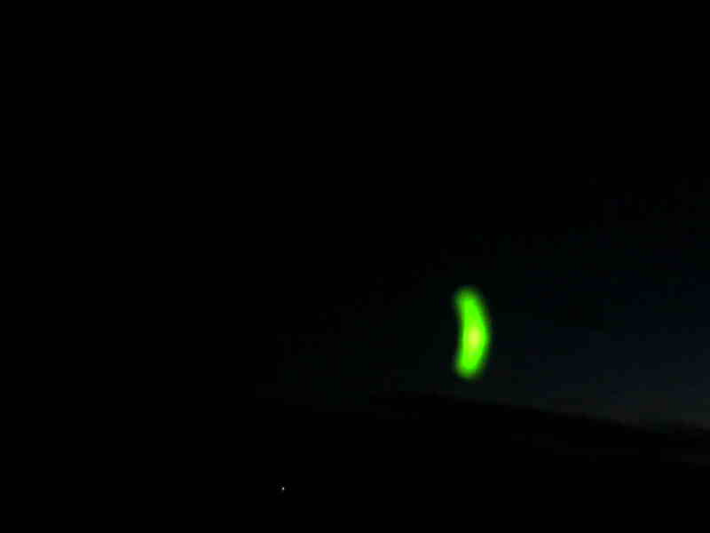
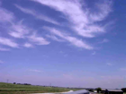
ISS2_Camera.201806060600.photo

|
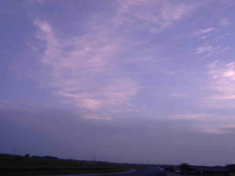
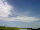
ISS2_Camera.201806060700.photo

|
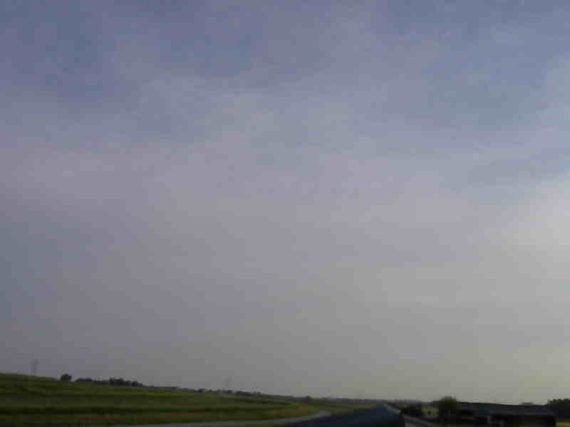
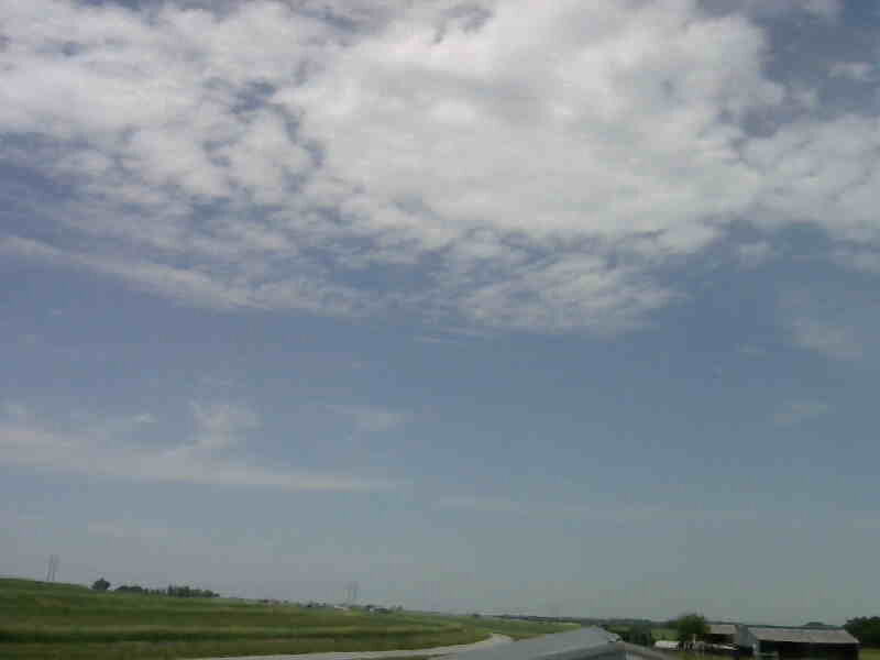
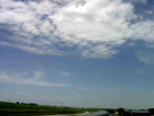
ISS2_Camera.201806060800.photo

|
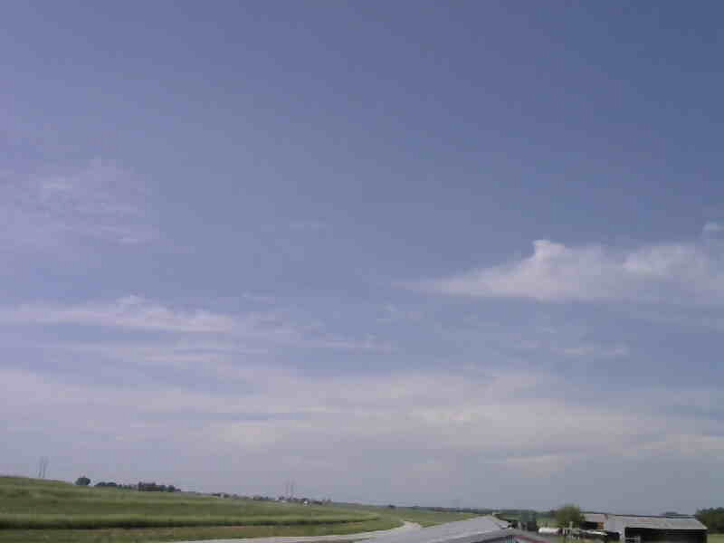
ISS2_Camera.201806060900.photo

|
ISS2_Camera.201806061000.photo
|
ISS2_Camera.201806061100.photo
|
ISS2_Camera.201806061200.photo
|
ISS2_Camera.201806061300.photo
|
ISS2_Camera.201806061400.photo
|
ISS2_Camera.201806061500.photo
|
ISS2_Camera.201806061600.photo
|
ISS2_Camera.201806061700.photo
|
ISS2_Camera.201806061800.photo
|
ISS2_Camera.201806061900.photo
|
ISS2_Camera.201806062000.photo
|
ISS2_Camera.201806062100.photo

|
ISS2_Camera.201806070500.photo

|
ISS2_Camera.201806070600.photo

|
ISS2_Camera.201806070700.photo

|
ISS2_Camera.201806070800.photo
|
ISS2_Camera.201806070900.photo

|
ISS2_Camera.201806071000.photo
|
ISS2_Camera.201806071100.photo
|
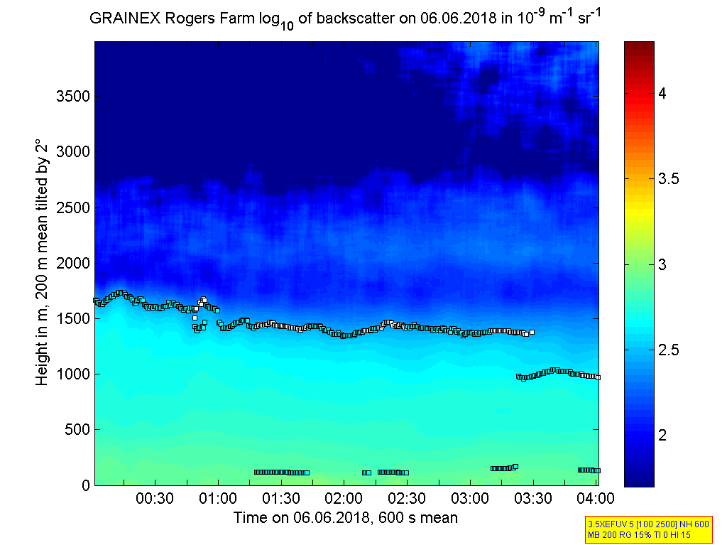
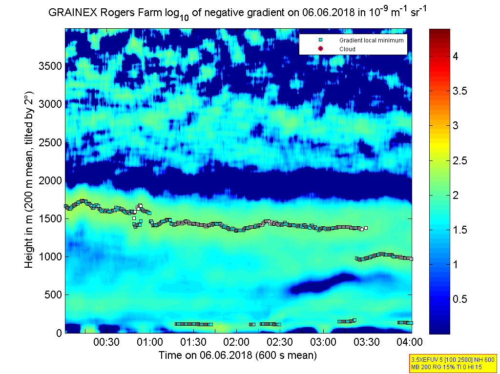
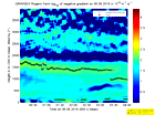
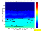
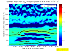
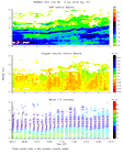
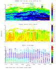
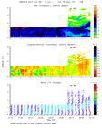
ISS2_Ceilometer.201806060000.de...
|
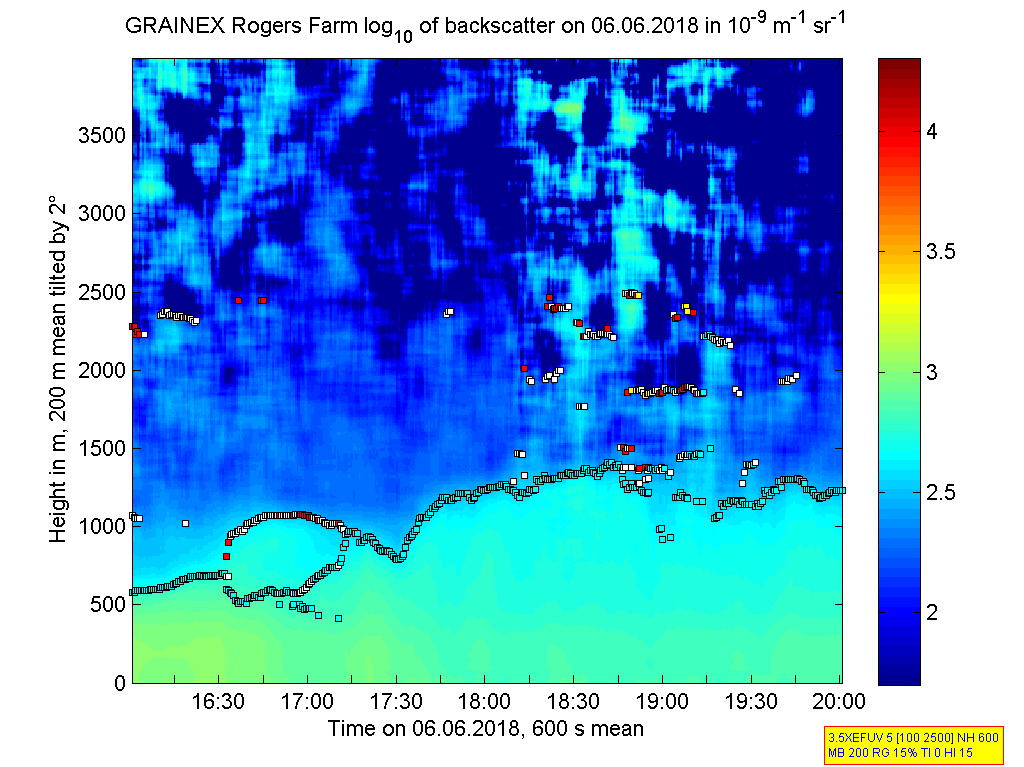
ISS2_Ceilometer.201806060000.gr...
|
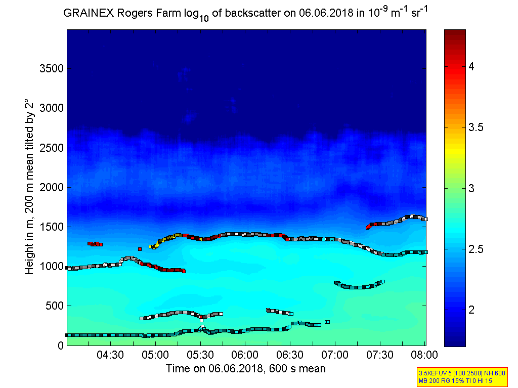
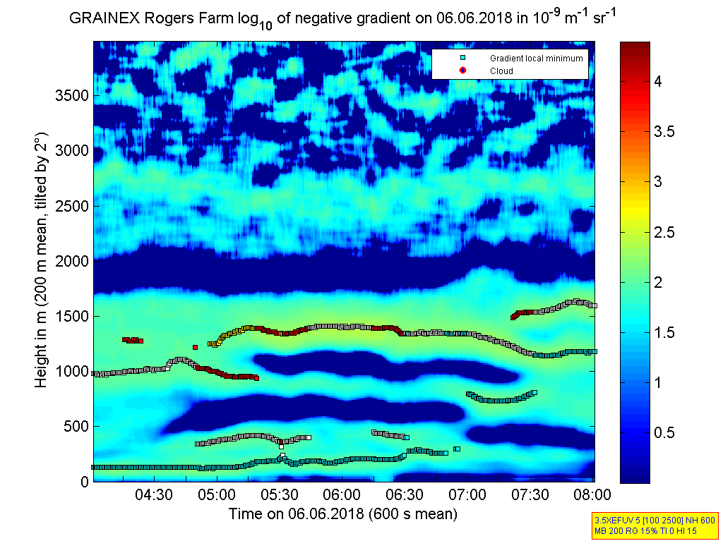
ISS2_Ceilometer.201806060400.de...
|
ISS2_Ceilometer.201806060400.gr...
|
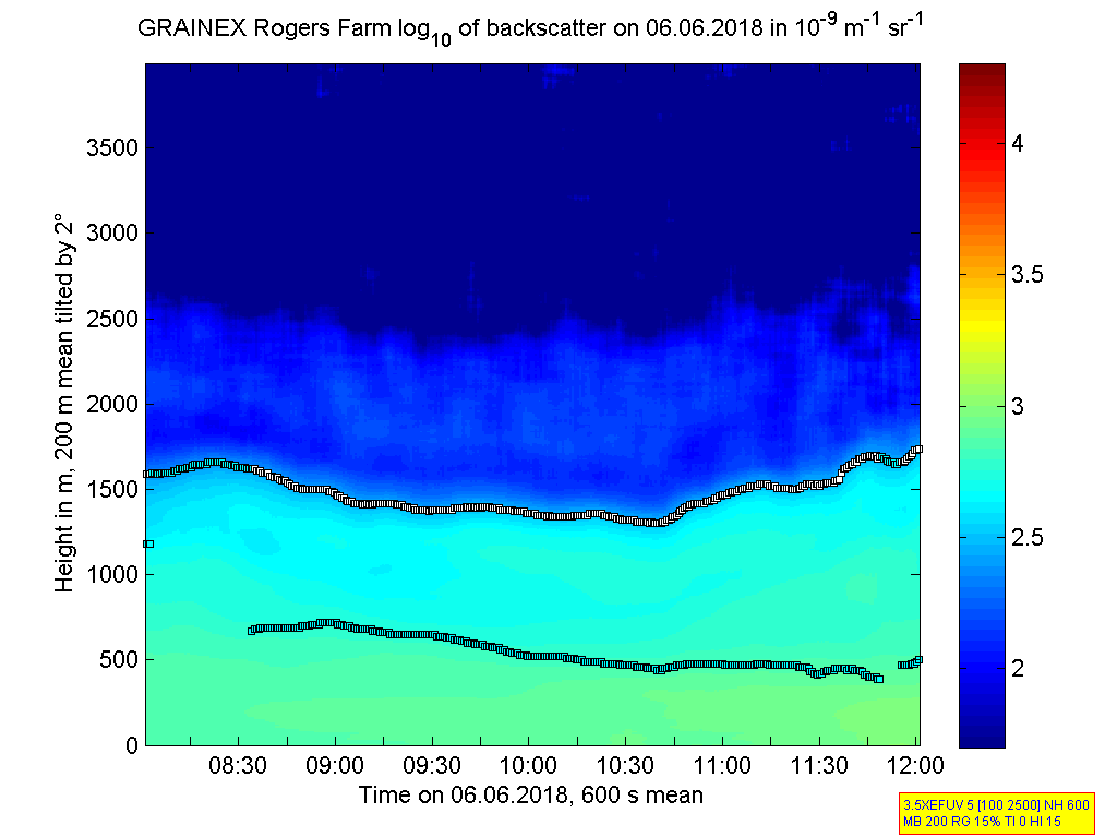
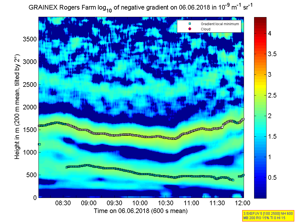
ISS2_Ceilometer.201806060800.de...
|
ISS2_Ceilometer.201806060800.gr...
|
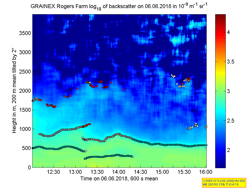
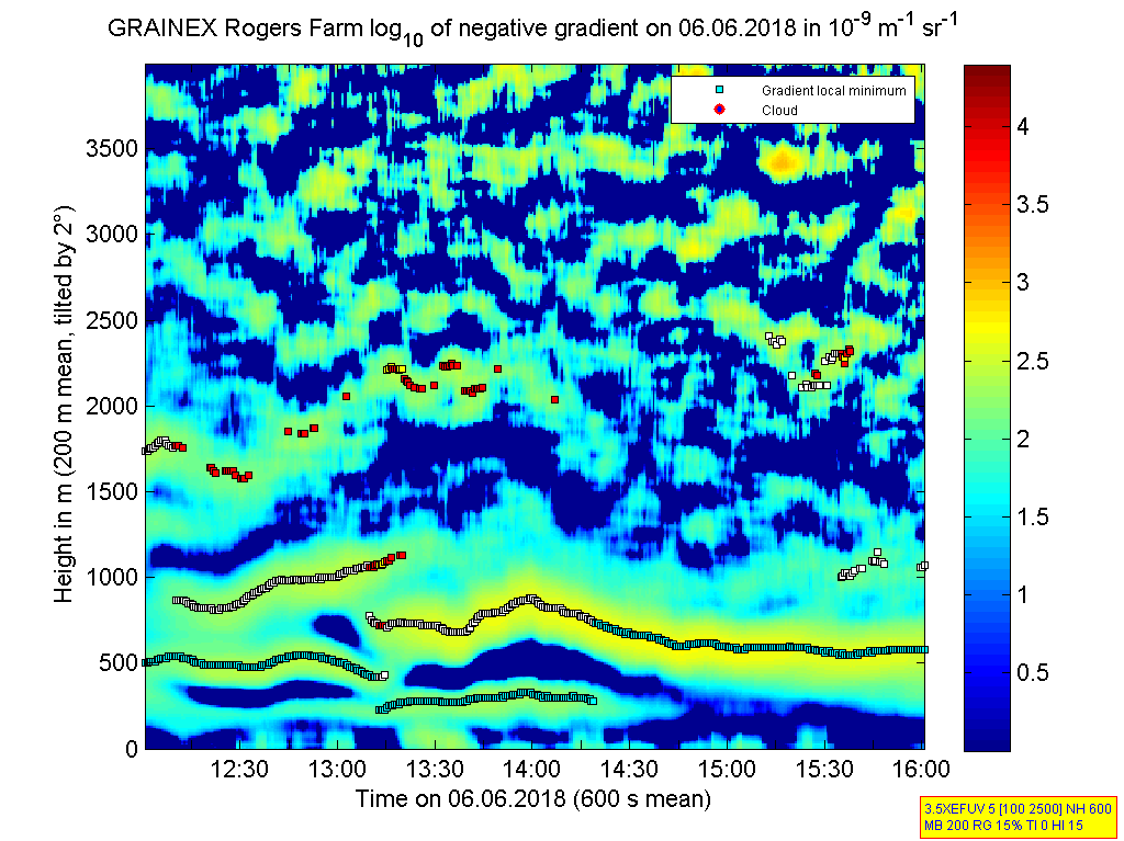
ISS2_Ceilometer.201806061200.de...
|
ISS2_Ceilometer.201806061200.gr...
|
ISS2_Ceilometer.201806061600.de...
|
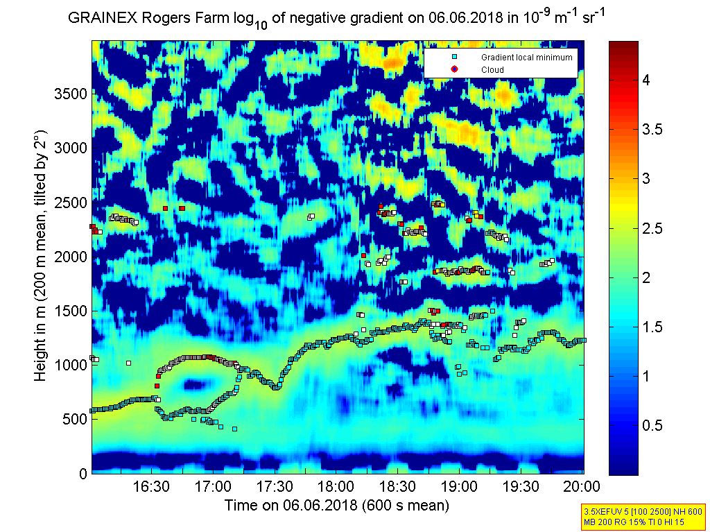
ISS2_Ceilometer.201806061600.gr...
|
ISS2_Ceilometer.201806062000.de...
|
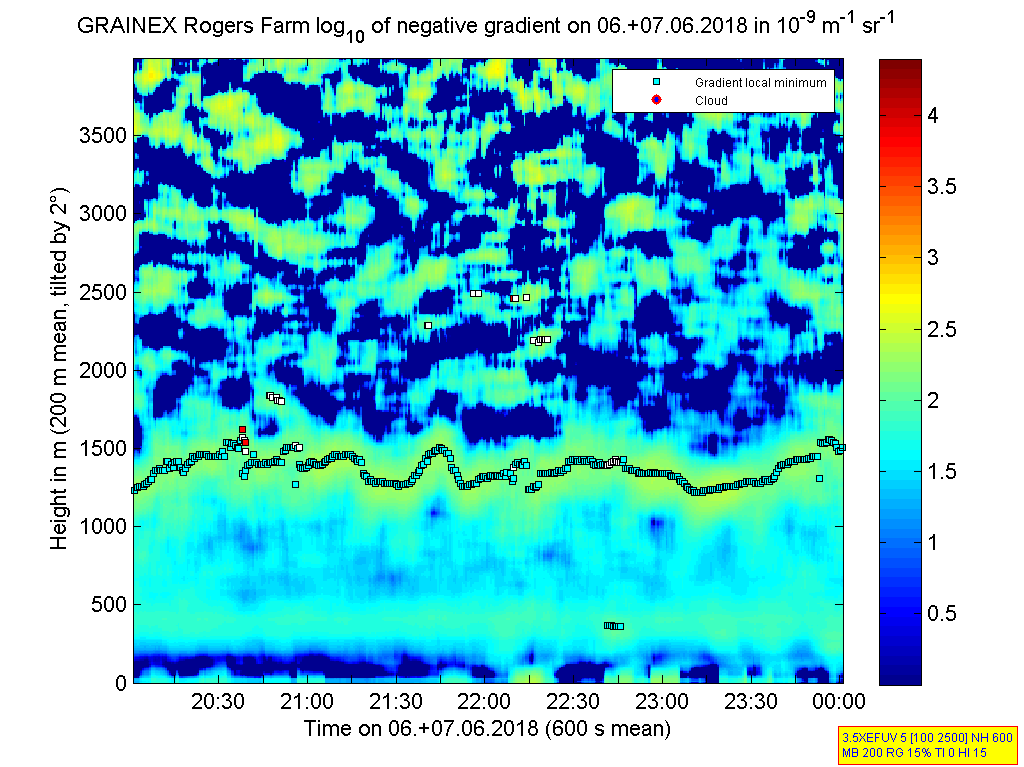
ISS2_Ceilometer.201806062000.gr...
|
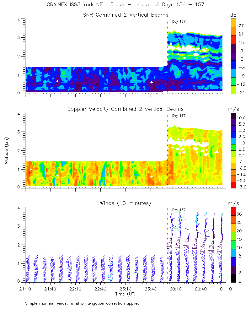
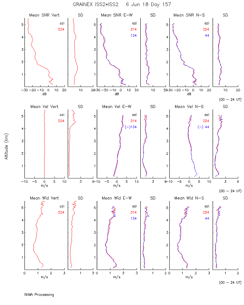
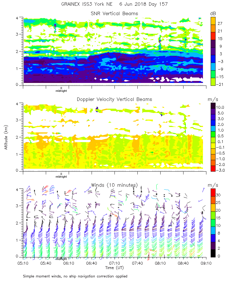
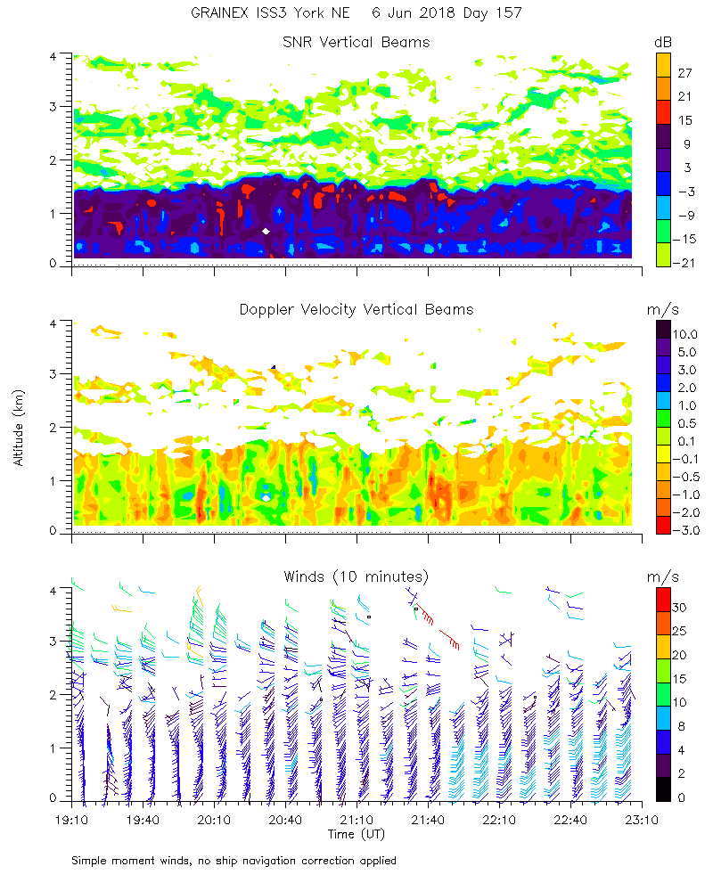
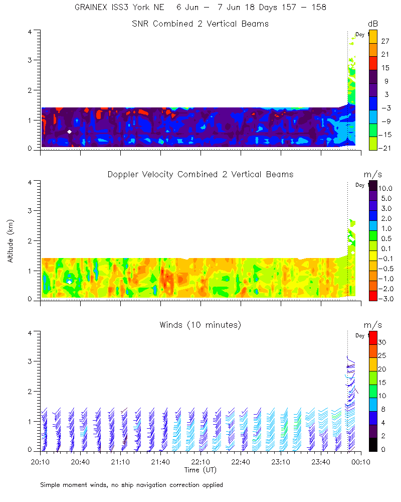
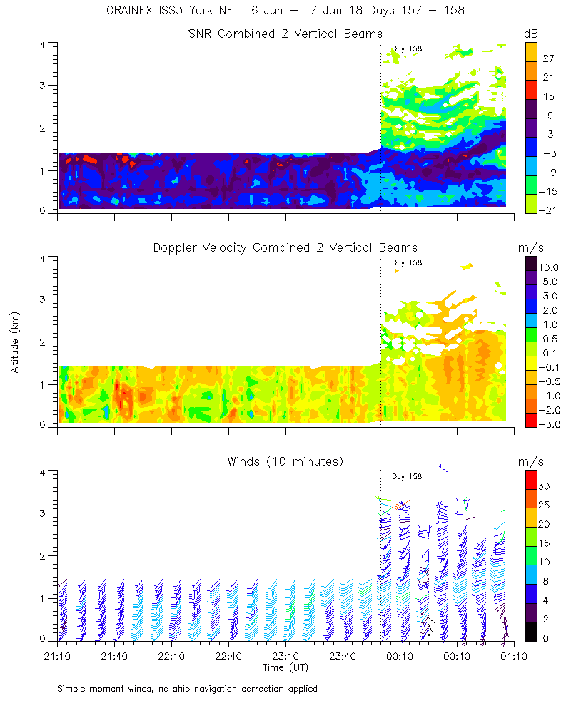
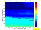
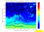
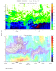
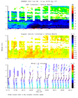
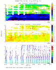
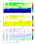
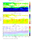
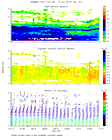
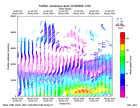
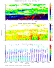
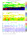
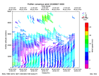
ISS2_Profiler.201806052300.mome...
|
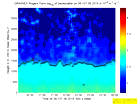
ISS2_Profiler.201806060000.mome...
|
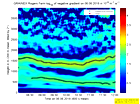
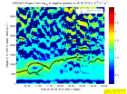
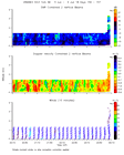
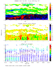
ISS2_Profiler.201806060000.nima...
|
ISS2_Profiler.201806060000.nima...
|
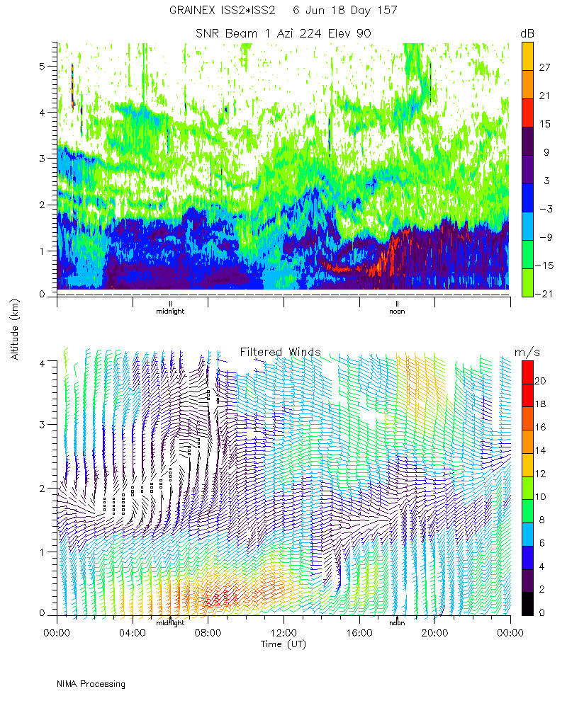
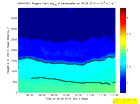
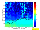
ISS2_Profiler.201806060000.snr_...
|
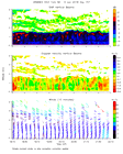
ISS2_Profiler.201806060100.mome...
|
ISS2_Profiler.201806060200.mome...
|
ISS2_Profiler.201806060300.mome...
|
ISS2_Profiler.201806060400.mome...
|
ISS2_Profiler.201806060500.mome...
|
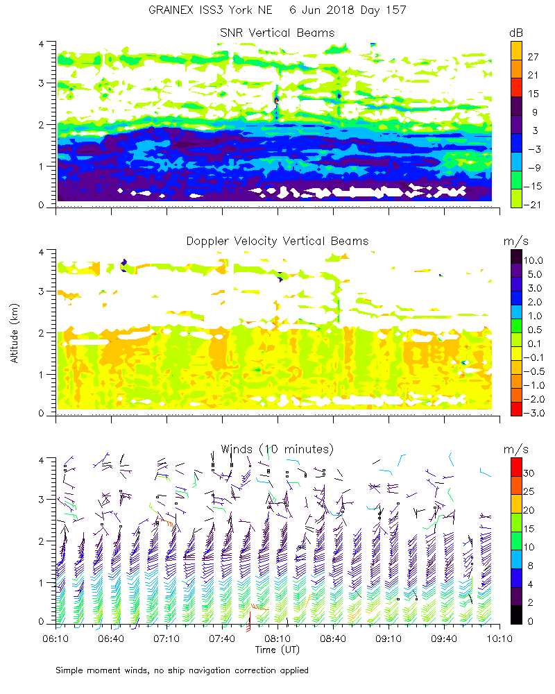
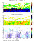
ISS2_Profiler.201806060600.mome...
|
ISS2_Profiler.201806060700.mome...
|
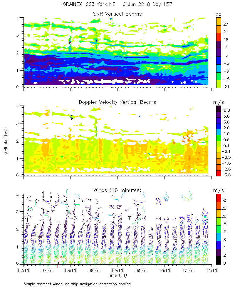
ISS2_Profiler.201806060800.mome...
|
ISS2_Profiler.201806060900.mome...
|
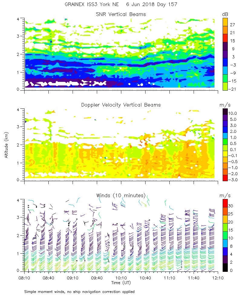
ISS2_Profiler.201806061000.mome...
|
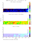
ISS2_Profiler.201806061100.mome...

|
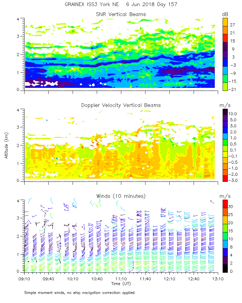
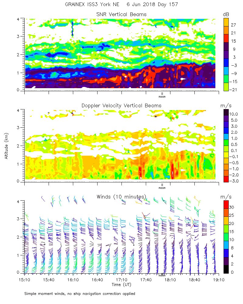
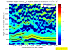
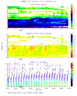
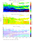
ISS2_Profiler.201806061200.mome...
|
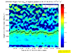
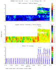
ISS2_Profiler.201806061200.wind...
|
ISS2_Profiler.201806061300.mome...
|
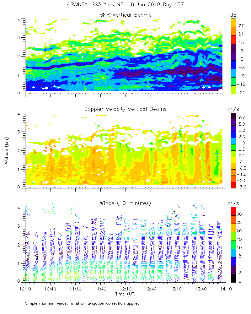
ISS2_Profiler.201806061400.mome...
|
ISS2_Profiler.201806061500.mome...
|
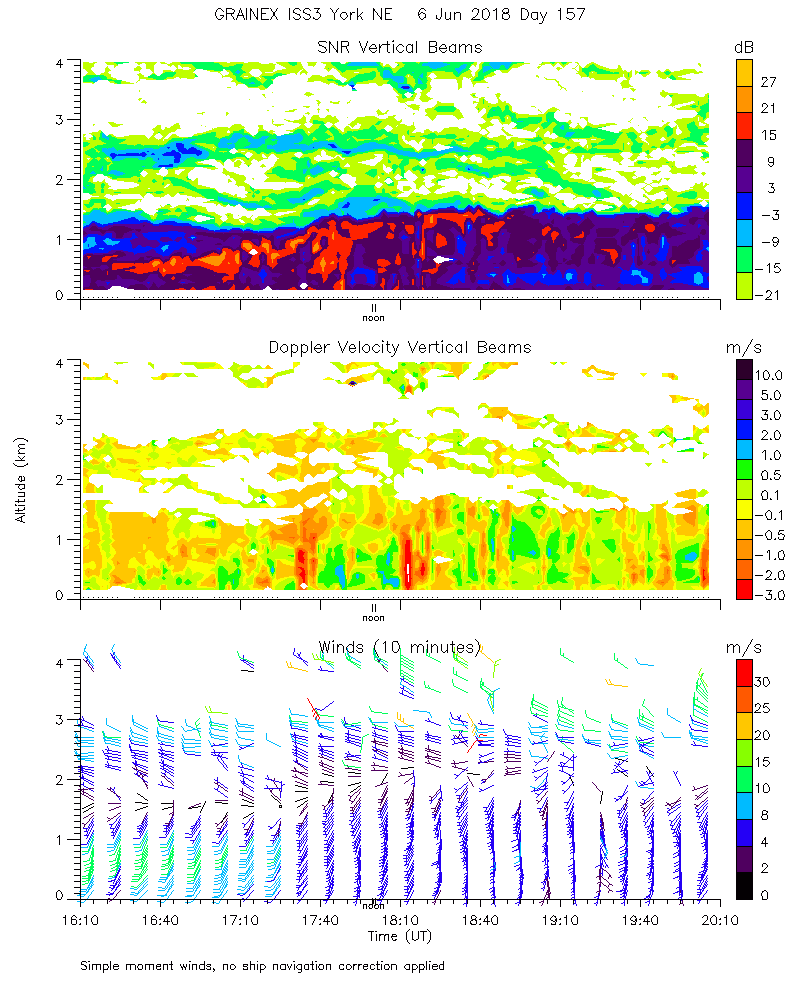
ISS2_Profiler.201806061600.mome...
|
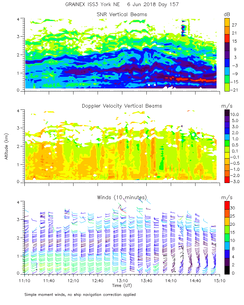
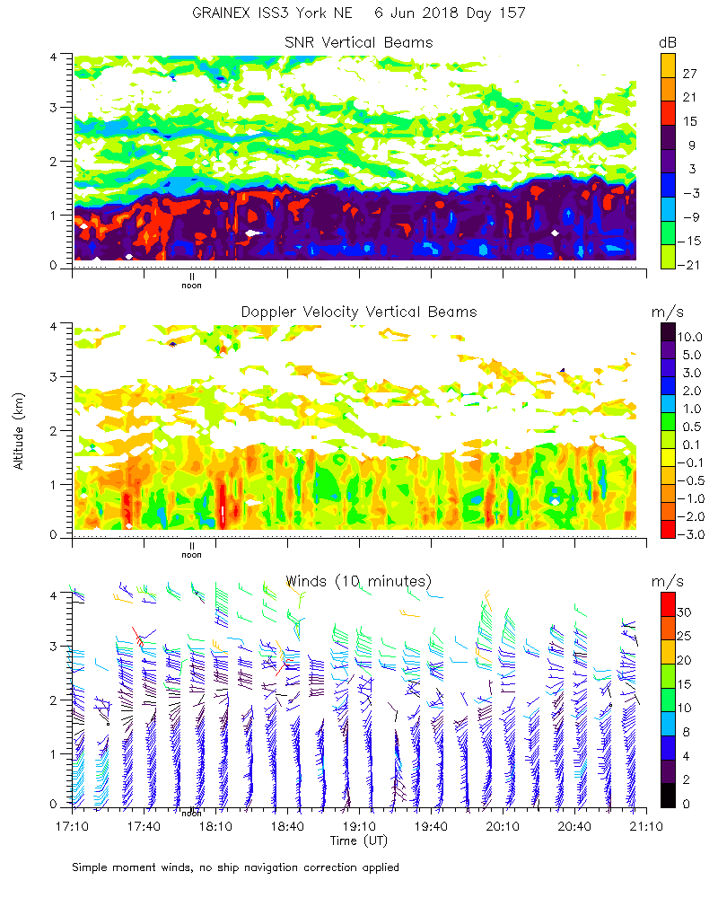
ISS2_Profiler.201806061700.mome...
|
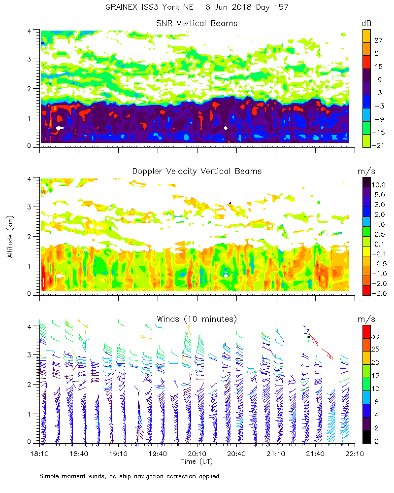
ISS2_Profiler.201806061800.mome...
|
ISS2_Profiler.201806061900.mome...
|
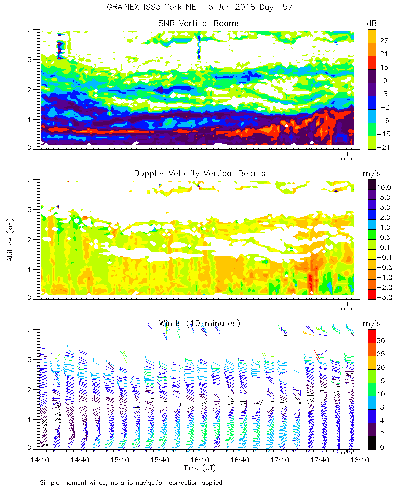
ISS2_Profiler.201806062000.mome...
|
ISS2_Profiler.201806062100.mome...
|
ISS2_Profiler.201806062200.mome...
|
ISS2_Profiler.201806062300.mome...
|
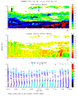
ISS2_Profiler.201806070000.mome...
|
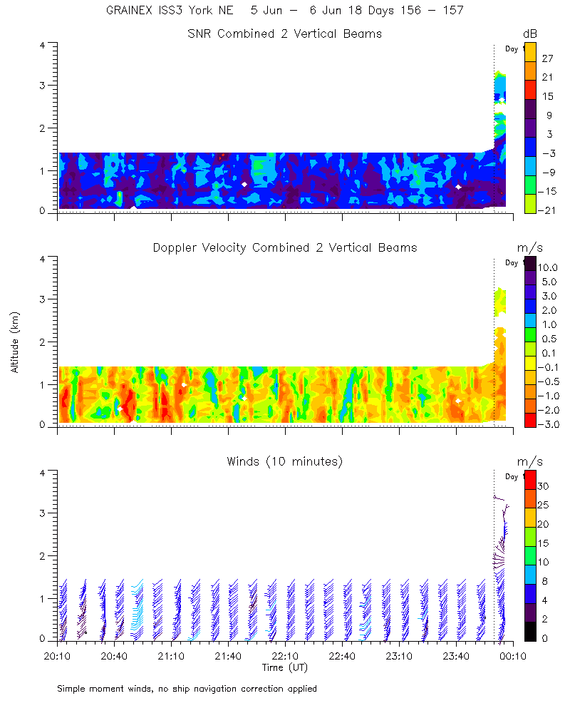
ISS2_Profiler.201806070000.wind...
|
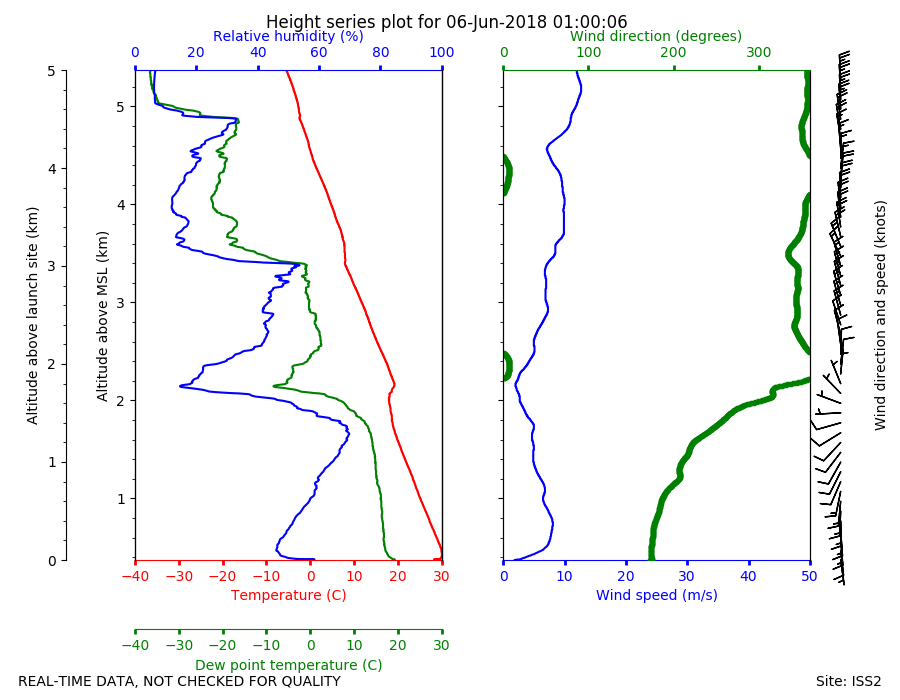
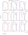
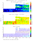
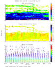
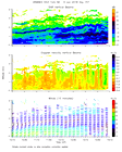
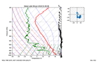
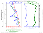
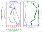
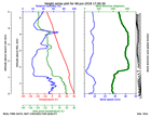
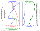
ISS2_Sonde.201806060100.height_...

|
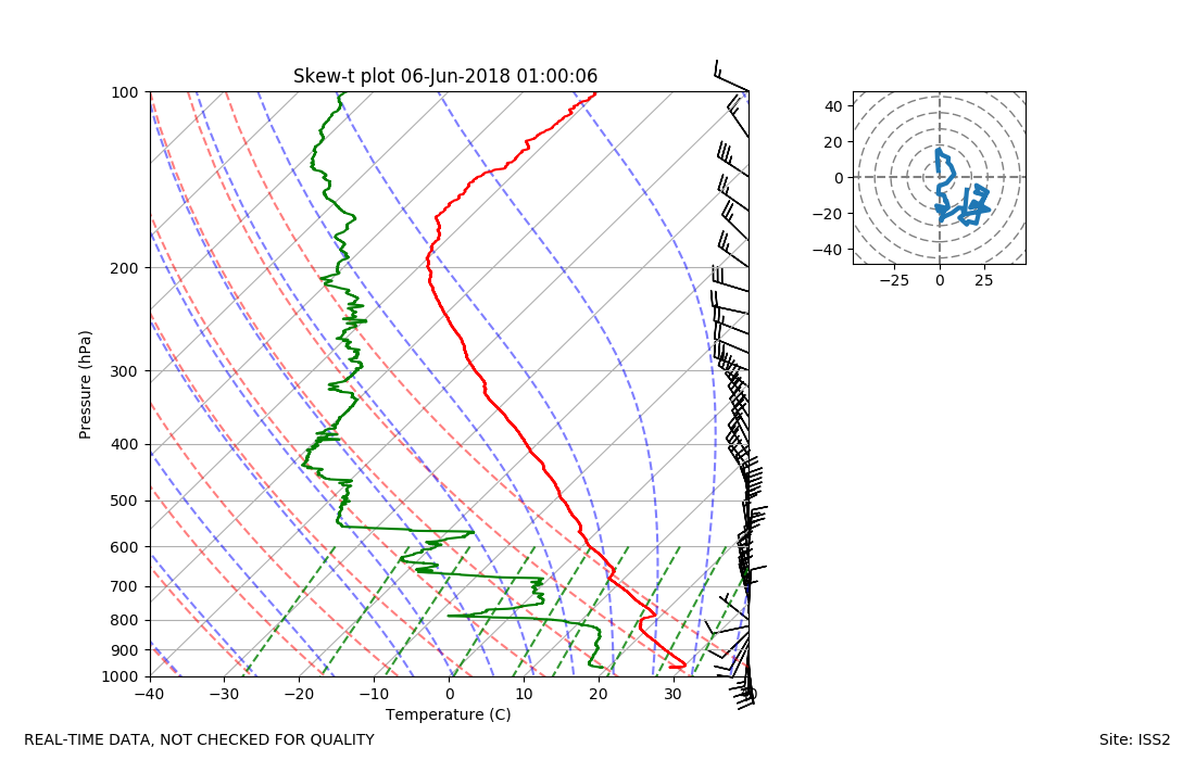
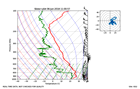
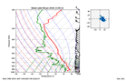
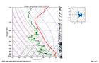
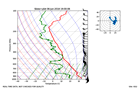
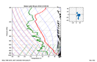
ISS2_Sonde.201806060100.skewT
|
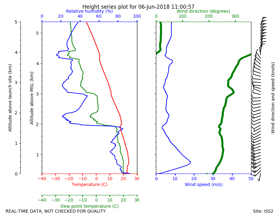
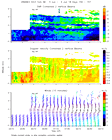
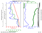
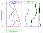
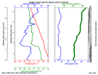
ISS2_Sonde.201806061100.height_...
|
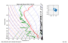
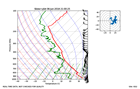
ISS2_Sonde.201806061100.skewT
|
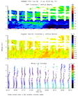
ISS2_Sonde.201806061300.height_...
|
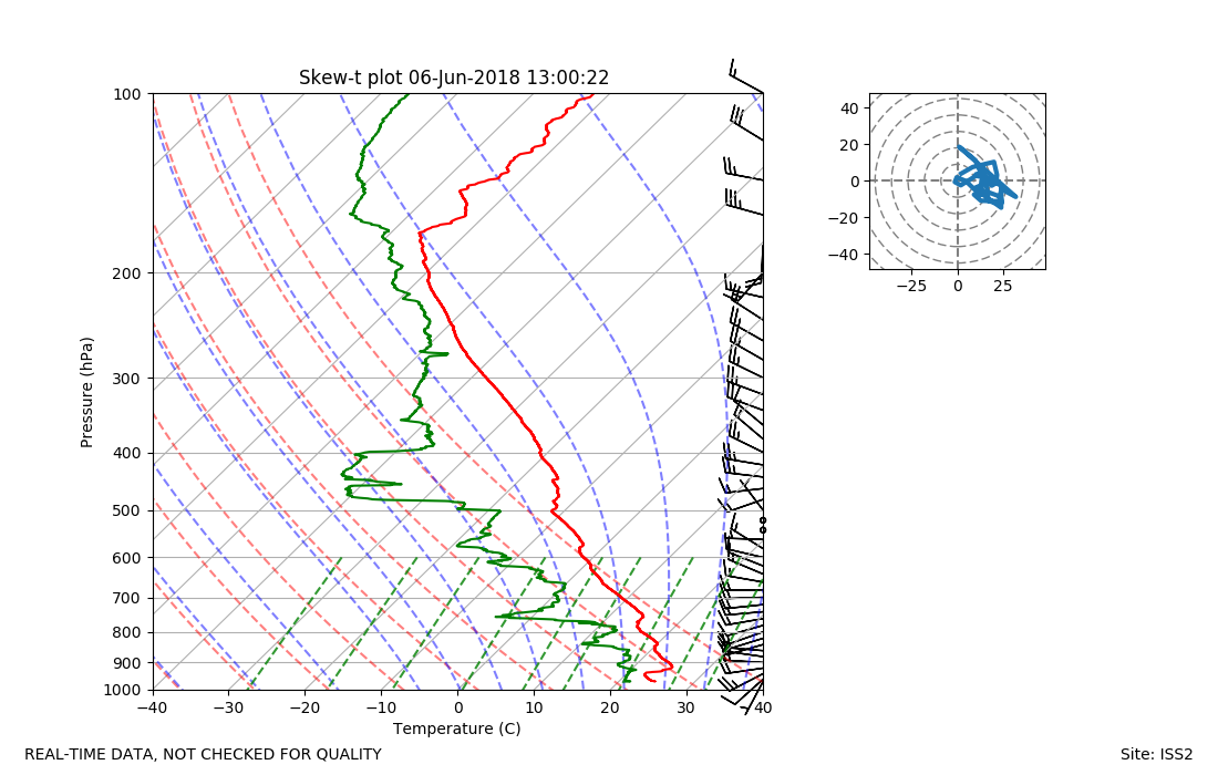
ISS2_Sonde.201806061300.skewT
|
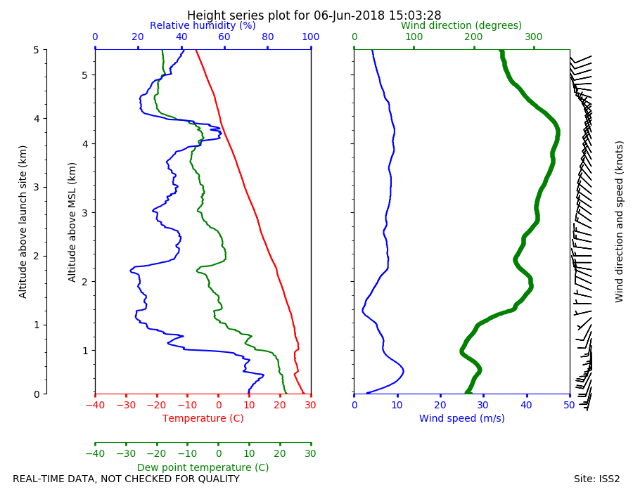
ISS2_Sonde.201806061503.height_...
|
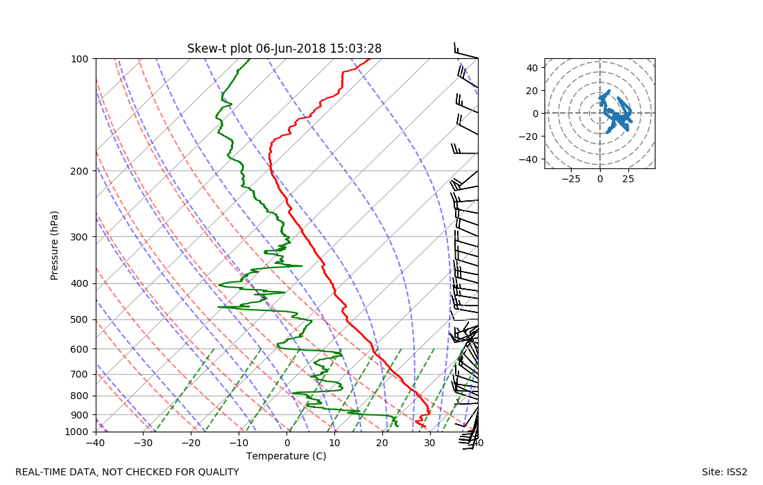
ISS2_Sonde.201806061503.skewT
|
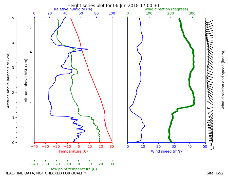
ISS2_Sonde.201806061700.height_...
|
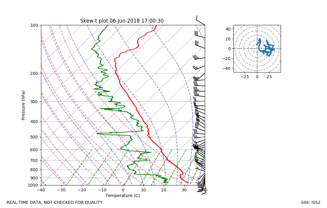
ISS2_Sonde.201806061700.skewT
|
ISS2_Sonde.201806061900.height_...
|
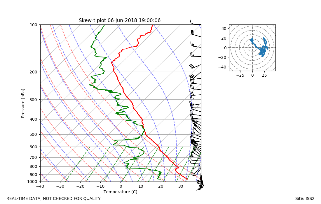
ISS2_Sonde.201806061900.skewT
|
ISS2_Sonde.201806062100.height_...
|
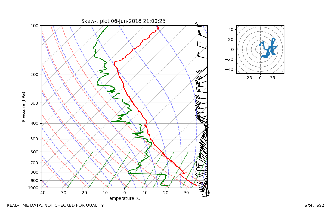
ISS2_Sonde.201806062100.skewT
|
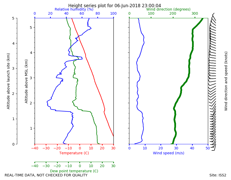
ISS2_Sonde.201806062300.height_...
|
ISS2_Sonde.201806062300.skewT
|
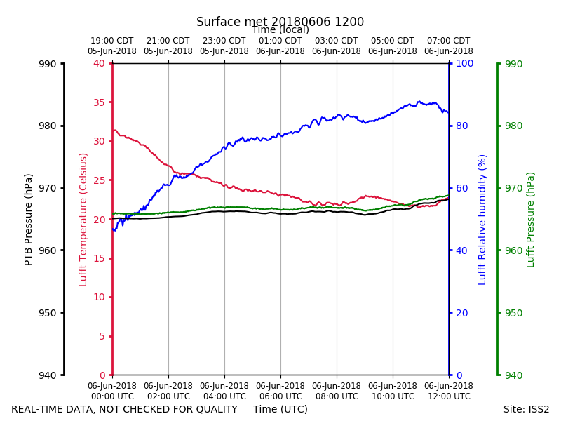
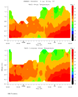
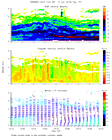
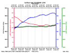
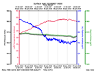
ISS2_Surface.201806061200.pth
|
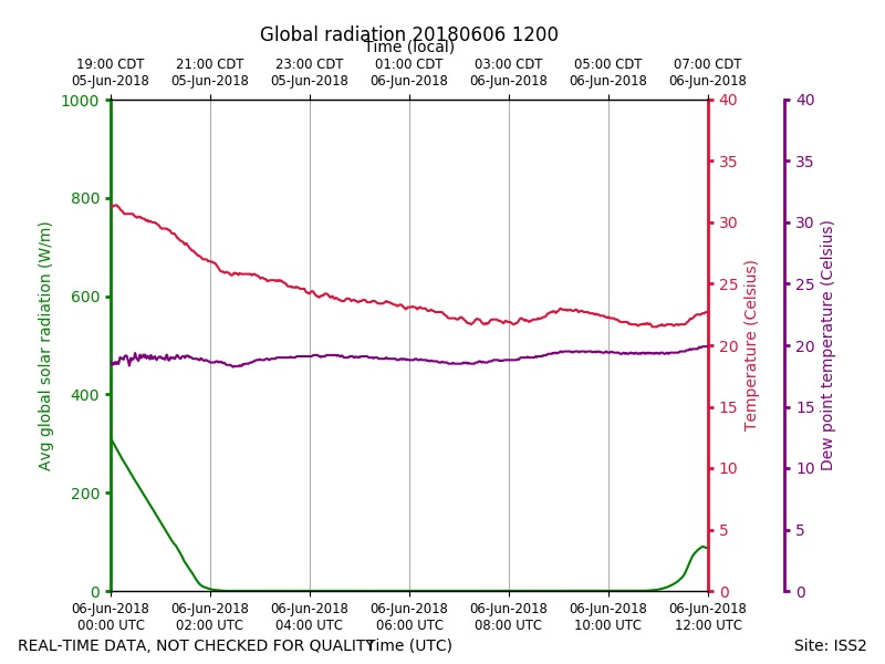
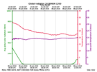
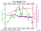
ISS2_Surface.201806061200.radia...
|
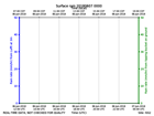
ISS2_Surface.201806061200.rain

|
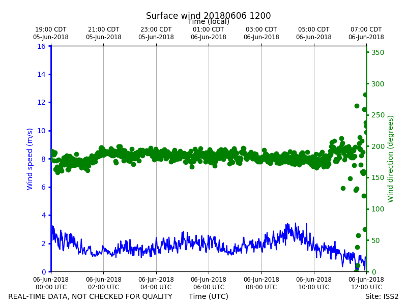
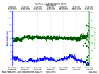
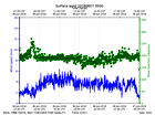
ISS2_Surface.201806061200.wind
|
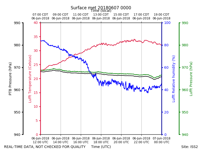
ISS2_Surface.201806070000.pth
|
ISS2_Surface.201806070000.radia...
|
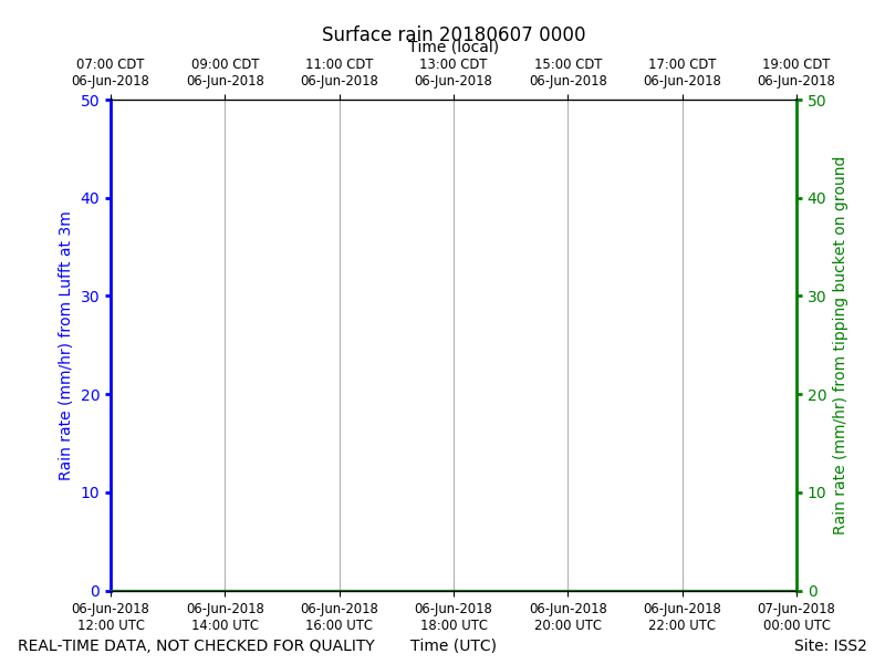
ISS2_Surface.201806070000.rain
|
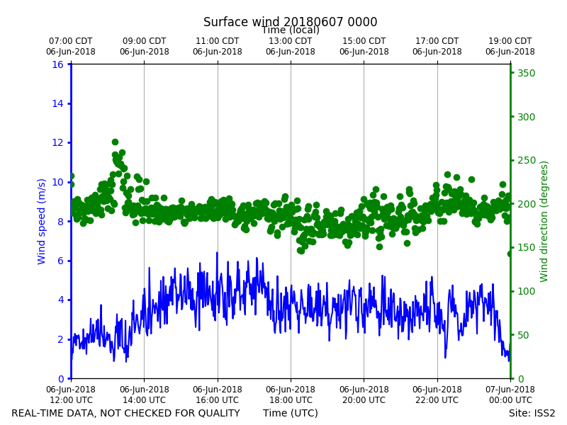
ISS2_Surface.201806070000.wind
|