Raman-shifted Eye-safe Aerosol Lidar (REAL)
observations from FL-1
How to interpret a lidar aerosol backscatter image
The usefulness of lidar aerosol backscatter images
NCAR Eye-safe Aerosol Lidar
Project Description
Time-lapse Weather Webcam animations from NCAR Foothills Lab 1
Live Weather Webcam from NCAR Foothills Lab 1
29 Oct 2003: Vertical pointing.


28 Oct 2003: Vertical pointing.


24 Oct 2003: Vertical pointing.


23 Oct 2003: Vertical pointing.


17 Oct 2003: Vertical pointing.

16 Oct 2003: Vertical pointing.


15 Oct 2003: Vertical pointing.


14 Oct 2003: Vertical pointing.

8 Oct 2003: Vertical pointing.

25 Sept 2003: Vertical pointing.

23 Sept 2003: Vertical pointing.

19 Sept 2003: Vertical pointing.

18 Sept 2003: Vertical pointing.


17 Sept 2003: Vertical pointing. The step changes in intensity around 10
and 11:30 AM occurred when we adjusted the position of the detector with
respect to the focal plane of the telescope.

16 Sept 2003: First day of data with
new telescope . Vertical pointing. The dark vertical
bands between 5 and 8 km are biases that occur when the reflection from the cloud below 5 km hits the detector very hard causing it to overshoot on recovery.
We typically don't expect lidars to provide useful data beyond the leading edge
of such a dense cloud in any case.

04 Sept 2003: Vertical pointing

03 Sept 2003: Vertical pointing

02 Sept 2003: Vertical pointing

29 Aug 2003: Vertical pointing

28 Aug 2003: Vertical pointing. Nice example of cirrus on this day between 7 and 9 km.


27 Aug 2003: Vertical pointing


26 Aug 2003: Vertical pointing

25 Aug 2003: Vertical pointing

22 Aug 2003: Vertical pointing

21 Aug 2003: Vertical pointing

20 Aug 2003: Vertical pointing

19 Aug 2003: Vertical pointing


18 Aug 2003: Vertical pointing

15 Aug 2003: Vertical pointing

14 Aug 2003: Vertical pointing


5 Aug 2003: Vertical pointing from 8:45 AM to 6:10 PM. Sharp drops in return signal strength during the
afternoon is thought to be caused by burned mirror in Raman cell. Investigation currently under way.
Nonetheless, the data shows growth of the mixed layer to 2 km AGL around 14:30 MDT.

4 Aug 2003: Vertical pointing from 9 AM to about 4 PM.

1 Aug 2003: Vertical pointing from 10 AM to 5 PM. Steady growth of the convective boundary layer observed during
the afternoon.


30 July 2003: Vertical pointing all day. First panel before rain (9 AM to 1:40 PM). Second panel after rain (2:30 - 5:50 PM).
In the first panel, we see evidence of down drafts from clouds sweeping out boundary layer aerosols between noon and 12:30.
The second panel shows two nice
bands of virga between 15:39 and 16:06. We have no explanation for the long band of descending aerosols after 16:06.


29 July 2003: Vertical pointing from 9:30 AM to 1:30 PM. Data collection terminated as rain began.

28 July 2003: Vertical pointing from 11 AM to 2 PM. Very hazy and humid. Waves can be seen
on a layer around 2 km on this image. Data collection was terminated when rain began.
Black stripes are shadows from cumulus clouds.

25 July 2003: Vertical pointing from 8:50 AM to 5:50 PM. (Note: abrupt broad vertical
bands of weaker intensity from 10:30 to 11 AM and around 11:45 were
caused by turning off the Raman cell's injection seeder for tests.)
White above about 4 km is cloud and white below 4 km is dense aerosol.
The day starts with a deep layer (orange and red colors on left, 0-4
km) of aerosol overhead. A very aerosol rich convective boundary layer
rises above the minimum range of the lidar around 11:30 AM (white).
Lowering and threatening clouds after about 15:00 provide no precipitation
but do finally accompany cleaner air around 5:30 PM (blue region).


24 July 2003: Vertical pointing from 10:20 AM to 5:05 PM. The images shown today cover
such long amounts of time, that we averaged in time by 10 s. Raw data were collected and saved
at 5 Hz.
The observations show a very deep aerosol layer extending up to about 5 km. (The systematic
horizontal bands of color below about 750 m are due to the position of the telescope focus
and can be adjusted in the future.)
The data also show a thin cloud layer between 12 and 13 km altitude. Cirrus clouds were not
visually observable during this period. (See
time-lapse Weather Webcam animations.)


18 July 2003: Vertical pointing from 9:45 to 11:45 AM, then 3-degrees above horizontal from 12:15 to 4 PM.
Returned to vertical from 4 to 6 PM. Vertical segments reveal strong layering. Top of the ML remains less
than 1 km at 11:30 AM. 3-degree elevation stares show aerosol structures out to about 10 km range.


17 July 2003: Vertical pointing from noon to 2:30 PM. Notice thin aerosol
layer at 12.5 km altitude. Each image is same data segment just different
vertical range and color scale.


17 July 2003: Vertically pointing from 2:30 - 4:15 PM. Same time period for each pic,
just different altitude range and color bar scale.


15 July 2003: Vertical pointing from 6:36 AM to 1:10 PM.

14 July 2003: Once again, we began by pointing at a shallow elevation
angle (probably < 10 degrees) in the direction of Haystack Mountain
between 12 and 2 PM (left two images). Observed aerosol structures out to 7 km range.
Also seeing
fine plumes between 750 m and 1.5 km range which we think may be exhaust
from traffic on the Diagonal Highway or trains that run parallel to
the highway (middle images). Concluded the day by pointing vertical only
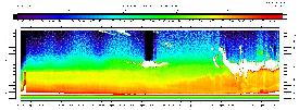
and observed a 3 km deep PBL with very diffuse top edge (right image).
(Note elevation angles of 90-degrees on left two images are incorrect.)


11 July 2003: Pointed at a shallow elevation angle (probably < 10 degrees) in
the direction of Haystack Mountain and obliquely slicing through the
mixed layer. Purpose of this test was to determine how far the system
could "see" when aerosols were present at all ranges along the beam.
Unfortunately, even with the low angle we selected, the beam penetrated
the top of the ML at about 4 km range and therefore the test was
inconclusive. We did see evidence of gravity waves at about 6 km
range between 14:18 and 14:30.

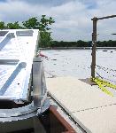
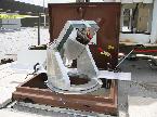
Turning flat used for this experiment courtesy Dr. Janet Machol, NOAA-ETL.
10 July 2003: Temporal growth of the convective boundary layer. Pointed vertical. Running with the focus adjusted for
better performance in the far-field. These data were collected with
the 200 micron InGaAs APD. The data were normalized for shot-to-shot
transmit energy fluctuations and had 10 shot averaging (1-s) applied.


2 July 2003: Morning boundary layer. A visually very clear and clean
atmosphere except for some low haze.
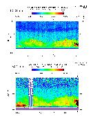
First comparison of 1064 nm (top panel) &
1543 nm (bottom panel) channels using a 200-micron diameter APD in 1543 nm channel. These data have been averaged to 1 s in time. Telescope focus
adjusted for minimum range of about 100 m in the 1543 channel.

25 June 2003: Cloud base. Comparison of 1064 nm & 1543 nm channels using a 300 micron diameter InGaAs PIN in the 1543 channel.
Note: data are not normalized correctly for shot-to-shot fluctuations in laser energy.
In the future, energy normalization and some averaging will greatly reduce the noise.


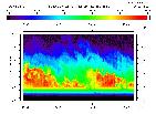
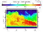
22 May 2003: PBL with a diffuse top edge from 1064 nm (left) and 1543 nm (right).
First comparison of 1064 nm & 1543 nm channels. 1543 nm using 300 micron InGaAs PIN.
Note: data are not normalized for shot-to-shot fluctuations in laser energy.
In the future, energy normalization and some averaging will greatly reduce the noise.


22 May 2003:
Clouds at 7.5 km from 1064 nm (left) and 1543 nm (right).
First comparison of 1064 nm & 1543 nm channels. 1543 nm using 300 micron InGaAs PIN.
Note: data are not normalized for shot-to-shot fluctuations in laser energy.
In the future, energy normalization and some averaging will greatly reduce the noise.


15 May 2003: A rapidly growing convective boundary layer at 1064 nm only.
The time tick marks on this image are unevenly spaced because we were not recording
every shot due to an overloaded data system.

28 Feb 2003: Cloud layer with 0.1 s temporal and 1.5 m range resolution from the 1064 nm channel only.
Note: Transmission for these observations did not use the Raman cell and
as a result normalization for shot-to-shot fluctuations in laser energy were not needed.

10 October 2002: Our first observations of clouds using 1064 nm and a LiCel 1.5 mm Si APD. Transmission for these observations did not use the Raman cell.

10 October 2002: Our first observations of the boundary layer and an overlying aerosol layer at 1064 nm. Transmission for these observations did not use the Raman cell.

